Download
1 / 14
140 likes | 152 Views
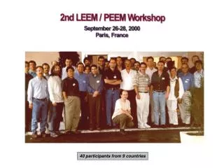
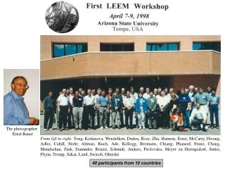
GEO Data Providers Workshop Introducing GEOSS Data Providers Steven Ramage 20 April, 2017 Florence, Italy. Workshop participants from 95 organizations. Workshop participants continued…. Implementing GEOSS through GCI. 158 Brokered Data Providers (April, 2017). Introducing Data Providers.

E N D
GEO Data Providers WorkshopIntroducing GEOSS Data ProvidersSteven Ramage20 April, 2017Florence, Italy
Introducing Data Providers • 95 different organizations • 47 data providers already contributing to the GCI • 51 potential new data providers
Introducing Data Providers • Non-for-profit research and innovation companies • Research Institutes - National and International • National Research Council (Italy) • National Geographic & Research Institutes • Regional Research Centers • Humanitarian and Environmental NGOs • United Nations and The World Bank • Governmental and Intergovernmental Agencies • National Space and Specialized Agencies • Private sector
How do you contribute to the GEO Vision? • Encourage and facilitate the use of geospatial data to assist in data driven policy and the development of solutions • By making the datasets discoverable with the help of GEOSS, the datasets become more visible to other communities. In this way, for example, ECMWF open data can be shared with other communities, which increases data uptake and thus, the overall value of the data • Eg. WWF supports spatial data transparency to help monitor changes to the natural world and secure accountability for companies, investors, governments and other stakeholders.
Data types: some of 200 million + resources • Satellite Imagery • Environmental data • Arctic Observations • Weather predictions • Geological data • In-situ data on mountain climate, water resources, glaciers, ecosystems • Ex-situ measurement results – mainly activity concentrations of naturally occurring and anthropogenic -radionuclides in seawater, marine sediment and marine biota . • Renewable energy • Geospatial Information for management of natural disasters, man-made emergency situations and humanitarian crises • Water temperature, salinity, dissolved oxygen, nutrients, air temperature • Time series of ecosystem related data, covering a very wide range of topics, both data on biodiversity and non-biotic topics • GRI: Orthoimages, DEM, Land Cover/Use, Transportation network, Hydrographic network, Urban Settlements • GIS, Socioeconomic Data, Statistics and Indicators
Why share data through GEO – GCI? • From Jamstec: Contribution to GEOSS is one of the important mission of JAMSTEC and we expect more users of our data/samples from international research communities. • From Copernicus: The free and open data access policy of Copernicus is in-line with GEO open data policies and thus CEMS becoming a data provider for GEO is very relevant. We believe that this will not only raise awareness about the service in the GEO community but also provide possibilities for collaboration including data and knowledge exchange. • From China GEOSS: GEO provide a platform to make the GCdataPR well known and make the staff communicate with other data providers • From Webservice Energy: Provide a mean to disseminate at a larger scale data for the good of the renewable energy community • From SIOS: SIOS would like to contribute to GEO as a data provider as we believe that it is in SIOS’s interest to make the data more widely available, which in turn will promote the SIOS research infrastructure.
Why share data through GEO – GCI? • From ECMWF: GEO brings together many different communities and it increases the visibility of a data organisation. • From Eurac: In joining the GCI there could be more options to share the research result, gaining more visibility, fostering further research and innovation activities • From NEXT Data: Because it is one of the main ways to distribute data and knowledge in an open and world-wide setting. • From HOT: Through our participation in GEO, we want to continue to advance the use of open source tools for applying OpenStreetMap and other open data to solve humanitarian and global development issues. We see our membership as a way for us to continue progress toward achieving the Sustainable Development Goals
How could GEO benefit your organization? • From Ecopotential: Wider visibility and link with a larger set of open-access data • From NODC: The participation of RNODC in the workshop will enable us to enter into the data exchange, to receive information on the development and application of software tools created within the GEOSS system • From IGNV: GEO would give us visibility and the opportunity to share data with a great number of users and institutions.
GEO Data Providers’ Statementshttp://earthobservations.org/me_201704_dpw.php
Break out session • Benefits • Challenges and Issues • Communication • Role of Private Sector 15 Minutes each – Please write your answers on a Post-It! (legible hand writing please!)