Download
1 / 33
330 likes | 332 Views
The ITU Joint Task Force (JTF) aims to establish a network of ocean mini-observatories to monitor key factors affecting global ocean health, including global warming, acidification, extinctions, and loss of biodiversity. The JTF plans to develop trans-ocean mini-observatories to measure changing seafloor temperatures and hazards, with the goal of increasing the reliability and integrity of global tsunami warning networks. This initiative addresses the need for sustained climate-quality data from sparsely observed deep oceans and coastal waters. The JTF is currently working on a pilot project in collaboration with the cable industry and ocean observatory researchers.

E N D
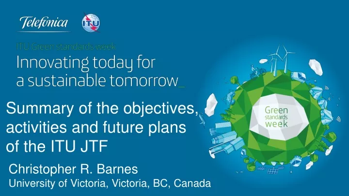
Summary of the objectives, activities and future plans of the ITU JTF Christopher R. Barnes University of Victoria, Victoria, BC, Canada
Science and Society: Global Ocean Health • Key ocean health issues: Include global warming, acidification, extinctions and loss of biodiversity • Long-term disruptions: Ocean temperature is keyfactor, particularly related to future changes with global warming and sea level rise • Short-term disruptions: Extent and impact of periodic seabed and coastal destruction, and ecosystem modification, by tsunamis and slope failures • Monitoring: Health and status of marine environment could be monitored in real-time on a global basis through a new generation of ocean mini-observatories
Establishing the JTF • The recent joint initiative between three UN agencies proposes to develop trans-ocean mini-observatories to measure changing seafloor temperatures and hazards over several decades • A Joint Task Force (JTF), established in 2012 by the International Telecommunication Union (ITU), the World Meteorological Organization (WMO) and the Intergovernmental Oceanographic Commission (IOC) of UNESCO, is examining novel uses for submarine telecommunication cables
JTF Activities: the green cable initiative • A wide network of mini-observatories could be established at many places across the world's ocean floors to measure these important parameters accurately over several decades • The initiative addresses two main issues: a) need for sustained climate-quality data from sparsely observed deep oceans and continental slopes, but extending into coastal waters; and b) desire to increase the reliability and integrity of the global tsunami warning networks • Presently, plans are being developed to launch a pilot projectwith active involvement of cable industry players and existing ocean observatory researchers
Ocean and global scales – what is required? • Widely spaced locations okay • Reduced sensor count okay • Evenly spaced fixed locations preferred • Ability for 40 Hz plus frequency of sensing • Real time data • No site visits after deployment • Sensors: • Pressure • Temperature • Ground acceleration
JTF Activities: Three ITU reports commissioned in 2012 Rhett Butler Kent Bressie Peter Phibbs
JTF Activities: established six committees; annual workshops • Executive (Chris Barnes) • Science and Society (Rhett Butler) • Engineering (Chris Meinig) • Business Model (Michael Costin/Antoine Lecroart) • Legal (Kent Bressie) • Publicity, Outreach and Marketing (David Meldrum/TBD) More details on activities given later in this Workshop Annual workshops (Rome ‘11, Paris ‘12, Madrid ‘13)
Threats to society and need for scientific data • Anthropogenic forcing and earth system response (World petroleum use set a new record in 2012of 88.9 million barrels/day): Global temperature increase Polar ice cap melting Ocean circulation change Sea level rise • Natural threats and hazards: Tsunamis; slope failures • What is reversible, over what time, and/or what is sustainable and affordable?
UNEP warns of catastrophic permafrost melt by 2100 • Melting permafrost could account for 40% of global greenhouse gas emissions and must be considered by governments at climate talks in Doha, warned the UN Environment Programme (UNEP). • Researchers have found that melting permafrost could emit 43 to 135 gigatonnes of carbon dioxide by 2100 and up to 415 gigatonnes by 2200. • This would blow apart hopes of keeping global warming below 20C on pre-industrial levels.
Ocean Warming Causes Sea Level Rise Church et al. (2011)
Future flood losses in major coastal cities “Here we provide a quantification of present and future flood losses in the 136 largest coastal cities. Using a new database of urban protection and different assumptions on adaptation, we account for existing and future flood defences. Average global flood losses in 2005 are estimated to be approximately US$6 billion per year, increasing to US$52 billion by 2050 with projected socio-economic change alone. With climate change and subsidence, present protection will need to be upgraded to avoid unacceptable losses of US$1 trillion or more per year. Even if adaptation investments maintain constant flood probability, subsidence and sea-level rise will increase global flood losses to US$60–63 billion per year in 2050.” Hallegate et al. Nature Climate Change3, 802–806 (2013)
AABW Dominates the Abyss (Johnson, 2008) • AABW twice NADW volume • Spreads north from Antarctic • Dominates SW Atlantic Abyss • Dominates entire deep Pacific • AABW twice NADW volume Atlantic Pacific Atlantic Ocean Pacific Ocean AABW NADW
GFDL climate model simulations project that the global thermohaline circulation will decrease in intensity as greenhouse gas warming occurs (enhanced precipitation and runoff on high latitude continents). In 4xCO2 experiment, thermohaline circulation essentially disappears in GFDL model.
Short-term disruptions: seabed destruction and ecosystem modification by tsunamis and associated slope failures • Major tsunamis occurred several times in last decade, associated with megathrust earthquakes between Mw 7.7 and 9.1 in Sumatra (2004), Java (2006), US Samoa (2009), Mantawai (2010), Chile (2010) and Japan (2011) resulting in severe loss of life and billions of dollars of anthropogenic, ecosystem and environmental damage. • Reducing such losses and mitigating damage is key factor in developing tsunami warning systems (Bernard and Robinson, 2009; Whitmore, 2009).
Magnitude 9.0 NEAR THE EAST COAST OF HONSHU, JAPANFriday, March 11, 2011 at 05:46:23 UTC Tsunami waves swept away houses and cars in northern Japan and pushed ships aground. The tsunami waves traveled far inland, the wave of debris racing across the farmland, carrying boats and houses with it. The tsunami, seen crashing into homes in Natori, Miyagi prefecture. AP Houses were washed away by tsunami in Sendai, Miyagi Prefecture in eastern Japan, after Japan was struck by a magnitude 9.0 earthquake off the northeastern coast. New York Times
JAPAN - Fukushima No. 1 (Daiichi) plant: devastating losses AFTER BEFORE
Magnitude 9.0 NEAR THE EAST COAST OF HONSHU, JAPAN Friday, March 11, 2011 at 05:46:23 UTC This tsunami propagation forecast model shows the forecast maximum tsunami wave height (in cm). Ocean floor bathymetry affects the wave height because a tsunami moves the seawater all the way to the floor of the ocean. This led to a Pacific wide tsunami warning being issued.
Magnitude 9.0 NEAR THE EAST COAST OF HONSHU, JAPAN Friday, March 11, 2011 at 05:46:23 UTC Projected travel times for the arrival of the tsunami waves across the Pacific. Nearby the earthquake there are only minutes to evacuate. However, in many other regions there is advance warning. A tsunami map shows projected travel times for the Pacific Ocean. This map indicates forecasted times only, not that a wave traveling those distances has actually been observed. NOAA
Arrival of Japanese tsunami, within tidal cycle, at 3 NC node sites, 11 March 2011
The JTF Initiative: the futureThe deep ocean is largely unknown…. • How could submarine cables be used as a real-time global network to monitor climate change and provide tsunami warnings? • A new generation of regional scientific cabled ocean observatories is emerging at selected sites, but with a need and opportunity to extend observations and monitoring over much wider area of the global oceans. • Submarine telecommunication cables equipped with sensors to measure key variables (e.g. water temperature, pressure and acceleration) on ocean floor are viewed as vital to monitor climate change and to provide tsunami warnings.
JTF Future: Dual-use Submarine Cables for Ocean/Climate Monitoring and Disaster Warning
Future systems: Proposed Arctic Fibre cable route: Tokyo to London
Evaluation of the JTF initiative • Pro: • Distributed seabed sensors across oceans have unique value • Without such sensors we cannot fully understand ocean processes • Submarine telecommunications systems offer a platform for these sensors • Supporting such sensors would be a positive gesture by system owners and suppliers • Con: • Changes to repeaters are a serious issue • Commercial and legal issues will be system specific • Who pays is unresolved
Technical feasibility • Appears technically feasible at this stage • More iterations required to match science goals with telecom requirements • Next steps • Detailed technical requirement document to be produced (Mallin Proposal) • Continue to pursue ongoing improvements in sensors (Sci/Soc & Eng Comms + industry) • Trial deployment required to demonstrate feasibility and value of data (Pilot Project)
Accelerating Ocean Exploration Marcia McNutt, Editor-in-Chief of Science. August, 2013 editorial: “Recently, however, exploration has taken on a more urgent imperative:to record the substantial changes occurring in largely undocumented regions of the ocean. With half of the ocean more than 10 kilometers from the nearest depth sounding, ecosystem function in the deep sea still a mystery, and no first-order baseline for many globally important ocean processes, the current pace of exploration is woefully inadequate to address this daunting task, especially as the planet responds to changes in climate. To meet this challenge, future ocean exploration must depart dramatically from the classical ship-based expeditions of the past devoted to mapping and sampling.”
Conclusions • This JTF initiative has real merit, responding to urgent societal needs • To be successful it requires: • technical support from industry • cooperation from owners and suppliers • iteration between scientists and industry • initial funding for proof of concept (pilot project) • operational business model once concept is proven and costs are better known • Science and society are looking to industry to make these ideas a reality • The new global data are critical for understanding and managing ocean health, ecosystems, and for mitigation strategies for future climate change and natural hazards
Thank you…. .…any questions?
Objectives: JTF Terms of Referencewww.itu.int/ITU-T/climatechange/task-force/sc/ • Study and evaluate scientific, engineering, business, and societal benefits, opportunities, challenges and risks associated to the use of submarine telecommunications cables for ocean and climate monitoring and disaster warning, as well as legal aspects of such use; • Develop a strategy and roadmap that could lead to enabling the availability of submarine repeaters equipped with scientific sensors for climate monitoring and disaster risk reduction such as pressure, temperature, salinity/conductivity, seismic, hydroacoustic and cable voltage in the near future; • Analyze the development of projects that could include renovation and relocation of retired out-of-service cables for disaster warning, ocean and climate monitoring; • Cooperate closely with the International Cable Protection Committee (ICPC) to investigate and report on the technical feasibility of incorporating the required scientific sensors into the design, manufacture, installation and operation of submarine repeaters in a safe manner without affecting cable systems and telecommunication signals, and avoiding risks that could affect the normal operation of the cables; • Consider a business model of how sensor data from submarine cables could be provided and could be made available for scientific purposes and societal benefit; • Identify financing models and opportunities to promote the development of ocean climate monitoring and disaster warning systems by the use of submarine cables; • Consider ways to further promote the implementation of the legal regime, as reflected in the United Nations Convention on the Law of the Sea (UNCLOS) and other instruments, for the protection of submarine cables, including awareness building and mobilization of support at the national and global levels; • Organize similar workshops to report on the progress; • Ensure that the outcomes of the above efforts/activities take into account and are consistent with international law, as reflected in UNCLOS; • Invite ITU to consider providing secretariat support for the joint task force.
Additional Observations are Needed NEPTUNE Canada Lack of Observations Critical for US Near Field Threat High currents Lack of Observations High threat Expensive O&M and High Vandalism