Download
1 / 11
110 likes | 113 Views
This article discusses the current capabilities and future plans for using satellite remote sensing to retrieve snow cover properties in Northern Canada. It explores the various research themes, such as cold climate energy and water cycle, and the development and validation of remote sensing techniques. The article also highlights the availability of regional snow water equivalent products for research and operational applications. Additionally, it discusses ongoing efforts to improve passive microwave snow water equivalent retrievals in Northern Canada through in-situ measurements and field campaigns.

E N D
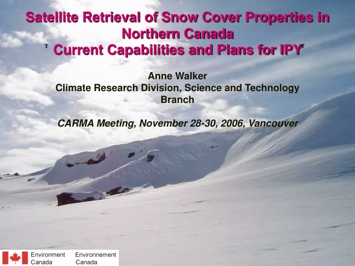
Satellite Retrieval of Snow Cover Properties in Northern Canada Current Capabilities and Plans for IPY Anne Walker Climate Research Division, Science and Technology Branch CARMA Meeting, November 28-30, 2006, Vancouver
Climate Processes Section • Research Themes • Cold climate energy and water cycle • RCM application/evaluation • Scaling of atmosphere and surface processes • MAGS – 2 (Mackenzie GEWEX Study) • Land surface processes and models • Developing parameterizations of key processes re: the energy, water and carbon cycle • CLASS--coupled land surface scheme for CGCM, RCM, GEM, MC2, WATFLOOD and others • BERMS--Boreal Ecosystem Research and Monitoring Sites • Cryosphere in the climate system • CRYSYS (Cryosphere System in Canada) • remote sensing--development, validation and implementation of new techniques • spatial and temporal variability of cryospheric elements • Measurement science/climate observation research • accuracy and compatibility of climate observations • automation and new technologies • special field observation programs (e.g. FOPEX)
Satellite Remote Sensing – Snow Cover Optical -- Snow extent Passive Microwave – Depth/SWE • Reflection of visible light • < 1 km spatial res. • Impeded by cloud cover and lack of sunlight • 40+ year record of satellite sensors (AVHRR, Landsat, MODIS) • Microwave emission from earth’s surface • 10-25 km spatial res. • “All-weather”, independent of light conditions • ~ 30 year record of satellite sensors (SMMR, SSM/I, AMSR-E)
Passive Microwave Remote Sensing of Snow Cover Properties • Snow cover snow grains and air • Microwave energy emitted by underlying ground (TBg) is scattered by grains • TB snow surface < TBg • Amount of scattering is a function of snow depth and density SWE • TB = SWE • Volume scattering of emitted earth radiation by snow cover provides basis for retrieval of snow cover properties from passive microwave data • Data available in near real time and as historical archive in gridded format • Canadian focus on development of regional-based retrieval methods (algorithms) for dominant landscapes – prairies, boreal forest, tundra
Regional SWE Products for Research and Operational Applications • Canadian Prairies • weekly maps produced and sent to users (federal, provincial agencies, private industry) who have a requirement for regular monitoring of snow cover in western Canada • - available to public on www.socc.ca (State of Canadian Cryosphere) C Manitoba – Red River watershed - specialized maps sent to provincial water resource agencies focussed on priority river basins for forecasting spring runoff and flood risk Snare River Basin – NWT - maps for hydro companies (e.g. NWT Power Corp.) in support of planning hydroelectric power operations Mackenzie Basin - MAGS research on snow cover variations, RCM evaluation
Current MSC Snow Depth/SWE Network 19.35 GHz 85.5 GHz 37 GHz 1.4 GHz 6.9 GHz Validation of Satellite Derived SWE Information • 1) Airborne/field validation campaigns • Acquisition of airborne microwave radiometer data and ground-based measurements to support: - validation of satellite retrievals - algorithm refinement/new development • 2) Regional snow surveys • Targetted to specific landscape environments • ground-based measurement transects over extensive areas MSC microwave radiometers on NRC Twin Otter In-situ measurements 3) Comparison with snow depth/SWE available from EC monitoring networks + other agencies
Improving Passive Microwave SWE Retrievals for Northern Canada (EC and Wilfrid Laurier U.) Tundra Ecosystem Research Station (TERS) located at Daring Lake NWT • Study Objectives: • Conduct in-situ snow survey to assess variability and physical properties of snow cover. • Integrate ground based and airborne radiometer data to investigate snow cover relationships for representative terrain units at a variety of scales (aircraft/field campaigns). • Investigate the influence of lake ice on passive microwave brightness temperatures - existing algorithms do not consider lake covered area and cause SWE underestimations. Field sampling and aircraft remote sensing data collection during 2004-2006 Derksen et al., Remote Sensing of Environment, 2005
Variability and Change in the Canadian Cryosphere Can. contribution to the “State and Fate of the Cryosphere” IPY 105 Planned IPY snow cover field campaigns in Canadian tundra regions: April-May 2007 NWT Jan-Feb 2008 Northern Quebec April-June 2008 NWT & Arctic Islands Photo: Vital Arctic Graphics, UNEP, GRID-Arendal, 2005
What is the spatial/temporal variability in SWE over northern Canada? • Major field activities planned for IPY with airborne over flights and ground surveys in NWT, Nunavut and Québec to address these issues • Assess transferability of satellite retrieval techniques developed at NWT and N. Manitoba study sites to other tundra regions IPY Deliverables: • Maps of validated SWE over northern Canada documenting spatial and temporal variations during IPY time period. • Application of retrieval techniques to passive microwave satellite time series to generate a 30 year time series of SWE and assess climate-related variability. • International collaboration Assess transferability of techniques to other circumarctic regions
2008 2008 2007 IPY Field Activities in Support of Validated Satellite SWE Products (Maps, Data Sets) April 2007 Alaska-Canada Barrens Snowmobile Transect 2007 and 2008 Field surveys and aircraft/field campaigns 2007
Outreach: Canadian Cryospheric Information Network (CCIN) • Near real-time access to Canadian cryospheric data for cryospheric monitoring and decision-making (www.ccin.ca) State of the Canadian Cryosphere (SOCC) site receives ~5000 unique visits per month during winter months