Download
1 / 23
230 likes | 444 Views
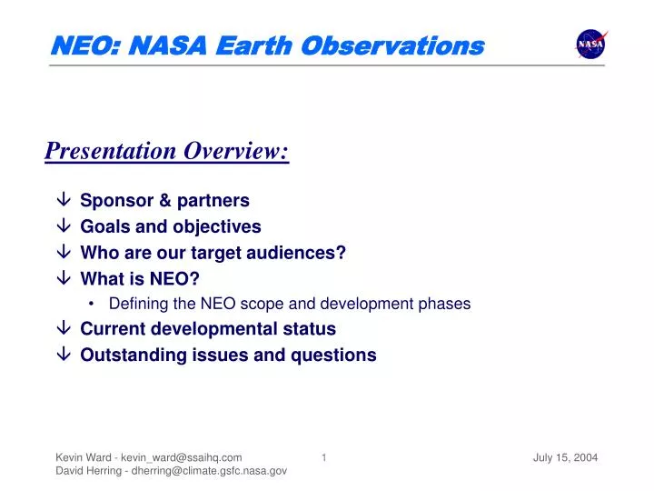
Sponsor & partners Goals and objectives Who are our target audiences? What is NEO? Defining the NEO scope and development phases Current developmental status Outstanding issues and questions. Presentation Overview:. A Collaborative Effort.

E N D
Sponsor & partners • Goals and objectives • Who are our target audiences? • What is NEO? • Defining the NEO scope and development phases • Current developmental status • Outstanding issues and questions Presentation Overview: July 15, 2004
A Collaborative Effort • Prototype effort sponsored by Vincent Salomonson, MODIS Team Leader • In partnership with the MODIS Discipline Groups • Mark Gray & Bill Ridgway, Atmosphere • Norm Kuring & Gene Feldman, Ocean • Jacques Descloitres, David Roy, & Robert Wolfe, Land • In partnership with ESDIS • Robin Pfister and the ECHO development team • In partnership with the Earth Observatory team • Kevin Ward, scripting and database design • Goran Halusa, interface design • David Herring, science writing • A diversity of “tirekickers” from outside NASA July 15, 2004
NEO Mission Statement “To significantly increase the demand for NASA Earth Science Enterprise (ESE) data while dramatically simplifying public access to geo-referenced browse images.” July 15, 2004
What are our objectives? • To raise awareness of, and provide easier access to, NASA remote sensing data • To provide novice and non-traditional users with a one-stop shopping interface for accessing geo-referenced imagery and/or ordering data • To help obtain support for and take advantage of the decentralized community where the expertise and infrastructure resides • To simplify the process, and shorten the timespan, of going from browse to analysis for our target audiences July 15, 2004
Who wants NASA images/data? • Communications partners & public media can easily access images &/or data for display, publication, or broadcast National Museum of Natural History Forces of Change Tokyo Science Museum “GeoCosmos” (~20-foot spherical TV) July 15, 2004
Target Audiences • Museums all across the country • AMNH, NMNH, Air & Space Museum, Maryland Science Center, etc. • Other popular Web sites • NASA Portal, Destination Earth, • Public media • StormCenter Communications, National Geographic • Education lesson developers • DLESE, TERC, WorldLink Media • Citizen scientists • Society for Amateur Scientists, The Heinz Center • NASA Earth Explorers Institute • The science community July 15, 2004
2004 EO Survey Results • From May 4 - 18, 2004, we surveyed both site subscribers & visitors and received a total of 3,717 (+1,896) responses • 509 Teachers (14%,+2%) • 238 Students (6%, -4%) • 673 Scientists (18%) • 224 Media Professionals (6%, +2%) • 94 Legislative Officials (3%) • 1,979 “None of the above” (53%) July 15, 2004
Earth Observatory survey results • If you had easy-to-use software and easy access to RS data, would you take up Earth observation as a hobby? • Almost two-thirds (64%) said “Yes” (!) and 27% said “Maybe” July 15, 2004
What is our objective? • To overcome technical and cognitive barriers so we can share images & data with unsophisticated target audiences Technical barriers: • Access to data &/or new science results • Bandwidth constraints • Storage constraints • Tools for subsetting &/or manipulating data • Tools for visualizing &/or extracting information from data • Tools & techniques for integrating these data into predictive models Cognitive barriers: • Topics often seem abstract &/or irrelevant • Chock full of jargon – intimidating • Highly politically charged subjects, hence myths & misinformation are perpetuated; what to believe? • Subject is extremely complex, spanning across many Earth science disciplines • B/c our info is brand new, our audience has no perspective on it July 15, 2004
What is NEO? • Centralized repository of geo-referenced browse images • associated metadata: lat/long, data product, satellite/sensor, etc. • centralized so that users will not have to locate and then browse independent image sites (e.g., MODIS discipline group or DAAC websites) • populated through the cooperation of partner image providers • Flexible user interface for varied user groups to meet the needs of • novice users requiring non-mission- or product-specific search capabilities • advanced users familiar with parameters, product names, satellites and sensors July 15, 2004
What is NEO? (cont) • Provide functionality to link directly from browse image to source data • Users may proceed from viewing browse image to checking data availability to ordering source data in minimum of steps • Data availability and ordering functions conducted through ECHO (EOS ClearingHOuse) -- a middleware framework for searching and ordering data from multiple data providers (http://www.echo.eos.nasa.gov/) • A resource that will make browsing for and ordering data much simpler and faster, and will be a site where data-related outreach and education can be centrally coordinated and disseminated A centralized interface for viewing browse imagery and selecting and ordering data July 15, 2004
System Overview NEO Browse. Browse images are produced, stored, and made accessible by different servers. The prototype NEO server will interface routinely with each of these servers to retrieve the desired images for storing, indexing and display. Additional browse images also available from ECHO. Atmos. Disc. Group Server Land Disc. Group Server Ocean Disc. Group Server MODIS Rapid Response System N E O ECHO Data Ordering. NEO will shake hands with the ECHO System, which provides an inventory of NASA’s data collections & Client API’s for ordering data. Thus, ECHO serves as a portal to the DAACs where MODIS data are archived. NSIDC DAAC GES DAAC LP DAAC July 15, 2004
File Formats • Spatial resolutions • 1 km, 5-minute granules: 1800 x 1800 and 300 x 300 pixels • Global products at 0.1 and 1 degree: 3600 x 1800 and 360 x 180 • Platte Carre is our preferred projection • Temporal resolutions • 1 day, 8 or 16 days, 1 month • File format • 8-bit binary number arrays, grayscale for products • Natural color is the exception • Users have the option of accepting our palettes, or devising their own July 15, 2004
Global Data Products • Atmosphere Products • Aerosol optical thickness • Cloud fraction / cloud mask • Fraction of fine aerosol • Cloud particle radius • Water vapor • Cloud optical thickness • Ocean Products • Sea surface temperature (day) • Water-leaving radiance • Chlorophyll concentration • Land • Land cover classification • Daily surface reflectance • 16-day albedo • Land surface temp (day & night) • Normalized Difference Vegetation Index • Leaf Area Index July 15, 2004
What Does NEO Search? • NEO browse image records • submitted by image provider partners: browse image and metadata packet generated during course of data processing; transmitted through FTP (push or pull) or other protocol • harvested from image sites in coordination with site managers; must be able to duplicate extent of metadata provided by direct submission • images remain on provider sites unless other storage required • Harvested ECHO records • browse images, data availability, and other metadata will be available from records harvested from ECHO and integrated into NEO • User will have ability to search just for records that have browse images or all records within scope of collection (i.e., MODIS) July 15, 2004
How Does NEO Search? • fielded search • query based on selections from populated pull-down menus (incl. specific sensors or product) and other options • selection of more parameters will allow the user to drill down to the most precise result set • more suitable to advanced users as it will require knowledge of product names, satellites, sensors, etc. • free-text search • assistive interface for users who do not have the specific terminology required for the fielded search • combination textual, spatial and temporal search • goal of free-text search (and underlying back-end) will be to return data products that are relevant to the user’s query; spatial and temporal parameters will be the same July 15, 2004
Orients users while managing their expectations: • Logical responses to illogical requests • How/where to download tools to work with data • About each product, links to algorithms &/or ATBDs • Size of order with ability to specify retrieval method • Provides many vectors for searching for images & browsing in 2 different projections • Data ordering allows users to place orders &/or track status of orders July 15, 2004
Adding Value to Browse Images • Provide comprehensive education to users regarding data file formats and tools to use them • tutorials: how to use images and data on site, links to websites for tools • “novice” perspective is default; enable advanced users to bypass or turn-off assistive messages and capabilities • Attach/link to ancillary files, metadata, or functions • geo-referenced grayscale image for use in Image Composite Editor [http://earthobservatory.nasa.gov/Laboratory/ICE/] • ASCII-formatted representation of data (Level 3 global images) [http://lake.nascom.nasa.gov/www/online_analysis/movas/monthly/] • links to relevant websites: more information about particular data product • data product descriptions: brief introductory paragraphs explaining goals and science behind product; advanced descriptions also, or links to ATBDs July 15, 2004
From Browse to Analysis • Image Composite Editor (ICE) at http://icetool.nasa.gov • Build true-color & false- color composites • Build scatter plots or graphs of transects to look for correlations • Perform histogram analyses • Probe images to find unit values and lat-lon info per pixel • Animate time-series images • Perform math functions • Zoom & pan • Assign color palettes July 15, 2004
Adding Value (cont) • Attaching ancillary files • Can be attached to either individual browse image records (grayscale image, ASCII data) or at a more general level to the data product (ATBDs, product URLs, dataset descriptions) • grayscale image and ASCII data files require further operations by the image provider and may require additional storage within NEO • The NEO collection will provide a platform upon which data-related education and outreach can be pursued • demonstrate how classroom analysis can be conducted using browse imagery (ICE tool, ASCII data) • Enables random access to images in a “pull mode,” thereby empowering NASA’s communications partners to work more massively parallel July 15, 2004
Current Development Progress • NEO Data model • Structure of database & metadata defined • Browse data ingest procedures • Infrastructure / applications in support of ingest via ftp pull, http • Currently ingesting MODIS Ocean datasets (thanks to Norman Kuring) • Full-text search based upon dataset metadata • Including investigation of conceptual searching techniques • ECHO (EOS Clearing HOuse) • Harvesting granule metadata • permits linking NEO browse data to raw granules/data products • Granule matching between NEO and ECHO • allows for placing orders for data directly from DAACs July 15, 2004
Primary Issues • Level 2 data format • Best format for storing browse data in NEO • Weigh performance vs. flexibility • how to store/present projected L2 data: local and/or Platte Carre • investigate potential for remapping to other projections and combining datasets together (GIS) • Production server • Disk space • ~ 6.5TB per year for selected MODIS products • Will need ample network bandwidth • both NEO-internal and for delivery • perhaps to share the Rapid Response network • Terra MODIS Ocean products? July 15, 2004
Upcoming Milestones • May 2004: NEO development server set up • July 2004: Commence interface design • September 2004: Prototype ready for evaluation • Limited dataset availability initially • December 2004: Procurement of production server • February 2005: Begin ingest of production data • April 2005: NEO launched publicly with selected MODIS datasets July 15, 2004