Download
1 / 8
90 likes | 277 Views
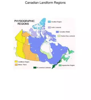
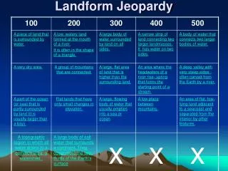
UNDERSTANDING LANDFORM PATTERNS. SHEILDS PLAINS LOWLANDS. hi. LANDFORM PATTERNS. Geographers are interested in patterns o the earth. They use arrangement of cities, landforms, or river systems to help them identify unique regions.

E N D
UNDERSTANDING LANDFORM PATTERNS SHEILDS PLAINS LOWLANDS hi
LANDFORM PATTERNS • Geographers are interested in patterns o the earth. They use arrangement of cities, landforms, or river systems to help them identify unique regions. • You learned that most active volcanoes are located at plate boundaries, especially around the Pacific Ring of Fire. • We will be discussing examples of landform patterns in North America – such as shields, plains, and lowlands
Plate Tectonics • PLATE TECTONICS – the theory that all the continents were once joined together and are gradually drifting apart. • During the earth’s 4.6 billion – year history, land masses have been built up and then worn away many times. • Scottish geologist James Hutton first advanced this idea in 1785, but most scholars rejected it. • At the time, scientists thought the earth was only 6000 years old, but this was too little time for so much change to have happened.
PANGAEA • German geographer Alfred Wegener was another landform pioneer. • In 1912, he proposed that all of the continents were once joined together in on huge land mass named Pangaea. • His theory was also criticized, but is now considered a key to understanding landform patterns. • The modern theory of Plate Tectonics is built upon Wegener’s work
SHIELD REGIONS • Pangaea was built around old shield regions. These regions were created by widespread volcanic activity billions of years before. • They are largely composed of igneous rock; that is, solidified magma. Later, heat and pressure altered some parts of these old shield regions. • This formed metamorphic rock, or changed rock. • As Pangaea broke apart, the shield regions were scattered across the earth as the core of the continents. • Today, they are heavily worn and carved by the relentless forces of erosion – water, ice, and wind.
PLAINS AND LOWLANDS REGIONS • The erosion of the shield regions created the rest of the continent Rivers and glaciers carried eroded material, called sediment into ancient seas. • There, it accumulated into thick beds that slowly solidified into sedimentary rock – (thick beds of sediment that have slowly solidified into rock) • New land emerged around the ancient shields as the seas filled in. These plains and lowlands are underlaid by horizontal layers of sedimentary rock. • Plains are broad areas of level land, such as the great plains region of central North America. • Lowlands are plains located along coastlines , for example, the Great Lakes – St. Lawrence Lowlands