Download
1 / 7
70 likes | 169 Views
Hillslope Erosion Implementation and Output. Colleen O. Doten August 18, 2004. http:www.geo.uni-bonn.de/cgi-bin/geodynamik_main?Rubrik=research&Punkt=geomorphology. Sediment Module Implementation. Spatially variable soil parameters

E N D
Hillslope ErosionImplementation and Output Colleen O. Doten August 18, 2004 http:www.geo.uni-bonn.de/cgi-bin/geodynamik_main?Rubrik=research&Punkt=geomorphology
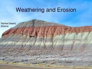
Sediment Module Implementation • Spatially variable soil parameters • Manning’s roughness coefficient, n: 0.01 – 0.02 (KINEROS2 model documentation) • Kindex: 30 – 62 1/Joule (Wicks and Bathurst,1996) • d50: 0.1 – 2.0 mm (Dietrich et al.,1982) • Run for a six year period: 10/1/1991 to 9/30/1997 • Hillslope erosion algorithm was run during eight periods of high modeled runoff: • 05/05 - 05/12/1992 • 05/18 - 05/31/1993 • 05/08 - 05/15/1994 • 05/21 - 06/06/1995 • 06/04 - 06/18/1996 • 05/16 - 05/21/1997 • 06/14 - 06/20/1997 • 07/06 - 07/12/1997
Default Output • AggregatedSediment.Values • Hillslope erosion (basin average in mm) • Sediment flux out (basin average in m3) • Total overland inflow (kg) • MassSediment.Balance • Hillslope erosion (basin average in mm) • Total overland inflow (kg) Final Sediment Mass Balance Average Surface Erosion Surface Erosion (mm): -1.42e-01 Surface Erosion (kg/hectare): -3.81e+03
Optional Output • Model Map (binary file) and Graphic Image (real-time): • Hillslope erosion (basin average in mm) • Sediment flux out (basin average in m3)
Model Results Simulated Rates, kg/ha/yr Hillslope erosion: 634 Road surface erosion: 17 – 41 (164 – 394 kg/km road) (3,247–7,842 kg/ha of road) Sediment Yield: 1,000 – 1,020 Published Rates, kg/ha/yr Hillslope erosion: 8 – 100 (north central WA) Road surface erosion: • 3,800 to 500,000 kg/km of road (Olympic Peninsula, WA) • 12,000 to 55,000 kg/ha of road (central ID) Sediment Yield: 813 – 13,500 (coastal OR and CA, western WA)
Sensitivity Analysis • Infiltration • six-year run, maximum difference in the average (daily and over the basin) runoff depth of less than 0.4 mm
References Dietrich, R.V., J.J.T. Dutro, and R.M. Foose, 1982: AGI Data Sheets for geology in the field, laboratory, and office, 2nd ed., American Geological Institute, Falls Church, VA. Engman, E.T., 1986: Roughness coefficients for routing surface runoff, Journal of Irrigation and Drainage Engineering, ASCE,112, 39-53. Helvey, J.P., 1980, Effects of a North Central Washington Wildfire on Runoff and Sediment Production, Water Resources Bulletin, l6, 627-634. Wicks, J.M. and J.C. Bathurst, 1996: SHESED: a physically based, distributed erosion and sediment yield component for the SHE hydrological modeling system, Journal of Hydrology, 175, 213-238. Woolhiser, D.A., 1975: Simulation of unsteady overland flow, Mahmood, K. and V. Yevjevich (eds), Unsteady Flow in Open Channels, V.II, Water Resources Publications, Fort Collins, CO., p. 502.