Download
1 / 11
180 likes | 263 Views
Land Degradation Neutrality Initiative (GEO-LDN). GEO Data Technology Workshop Antje Hecheltjen, Fabian Löw, Sasha Alexander, Barron Orr, Neil Sims, Alex Zvoleff, Amos Kabobah, Joost Teuben / 23 April 2019 / Vienna, Austria antje.hecheltjen@giz.de , fabian.loew@bbk.bund.de.

E N D
Land Degradation Neutrality Initiative (GEO-LDN) GEO Data Technology Workshop Antje Hecheltjen, Fabian Löw, Sasha Alexander, Barron Orr, Neil Sims, Alex Zvoleff, Amos Kabobah, Joost Teuben / 23 April 2019 / Vienna, Austria antje.hecheltjen@giz.de , fabian.loew@bbk.bund.de
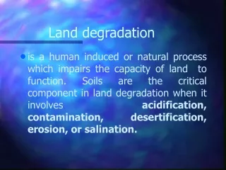
Land degradation - Whydoesit matter? 1. Needtoincreaseproductive potential ofland, delivergoodsandservicestoincreasingpopulation 2. Land is finite in quantity,increasedcompetitionforlandressources 3. Around 30% ofthe total landmassaffectedbydecliningsoilproductivity 4. Over 10 million hectares of arable land worldwide are degraded every year - an area roughly 1/3 the size of Germany Source: www.unccd.int/actions/global-land-outlook-glo
WhatisLand Degradation Neutrality (LDN)? LDN is“a state whereby the amount and quality of land resources necessary to support ecosystem functions and services and enhance food security remain stable or increase within specified temporal and spatial scales and ecosystems” (Definition by UNCCD COP12, 2015) SDG 15.3.1. “Proportion of land that is degraded over total land area” Source: Orr, B.J. et al. (2017): Scientific Conceptual Framework for Land Degradation Neutrality. A Report ofthe Science-Policy Interface. UNCCD, Bonn, Germany. p. 28
Whymeasure LDN? • Report on SDG 15.3 • UNCCD national reports Support planning and decision making processes for LDN implementation Source: Based on Orr, B.J. et al. (2017): Scientific Conceptual Framework for Land Degradation Neutrality. A Report ofthe Science-Policy Interface. UNCCD, Bonn, Germany. p. 66
Data andinformationneeds – whoseneeds? Diffentusers… • National reporting officer for international agreements (UNCCD, UNFCCC, UNCBD, SFDRR, SDGs…), e.g. NSO, NFP • National policy-maker, e.g. Ministry of Environment, Agriculture, Development, or Planning • Local decision-maker involved in territorial planning • Project manager in partner country • Farmerkeen to increase yields or adapt to climate change …face different information needs and challenges.
The GEO LDN Initiative… …helps national andlocalactors in all countries use Earth observationstoachieve LDN. …is a uniquestakeholder-driven initiativewith a clearpolicymandatefrom UNCCD.
Working Group 1 - “CapacityBuilding“ Main tasks: Increase the involvement of partner countries and other organizations. Develop innovative and fit-for-purpose training curricula and learning modules. Organize and implement of training on the use of available tools for accessing, processing, analyzing and interpreting data as well as validation techniques.
Working Group 2 - „Developingdataqualitystandardsandprotocols“ 1. Develop “minimum” data quality standards, ensure consistency, coherence and comparability of data sets supplied by various data providers in support of country efforts to monitor SDG 15.3.1. 2. Review existing standards & global consultation: taking into account the perspectives & requirements of Data providers and end-users 3. Revision ofexisting GPG: specification of data quality standards and related requirements, practical decision trees to guide countries in selecting datasets that meet their specific need 4. Reconciling global dataqualitystandardsandnational ownership, globalcomparabilityandnational usability. 5. Synergieswithexisting initiatives such as CARD-L, FAO Global SoilPartnership (GSP), other GEO Inititatives Refine and elaborate these standards to produce Version 2.0 of the GPG for SDG indicator 15.3.1
Working Group 3 - „Data analytics“ Background Many countries need improved access to data and tools to map and monitor SDG 15.3.1 and assist land planning decisions to achieve LDN. Cloud computingfacilitiescanreducedataexchangevolumesandimprovedataavailabilityformanydeveloping countries. Thereis a proliferationofclouddatasources, but still challengingtouseand not specificallyintendedtosupport SDG analytics. Objective Developorestablish a federatedcollaborativedataanalyticsplatform Tasks Reviewingexistingcollaborativeplatforms (Environmentlive, Trends.Earth, Open Data Cubes) Identifydevelopmentgaps/needs Call fororcommissionprojects
Let‘sworktogether! • Synergiesorduplicationofefforts? • Land degradationiscloselyrelatedtovarioussectorsincludingagriculture, forest, climate, anddisasterriskreduction. • LDN sub-indicatorsare relevant tootherreportingprocesses. • How do weensureinsideand outside of GEO thatwe follow a coherentapproach in capacitybuilding, definingdataqualitystandards, anddevelopingfederatedcollaborativedataplatforms? • How do weensurethatwetalkwith „datausers“ withonecoherentapproach?
Contact Amos Kabo-bah University of Energy and Natural Resources, Sunyani, Ghana amos.kabobah@uenr.edu.gh Antje Hecheltjen Deutsche Gesellschaft für Internationale Zusammenarbeit (GIZ), Bonn, Germany antje.hecheltjen@giz.de Neil Sims Commonwealth Scientific and Industrial Research Organisation(CSIRO), Melbourne, Australia Neil.Sims@csiro.au