Download
1 / 15
150 likes | 225 Views
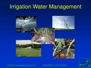
Karst Initiatives/Storm Water Management in Berkeley County. Brian Hopkins, Ph.D., P.E. Berkeley County Engineering Department. Issues for stormwater management. The Water Balance Water Quantity Control Water Quality Control Karst

E N D
Karst Initiatives/Storm Water Management in Berkeley County Brian Hopkins, Ph.D., P.E. Berkeley County Engineering Department
Issues for stormwater management • The Water Balance • Water Quantity Control • Water Quality Control • Karst • Maintaining water balance as impervious covers the Karst features and other recharge receptors • Good quality recharge • Structural issues • Nuisances Issues
Measures and Ordinance based on WV DEP/US EPA/Center For Watershed Protection Guidelines • Water Quality Volume( WQv) (0.9” in. Precipitation) • Capture and TREAT 90% of average rainfall (0.9” rainfall) • Recharge Volume (Rev) • Maintain dry weather hydrology • Based upon the USDA hydrologic soil groups • Channel Protection Volume (Cpv) • Protection from erosive events caused by bankful flows due to urbanization • Overbank Flood Protection (Qp25) • Protect infrastructure from flooding from increased PEAK flows • zero discharge of 10 yr event in flood hazard areas • Extreme Flood Protection (Qf) • Protect infrastructure from flooding during extreme flood events • Restrict development in flood plains
Water Quantity Control • Channel Protection Volume – detention of 1 yr event over 24 hours – lower peak discharges and provides a buffering effect • Over Bank Protection Volume - Manage the 25 yr storm peak flow rates to pre-existing peak discharge conditions – not volume • Extreme Flood Event – Safely pass the 100 yr event • Flood prone areas – additional storage required – zero discharge of the 10 yr event • Down stream analysis required
Quality • Goal is to protect surface and sub surface aquatic systems. • Reduction of pollutants. • TREATMENT through BMP’s – (Water Quality Volume) • Filtering • Chemical processes (oxidation) and adsorption • Biological processing – microbes, plants, etc. • Plants – filter, uptake, and provide substrate. • Residence time for treatment.
Ponds Micro-pool ED pond Wet Pond Wet ED pond Pocket pond Wetlands Shallow Marsh ED wetland Pond/marsh system Pocket Wetland Commercial Contech Storm Filter Aquaswirl Filtering Sand filter Underground Surface Perimeter Organic Filter/Bioretention Infiltration Infiltration trench Infiltration basin Open Channels Dry/Wet Swales Effective SWM Practices
Recharge • Discrete vs. Diffuse Recharge: • Treatment required for pure groundwater • Maintain a Water Balance • Exfiltration or Recharge Augmentation: • More impervious and more abstraction means less ground water in general thus methodology to make up for what is lost is required. • Understanding the dynamics of recharge: • Studies, field investigations, and modeling required to understand total implications
Nuisances • Ponded Water SWM and Mosquito abatement • Pretreatment – remove nutrient and organics loadings • Small, Deep pools – “micro pools” promote mixing, reduce stagnation, provide habitat for predators and inhibit invasive emergent vegetation • Predators in properly designed facility • Mosquito fish, dragon flies, aquatic beetles, and amphibians. • Fluctuating water surface elevation • Vegetation - Some types of vegetation help with mosquito control, while others exacerbate mosquito problems • Spatterdock, Arrowhead, etc. recommended • Chemical - Mosquito dunk and other treatments in maintenance schedules • Flexibility - Other filtering options (bioretention, sand filters, channels, etc. do not include standing water (designed for 48 hour drain down time)
Initiatives • More geotechnical testing requirements. Requirements of “Geotechnical methods for Karst feasibility testing” specifically added to SWM Ordinance • Karst study, borings, geophysical investigations • Monitoring systems, Maintenance and repair of sinkholes • Recommendations for providing Phase I environmental assessments and phase II where required prior to site plan approval • Increased field inspections at review time and coordination with WV DEP on Karst areas and features
Initiatives Continued • Comprehensive plan for county and zoning to proposed to preserve recharge zones and limit development in more sensitive areas • County wide comprehensive topographic data • Potential for Master SWM Plan – Storm Water Utility being planned • LID options - 2 acre lots, 18’ pavement open street sections
Future/Goals • Continued Identification and Studies of Karst Features within the county • Computer and GIS based stormwater quantity and/or quality models • Water quality testing
References • WVDEP Storm Water Management – Ground Water Protection Plan Guidance Document • 2000 MD SWM Design Manual Vol. I&II– MD DEP, Center for Watershed Protection, et.al. • USDA Natural Resources Conservation Service Maryland Conservation Practice Standard Pond Code 378 (January 2000) • “Managing Mosquitoes in Stormwater Treatment Devices” 2004, University of California, Department of agriculture and natural resources. • HydroGIS ’96: Application of Geographic Information Systems in Hydrology and Water Resources Management. • Brown, W. and T. Schueler, 1997. National Pollutant Removal Performance Database for Stormwater BMPs. Center for Watershed Protection. Chesapeake Research Consortium. • Meyer, S.P., Salem, T.H., and Labadie, J.W. (1993) Geographic Information Systems in Urban Storm-Water Management, Journal of Water Resources Planning and Management, 119 (2): 206-228. • Chesapeake Bay Program • Recommendations for Refinement of a Spatially Representative Non-tidal Water Quality Monitoring Network for the Chesapeake Bay Watershed August 2005, Report of the Task Force on Non-tidal Water Quality Monitoring Network Design Scientific and Technical Advisory Committee, STAC Publication 05-006