Download
1 / 38
380 likes | 477 Views
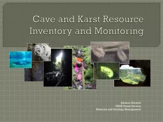
Establishing Monitoring Networks in Karst Terrain. Components of Water-Level Monitoring Program. Site selection for observation wells Frequency of water-level measurements needed for purpose Implementation of quality-assurance Establishment of data-reporting and archival process.

E N D
Components of Water-Level Monitoring Program • Site selection for observation wells • Frequency of water-level measurements needed for purpose • Implementation of quality-assurance • Establishment of data-reporting and archival process
Site SelectionWhy Monitor Water Resource? • To establish baseline to measure against future change • To measure variability over time • To quantify water availability over time and over a range of climatic conditions • To incorporate into land-use planning, engineering design • For early-warning (drought) systems
Time period for meaningful data Typically, collection of water-level data over one or more decades is required to compile a hydrologic record that encompasses the potential range of water-level fluctuations in an observation well and to track trends with time. Taylor and Alley, 2001, USGS Circular 1217
What is the geographic range served by the monitoring network? • Site-specific • Local • Regional • National
LOCAL Jefferson and Berkeley Counties, WV
Percentage of Population Served by Private Wells • Jefferson County 58% • Berkeley County 35%
Public Water Supply Dependency on Ground Water • Jefferson County 86 % • Berkeley County 60%
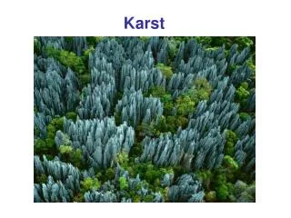
Functions of ground-water system Local , intermediate, and regional flow systems
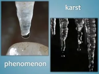
Rocks and Water Primary openings Well-sorted sand Poorly-sorted sand Porous material Secondary openings Fractures in Caverns in Granite Limestone Fractured rock
Recharge GW Discharge GW RECHARGE = GW DISCHARGE
Need for baseline data to measure against future change • Natural variability occurs on a variety of time scales: daily, monthly, decadal, or longer • Human activities can modify those trends at any of those temporal scales
WATER-LEVEL FLUCTUATIONS CAUSED BY ET FROM GROUND WATER 8AM DEPTH TO WATER IN FEET 9PM 24 25 26 27 28 29 30
Well Hydrograph Showing Climatic Effects
Regional ICPRB network at http://www.potomacriver.org/water_supply/groundwater.htm
National USGS national network at http://groundwaterwatch.usgs.gov/
Summary • Ground-water monitoring networks should be designed for intended purpose • Data should be quality-assured and archived for future use • Continuous-data record of at least a decade provides best information • Real-time transmission combined with historical record can give drought status