Download
1 / 46
460 likes | 541 Views
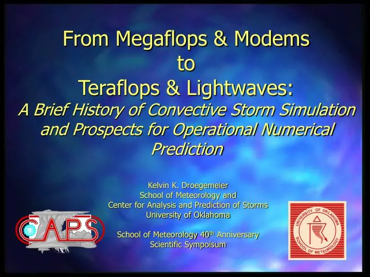
From Megaflops & Modems to Teraflops & Lightwaves: A Brief History of Convective Storm Simulation and Prospects for Operational Numerical Prediction.

E N D
From Megaflops & ModemstoTeraflops & Lightwaves:A Brief History of Convective Storm Simulation and Prospects for Operational Numerical Prediction Kelvin K. DroegemeierSchool of Meteorology and Center for Analysis and Prediction of StormsUniversity of OklahomaSchool of Meteorology 40th AnniversaryScientific Sympoisum
It Began with a Vision: L.F. Richardson’s “Forecast Factory”
It Began with a Computer: ENIAC • Not the first computer, but it opened the door for the “von Neumann architecture” • Built to generate ballistics tables • Weighed 30 tons • Had 18,000 vacuum tubes, 1,500 relays thousands of resistors, capacitors, inductors • Peak speed of 5000 adds/second and 300 multiplies/sec • Played a key role in the development of the hydrogen bomb
Some Interesting Comparisons • The ENIAC was 1000 times faster than its predecessor • A 600 MHz Pentium III processor is 240,000 times faster than the ENIAC • A desktop PC with 128 mbytes of RAM can store 640,000 times as much data as the ENIAC • The ENIAC was decommissioned in 1955 • The ENIAC ran the first NWP calculation (Charney et al., 1950)
Charney, Fjortoft, and von Neumann (1950) • Numerically integrated the barotropic vorticity equation • 736 km resolution • 24 hour forecast • Encountered nonlinear instability (later solved by Norm Phillips) • Did exploratory work on baroclinic equations
Parallel, Parallel, Parallel Distributed Memory Scalable Parallel Shared Memory Vector/Parallel Vector/Pipeline
The Future: Inexpensive Clusters Built Around Commodity Processors and Linux
Cloud-Scale Modeling • 1950’s: Early 1-D models (Malkus, Warner, Holton) • Lagrangian parcel representations • Simple microphysics and entrainment • Neglected vertical PGF (explicitly) • Very controversial results, but a good start • 1960’s: Early 2-D models (Ogura, Lilly) • Axial or planar symmetry • Inverse cascades (couldn’t reproduce similarity theory) • Basic microphysics • Soong and Ogura (1973) was a watershed paper
Cloud-Scale Modeling • 1970’s: Emergence of 3-D Models • Steiner was the first (1973) • Computers were still not sufficiently powerful • Successes by Lipps, Cotton, others • Arrival of Cray-1 at NCAR and the collaboration of Joe Klemp and Bob Wilhelmson marked the turning point
Early Contour Plot of Horizontal Wind from 3-D Simulation Courtesy R. Wilhelmson, University of Illinois
Early “Animation” of a 3-D Simulation Courtesy R. Wilhelmson, University of Illinois
3-D Structure Based on Trajectories Courtesy R. Wilhelmson, University of Illinois
Pipe Cleaner Perspective! Courtesy R. Wilhelmson, University of Illinois
Computer-Generated Pipe Cleaners! Courtesy R. Wilhelmson, University of Illinois
From Simulation to Prediction Observations Courtesy R. Wilhelmson, University of Illinois
From Simulation to Prediction Observations Simulation Courtesy R. Wilhelmson, University of Illinois
Based on Simulations, Observations (radar, chase teams), and Theory, We’ve Learned • Why storms split • Why storms have deviate motion • How storms acquire rotation • How to determine storm time • Something about storm energetics
Translating this Knowledge to Operations: Current Operational Grid
What Causes Most of the Problems? • Intense severespring and winter storms that create high-impact, locally disruptive weather
An Emerging Question in the Late 1980s . . . explicitly predict this type of weather? Can computer forecast model technology. . .
This Led Doug Lilly and His Studentsto Explore Single-Doppler Velocity Retrieval (SDVR) real wind observed component
Center for Analysis and Prediction of Storms (CAPS) • One of first 11 NSF Science and Technology Centers established in 1989 • Mission of CAPS: To • demonstrate the practicability of numerically predicting local, high-impact storm-scale spring and winter weather, and • to develop, test, and help implement a complete analysis and forecast system appropriate for operational, commercial, and research applications
The Key Scientific Questions • Can the 3-D wind and mass fields be retrieved reliably from single Doppler radar observations and used to initialize a prediction model? • Which storm-scale structures and processes are most predictable, and will fine-scale details enhance or reduce predictability? • What physics is required, and do we understand it well enough for practical application? • What observations are most critical? • What networking & computational infrastructures and coding techniques are needed to support high-resolution NWP? • How can useful decision making information be generated from forecast model output?
Sample SDVR Result SDVR-Retrieved Dual-Doppler Weygandt (1998)
Sample SDVR Result SDVR-Retrieved Dual-Doppler Weygandt (1998)
5 April 1999 - Impact of NEXRAD Data 3 hr ARPS Reflectivity Forecast (9 km) – NO RADAR DATA Valid 15Z 3 hr ARPS CREF Forecast (9 km) WITH RADAR DATA and SDVR Valid 15Z 15 Z Reflectivity Courtesy S. Weygandt and J. Levit
The Impact of Horizontal Resolution Radar CAPS 12-hour Forecast Radar (Tornadoes in Arkansas)
The Impact of Horizontal Resolution CAPS 6-hour Regional Forecast Radar Radar (Tornadoes in Arkansas)
The Impact of Horizontal Resolution Radar CAPS 6-hour Local Forecast
Detail is a Double-Edged Sword! Forecast Actual Event D/FW Airport 30 miles A perfectly predicted storm having a position error of 30 miles may be a terrible forecast on the scale of a single airport
Where Do We Go From Here? • CAPS has provided some evidence of small-scale predictability, but … • Operational prediction of storm-scale weather will require • better understanding of predictability (?) • better understanding of scale interaction • intense training by forecasters and fundamental changes in their interpretation/use of model output • more computing power • access to NEXRAD radar data and better techniques for retrieval and assimilation
Current Status of the CRAFT Real Time NEXRAD Level II Ingest Test Bed
10 km 3 km 1 km 20 km CONUS Ensembles The Future of Operational NWP
10 km 3 km 10 km 3 km 3 km 3 km 20 km CONUS Ensembles The Future of Operational NWP
My “Prediction” of the Future • NCEP begins operating the WRF model (or variants thereof) • at 10 km resolution: 2003-2004 • at 3 km resolution (nested) using NEXRAD radar data: 2006 • at 1 km resolution (nested): 2008 • at 1 km resolution North America: 2010-2012 • By 2005, the private sector weather industry will achieve $100B in revenues