Download
1 / 15
150 likes | 297 Views
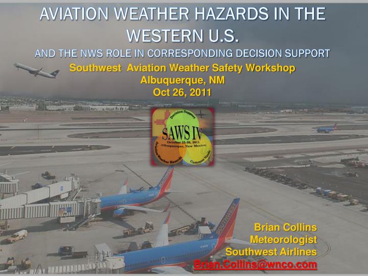
Southwest Aviation Weather Safety Workshop Albuquerque, NM Oct 26, 2011. Brian Collins Meteorologist Southwest Airlines Brian.Collins@wnco.com. Aviation Weather Hazards in the Western U.S. and the NWS Role in Corresponding Decision Support. Topics of Discussion.

E N D
Southwest Aviation Weather Safety Workshop Albuquerque, NMOct 26, 2011 Brian Collins Meteorologist Southwest Airlines Brian.Collins@wnco.com Aviation Weather Hazards in the Western U.S.and the NWS Role in Corresponding Decision Support
Topics of Discussion • Quick look at SWA Facts and Figures • SWA Weather Overview • Western Weather Hazards and the corresponding decision making process • NWS Product Suite – Consistency is key
SWA Facts and Figures • 3400+ daily flights from 72 airports • 550 Boeing 737 aircraft (300’s, 500’s, 700’s) • Average flight length is 653 miles • Shortest: 133 miles (RSW-MCO) • Longest: 2,295 miles (BWI-SAN) • Southwest consumed 1.4 billion gallons of jet fuel in 2010 • New 737-800 aircraft expected to begin sevice next Spring (increase passenger capacity from 137 to 175)
SWA Weather • Big picture is a major responsibility • Significant involvement in strategic decision making process (i.e., large scale aircraft movement, weather related station decisions) • Involvement in tactical decision making as needed • Rely solely on NWS TAFs for individual flight planning decisions • Twice daily briefings to ops-related groups (Dispatch, Pilots, Maintenance, Ground Operations, Reservations, Crew Scheduling, Executive Office, Customer Service) • Significant participation in various industry workgroups
Convection in the Western U.S. • Implications and decisions for SWA operations • Decisions not always clear cut, sometimes risk/reward thought process is necessary • Traditionally it would be go, go, go until forced to stop…..that has changed • Sometimes holding flights upstream can pay off more than sending them all • Connections also big part of the puzzle • Factors besides actual weather also influence decisions • What is the specific airport? • Is it a maintenance and/or crew base? Handle crew timing out? • Aircraft availability for swaps on late lines? • Potential for taxi/ramp congestion, ATC initiatives (can get planes caught) • Late operations - airport curfews, station staffing (able to support sig late ops)
Convection in the Western U.S.Getting flight in ahead of significant weather • Positives • Maintain schedule times • Potential to turn & go before sig weather hits • Weather could diminish prior to impacting station • Negatives • Aircraft may be in path of potential damage (hail, strong winds, lightning, dust deposits) • Cost of damaged aircraft quite high • Crew timing out possible if departures stopped for any length of time • Less control when wx impacts a station (it’s not easy to speed up a departure) • Gridlock can develop if flights come in but are not getting out
Convection in the Western U.S.Holding flights (in air or on ground) ahead of sig weather • Positives • Protect aircraft from possible damage • Multiple aircraft damaged by hail this year (DAL, OMA, TUS) • Dust has accounted for 6-10 OTS aircraft at PHX in several events this season • Can address possible crew timeout issues upstream (position new crew) • When held upstream, better control of aircraft into station after weather moves off • Negatives • Passengers aren’t there yet! • Airborne flights have increased diversion potential with holding limitations based on fuel • Distant alternates, minimal services, unpleasant passenger experience • Cost of diversions quite high • Post-divert return to original destination not a guarantee (dependent on wx) • Lost time (also increases delays down line)
Decision Support from the NWS • Aviation portion of AFD is a huge asset • Adds clarification, conveys forecast confidence, and presents potential “if then” secondary scenarios • Provides access to local NWS office expertise on timing and type of precip, wind variations, ceiling/vis issues • Breaking out specific airports (LAS, PHX, LAX) is VERY helpful • TAF Highlights • Amend in timely manner when necessary, even if near end of TAF cycle (Important with regard to planning for fuel load!) • Utilization of VCTS and CB in TAF are key and can be very helpful • Same notation can have different interpretation in west vs east U.S. • East - frequently means potential for T-storms with rain/showers, or timing of storms still somewhat uncertain • West - terrain factors play large role, with these terms used often in storm season • Frequently depict distant high terrain T-storms • AFD usually brings out the potential for actual terminal impacts
Decision Support from the NWS • NWS products (and consistency among them) are key in being prepared to make operational decisions • Multiple products are viewed and utilized for various aspects of operational planning • TAF is first and foremost among tools, but dispatchers frequently look at other supporting products • Gridded Forecasts & Zone Forecasts • AFD • Convective Products (CCFP, SPC, LAMP, Model Output) • Special Weather Statements • Airport Weather Warnings • Advanced outlook event statements are big help (LBB, PHX) • Can sometimes be significant variation in forecast products (at terminal or within the local airspace) • Inconsistent products can be a source of confusion in flight planning (especially in terms of the fuel load)
Decision Support from the NWS Mixed Messages (Example #1) AREA FORECAST DISCUSSION NATIONAL WEATHER SERVICE TAUNTON MA 656 AM EDT MON AUG 8 2011 AVIATION /12Z MONDAYAFTER 12Z TODAY…SCATTERED SHOWERS AND THUNDERSTORMS SHOULD BEGIN TO FIRE BY LATE MORNING INTO EARLY AFTERNOON WHICH MAY RESULT IN LOCALIZED LOWER CONDITIONS. MAIN HAZARDS WITH ANY TSTMS WILL BE HEAVY RAINFALL. KBOS TERMINAL...MEDIUM CONFIDENCE IN TAF. ITS UNCERTAIN HOW QUICKLY LOW CLOUDS BURN OFF LATER THIS MORNING AND AFTERNOON. IN ADDITION...SCATTERED SHOWERS AND THUNDERSTORMS MAY AFFECT THE TERMINAL AT TIMES TODAY. VFR CONDITIONS ARE EXPECTED BY TONIGHT. ZONE FORECAST PRODUCT FOR SOUTHERN NEW ENGLAND 715 AM EDT MON AUG 8 2011 INCLUDING THE CITIES OF...BOSTON...CHELSEA...REVERE...WINTHROP 715 AM EDT MON AUG 8 2011 TODAY: MOSTLY CLOUDY. A CHANCE OF SHOWERS WITH ISOLATED THUNDERSTORMS THIS MORNING...THEN NUMEROUS SHOWERS AND SCATTERED THUNDERSTORMS THIS AFTERNOON. AREAS OF FOG THIS MORNING. LOCALLY HEAVY RAINFALL POSSIBLE THIS AFTERNOON. HIGHS IN THE UPPER 70S. NORTHEAST WINDS 5 TO 10 MPH. CHANCE OF RAIN 60 PERCENT. KBOS 081122Z 0812/0918 02004KT 4SM BR FEW008 SCT060 FM081500 04007KT P6SM SCT012 BKN070 FM082300 33006KT P6SM BKN050 FM091500 08007KT P6SM SCT050
Decision Support from the NWS Mixed Messages (Example #2) AREA FORECAST DISCUSSIONNATIONAL WEATHER SERVICE NEW ORLEANS LA1214 PM CDT TUE SEP 27 2011AVIATIONSTRONG OUTFLOW BOUNDARY GENERATED FROM OVERNIGHT MESOSCALE CONVECTIVE SYSTEM IN CENTRAL MISSISSIPPI CURRENTLY PASSING THROUGH SE LOUISIANA AND OFF THE MISSISSIPPI COAST. MORNING SOUNDING SHOWED HIGH INSTABILITY SUPPORTIVE OF CONDITIONALLY STRONG THUNDERSTORMS AS TEMPERATURES EXCEED 88F. MAY NEED TO INCLUDE BRIEF TEMPO GROUPS AT A FEW TERMINALS FOR ANTICIPATED CONVECTION BUT WILL TRY TO SHOW DISCRETION TO MOST LIKELY LOCATIONS...LEAVING OUT OTHERS WITH LESS THAN 30 PERCENT EXPECTATIONS. KMSY 271729Z 2718/2818 00000KT P6SM FEW040 SCT250 TEMPO 2719/2722 VRB20G40KT 1SM +TSRA BKN025CB FM280600 25005KT P6SM SCT015 TEMPO 2809/2813 5SM BR BKN012 NWS New Orleans/Baton Rouge, LA Point Forecast:New Orleans International Airport LA (29.97°N 90.25°W): This Afternoon: Mostly sunny, with a high near 91. West wind around 10 mph. Tonight: Partly cloudy, with a low around 74. West wind around 10 mph.
Summary & Thanks • Going the Extra Mile • Allowing us to be included in conference calls initiated for media or emergency management on significant weather events….very helpful. • Accepting our calls for brief discussions as conditions warrant…..is a huge help. • Additional Helpful Actions • Familiarity with your airports operating criteria and local minimums • Working closely with your CWSU to ensure forecast consistency and awareness of traffic flow status • Web sites have become excellent sources for keeping up with current weather events and looking ahead to upcoming events • Overall increased attention to aviation weather has been very recognizable!