Download
1 / 18
220 likes | 598 Views
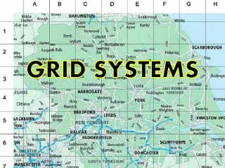
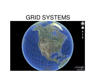
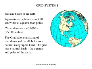
Grid Systems. The most common way to locate a place on a map is to use a GRID system There are three different grid systems: Alphanumeric Grid Map Grid/Military Grid Latitude and Longitude. Eastings. Run vertically on a grid They are always written first)

E N D
The most common way to locate a place on a map is to use a GRID system • There are three different grid systems: • Alphanumeric Grid • Map Grid/Military Grid • Latitude and Longitude
Eastings • Run vertically on a grid • They are always written first) • Each is identified by a two-digit number(In a six-digit grid it is identified by three digits) • The easting refers to the column to the right of the line
Northings • Horizontal lines that run across a map • The northing refers to the row above the line • By combining the 2 digits of easting/northing we can identify a specific square on the map
1. Alphanumeric Grid • Uses letters and numerals to identify squares in a grid pattern • Grid square are identified by letters along one edge of the map and a number along the other • i.e. A1 (found on road maps, the game battleship)
How to read an Alphanumeric Grid The smiley face is found in box F7
2. Military Gridex. 4&6-Digit Grid Reference • Any point on a map may be located using a four or six digit number Four Digit Grid • When locating a general location you can use a four digit reference.
Four Digit Reference • The Church in this example is located at 9194 • “91” refers to the easting and the Church is located to the right of major reference line 91 • “94” refers to the northing (the Church is located above 94)
Six Digit Reference • Each grid square can be divided into tenths. • When given a 6-digit grid reference like this: 916 944 the last digit in each set measures a specific location within the box
Remember… READ RIGHT, READ UP
3. Latitude and Longitude • Latitude: • Is the distance north and south of the equator; measure in degrees • Runs horizontally • Lines run parallel (never touch) • There are 180 lines of latitude • North pole 90 N • South pole 90 S
Longitude: • Is the distance east and west of the Prime Meridian • Half way around the globe is the International Date Line • Runs vertically • Lines meet in the poles • There are 360 lines of longitude
The Equator: • O degrees latitude • Divides the planet into northern and southern hemispheres
Prime Meridian: • Is the line of longitude on maps and globes that joins the North and South Poles • 0 degrees longitude • Runs through Greenwich, England • Divides the earth into the eastern and western hemispheres
WHAT QUADRANT OF THE EARTH DO WE LIVE ON? • NE • SE • NW • SW ?????????