Download

1 / 13
130 likes | 266 Views
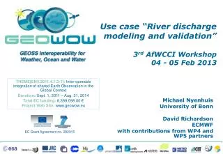
Use scenario “River discharge modeling and validation” GEO Plenary IX, EC Side Event 22 Nov 2012. Michael Nyenhuis University of Bonn David Richardson ECMWF with contributions from WP4 and WP5 partners. River discharge. Critical water cycle variable

E N D
Use scenario “River discharge modeling and validation” GEO Plenary IX, EC Side Event 22 Nov 2012 Michael Nyenhuis University of Bonn David Richardson ECMWF with contributions from WP4 and WP5 partners
River discharge • Critical water cycle variable • Long-term observations are essential for many water resource applications, to analyse climate trends, and to assess environmental impacts and risks • (Near)-real-time observations especially relevant for flood forecasting • Observations are used to calibrate hydrological or coupled land, atmosphere and ocean models
River discharge • Under the auspices of WMO, the Global Runoff Data Centre (GRDC) collects river discharge data at daily or monthly intervals from more than 8400 stations in 157 countries • Through the Global Terrestrial Network of Hydrology (GTN-H), GRDC is linked to GEOSS • To support • The climate-related programmes and projects of the United Nations and their special organisations; • The international scientific community on global change, climate and hydrology, research and assessment. GEO Plenary IX, Foz do Iguacu, Brazil, 22 Nov 2012
River discharge • GRDC stations with original daily discharge data
TIGGEensemble weather forecasts • TIGGE, the THORPEX Interactive Grand Global Ensemble, is a collection of ensemble weather forecasts from global and regional models, available for scientific research • The ensemble forecasts are made from slightly perturbed initial conditions to capture uncertainties stemming from the initial weather conditions and model errors • GEOWOW will significantly enhance the accessibility of TIGGE archive for the wider user community, an essential requirement to exploit the substantial multi-disciplinary potential in TIGGE data GEO Plenary IX, Foz do Iguacu, Brazil, 22 Nov 2012
Application development and GCI components integration • WeatherSocietal Benefit Area (WP4): • Integrate the TIGGE archive into the GEOSS Common Infrastructure (GCI) • Improve the accessibility of TIGGE for long time series of forecast data at user-specified locations • Demonstrate the potential of the TIGGE archive in multi-disciplinary applications • WaterSocietal Benefit Area (WP5): • Allow discovery, access, and use of GRDC data through the GEOSS Common Infrastructure (GCI) • Standardisation of the exchange of hydrological data (WaterML 2.0 and SOS 2.0 Hydrology Profile) • Towards increased multi-disciplinary interoperability to allow integration of data from different domains GEO Plenary IX, Foz do Iguacu, Brazil, 22 Nov 2012
Showcase development “Modeling of river discharge using weather predictions and validation based on river discharge observations” • The Water and Weather SBAs are defining a scenario, which will soon provide an additional showcase (#River Discharge) for prototyping additional components • To demonstrate the benefits of improved interoperability of domain resources through GCI evolutions Weather prediction Discharge observations Validation / visualisation www.usgs.gov EPS
Showcase development “Modeling of river discharge using weather predictions and validation based on river discharge observations” • Development, validation and calibration of forecasting workflowusing Ensemble Prediction Systems (EPS) of Numerical Weather Predictions (NWP) and a runoff model • Availability of river discharge forecasts from the TIGGE archive • Enlarged availability of GRDC/GTN-R discharge data • Enhanced GCI to enable interoperable exchange of (hydrological) observation data by linking the GCI to Sensor Web data formats, models, and interfaces (e.g. WaterML 2.0 and the Sensor Observation Service (i.e. hydrology SOS profile) • GCI based visualisation of discharge forecasts and observations in combination for different forecast ranges, different river catchments, and different ensemble models GEO Plenary IX, Foz do Iguacu, Brazil, 22 Nov 2012
Showcase development GEO Plenary IX, Foz do Iguacu, Brazil, 22 Nov 2012
Achievements - Weather • Test computations with river discharge based on TIGGE • First feasibility studies of using the SOS system and coding the river discharge forecasts in WaterML2.0 format GEO Plenary IX, Foz do Iguacu, Brazil, 22 Nov 2012
Achievements - Water • Initial selection of 148 GRDC stations for integration into GCI • On-going efforts to make more stations accessible
Achievements - Water • Development of OGC SOS Hydrology Profile: optimised interface to access WaterML 2.0 encoded data • Sensor Web Client upgraded to load SOS timeseries
Use scenario “River discharge modeling and validation” GEO Plenary IX, EC Side Event 22 Nov 2012 ThankYou!