Download
1 / 7
80 likes | 386 Views
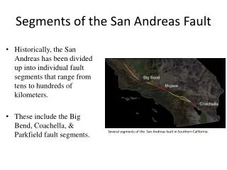
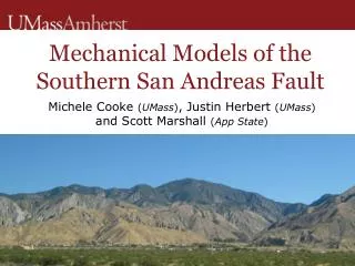
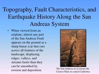
LiDAR and the San Andreas Fault exercise. Sarah Robinson ASU. Plate tectonics and earthquakes. Wallace Creek Field Trip. Download kmz here: http://cordillera.la.asu.edu/field_trip/WallaceCreekFieldTrip5.kmz.

E N D
LiDAR and the San Andreas Fault exercise Sarah Robinson ASU
Wallace Creek Field Trip Download kmz here: http://cordillera.la.asu.edu/field_trip/WallaceCreekFieldTrip5.kmz
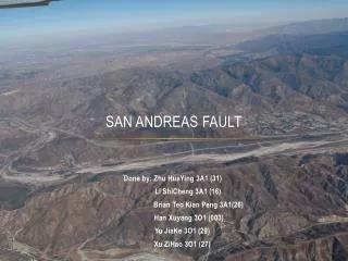
Find 5 pieces of evidence to support your conclusion about why the landscape is this way • What do you see here? • Using the measuring tool in Google Earth, measure the horizontal offset of Wallace Creek
Researchers have determined via carbon dating that Wallace Creek channel is 3700 years old. What is the average rate of motion defined by the offset at Wallace Creek? (slip rate = displacement/time) • Calculate the mean slip rate using several slip rate measurements from the previous question • Determine the standard deviation from the mean using the standard deviation formula:
Look elsewhere along the fault for other offset channels. What is the smallest offset you encounter? Remember that the local smallest offset is attributed to the last ground rupturing earthquake. • How much offset would you attribute to the 1857 event? • How long will it take to build up the offset that occurred in 1857 based on the average rate of motion calculation? • Based on your calculation of how long it takes to build up the offset that occurred in 1857, when would you expect the next earthquake?
Web Resources • Earth Exploration Toolbook • computer-based Earth science activities • http://serc.carleton.edu/eet/index.html • Google Earth Help website • Link to forum that explains how to create placemarks and insert images into Google Earth • http://bbs.keyhole.com/ubb/ubbthreads.php?ubb=showflat&Number=1125872 • ASU Lidar/ALSM Research website • http://lidar.asu.edu/TeacherTech08.html • DLESE Teaching Boxes • Free online teaching "boxes" for educators in earth science topics. • http://www.teachingboxes.org/index.jsp • USGS data kml files • ftp://hazards.cr.usgs.gov/maps/qfault/