Download
1 / 24
240 likes | 402 Views
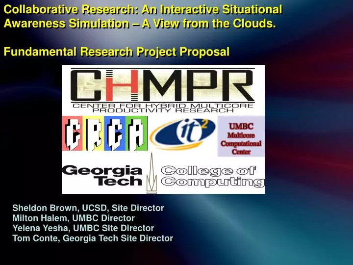
Collaborative Research: An Interactive Situational Awareness Simulation – A View from the Clouds. Fundamental Research Project Proposal. Sheldon Brown, UCSD, Site Director Milton Halem, UMBC Director Yelena Yesha, UMBC Site Director Tom Conte, Georgia Tech Site Director. Summary.

E N D
Collaborative Research: An Interactive Situational Awareness Simulation – A View from the Clouds. Fundamental Research Project Proposal Sheldon Brown, UCSD, Site Director Milton Halem, UMBC Director Yelena Yesha, UMBC Site Director Tom Conte, Georgia Tech Site Director
Summary. We will create a virtual world simulation, distributed across a heterogeneous compute infrastructure, to facilitate dynamic analysis of complex situations. The virtual world will be built from a variety of data sources; including high fidelity, well correlated data sources to data mining of internet feeds and many-user updates with commodity devices such as cell phones and digital cameras. Integrating heterogeneous computing resources to enable applications that can provide robust representations of dynamic situations, including those with tragic human and environmental impact, with data derived from a multitude of sources in a timely manner for decision makers and for citizens at large.
Summary. Working collaboratively with our industry partners, who have joined with us in planning and committed to participating in executing this project, will help extend our center’s capabilities to begin addressing fundamental research problems of societal relevance requiring longer term development through the effective integration of our broad informational science base with its rich variety of computing resources that are increasingly heterogeneous in their architecture, distribution and organization. This project will allow us to synthesize best current practices in divergent areas of multi-core computing, data assimilation models and knowledge representation while exposing areas requiring new approaches to better utilize emerging computing paradigms to solve urgent broad social needs.
We propose to develop a test bed virtual world simulation which will be computed upon a widely distributed, heterogeneous compute platform; combining cloud services, virtual world servers, compute accelerators and client systems ranging from multi-core desktops to mobile phones. We will develop the methods by which the multi-user virtual world can have a coherent representation of assets which differ by type and scale. We will utilize the distributed compute services to integrate these divergent assets for effective real time data assimilation of multi-media data information streaming, meta-tagging, into real world socio- physical models, distributed media databases, creating specific virtual world experiences for distributed viewers and decision makers, whose activities will interact with the virtual world to make more effective decisions in planning event response by providing a scenario testing platform.
Different aspects of the virtual world will be computed using the best available resource to its particular needs, with a shared database tracking resource availability and cataloging assets. Each center site will bring specific expertise to bear: UCSD will extend its work in virtual world client server architectures; UMBC will develop new techniques in multi-media database management to encompass the emerging types of data along with a methodology for cloud hosting and network traffic analysis as indicators of event conditions. Georgia Tech will undertake asset analysis and network data mining. In this first year, we will begin by collecting pre-event data bases to form the baseline virtual world, and then update with static data at various time increments, up to the point of integrating real-time data by year end.
The work will be readily applicable to develop future event response situations, either natural or anthropogenic. We will begin this work utilizing data from the recent Haitian earthquake of January, 12, 2010, and the dynamic relief efforts which followed and will continue for some time. This recent event will allow us look across different temporal windows of the situation and allow us to show which methods have the most validity for further study and development.
Partially Destroyed Cathedral of Port-au-Prince, January 14, 2010As Seen From A U.S. Air Force RQ-4 Global Hawk Unmanned Aircraft
The BLUR is a virtual world where many people interact and update heterogeneous datasets of dynamic environments. LiDAR scan Torrey Pines State Beach by Falko Kuester, UCSD
Data is mined from communication sites, and linked into the evolving virtual world, along with portals for mobile media devices, supplementing more deliberate methods.
"many newspapers have put precious resources into developing a people-finder system." However, he explained, "This excellent idea has been undermined by its success: Within 24 hours it became clear that there were too many places where people were putting information, and each site is a silo.""Sharing common data and making it all accessible is key, because if Jean Q. Publique enters a name of a missing loved one on one site, and another person says they have found that loved one on a different site, they will not connect," Csikszentmihalyi told me by e-mail.Others were thinking of a single, centralized site as well, including designer Tim Schwartz, who createdHaitianquake.com, a registry for tracking missing persons."I realized immediately that in our Web 2.0 environment, with tons of social networking sites, that missing people information was going to go everywhere on the Internet, and it would be very hard to actually find people and get back to their loved ones if everything was scattered," Schwartz said by e-mail. "So, my initial goal was to create a unified database that would be the one repository for missing people data, and other online applications could connect to it." Over the weekend, the 22,000 entries collected at Haitianquake.com were moved to Google's database, which Schwartz said was up to 30,000 records "and growing" as of early Sunday evening. (I have not received any figures from Google on the number of records in its system.)
LiDAR scan at Yosemite National Park by J. Toby Minear, UCB Users interact with the data within the virtual world; creating, correlating, validating and annotating data to derive consensus scenarios. Visual semantics allow for a wide range in data qualifications for scenario inclusion.
Developed in discussions with industry partners, who have joined with us in planning and committed to participating in executing this project: • Northrop Grumman – remote sensing, visualization, data integration, command and control • NOAA – informal data collection and integration • LTS – cyberspace security applications • NIST – cloud computing integration • IBM – Smarter Planet initiatives
The virtual world simulation has five interrelated operations: • It provides the scheme to correlate the various pieces of data • A collaborative tool in which data elements are improved and verified • An experiential tool to enable understanding of how the different components of a complicated scenario unfold • Facilitates short term planning activities at the real site • A platform to simulate scenario forecasting for purposes such as long-term planning or future incident mitigation.
Distributed computation User participation, extensibility and coherency Distributed Multi-Media Data Base Management Network Analysis Asset Analysis, Integration and Computation Mobile Devices
Quarter 1: Establish an Ad Hoc CHMPR member industry planning and evaluation team. Quarter 1: Implement a Distributed Heterogeneous Cloud Computing system based on the open Apache provided Hadoop system consisting of their File system, H base system for large image data base querrying and the MapReduce algorithm for content search and query. Quarter 1 Milestone: Import large volumes of Haiti earthquake data for storage in the H base system Quarter 2 – 3: Extend the virtual scalable city world with real world data. Quarter 2 Milestone: Visualize Haitian data static data from distributed cloud Quarter 3 Milestone:Distribute visualization to simultaneous multiple users. Quarter 4: Demonstration scenario with advanced GPS equipped multi-media mobile devices Quarter 4 Milestone: Test quality control features on human acquired event data. Quarter 4: Test uploading of streaming data from variety of devices Quarter 4: Implement user data refinement annotations within virtual world Quarter 4 Milestone: Compare user refined and unrefined models through external analysis. Quarter 4: Run simulation extraction scenarios for initial demonstration of proof of concept. Road re-devlopment as initial test case. .