Download
1 / 20
220 likes | 673 Views
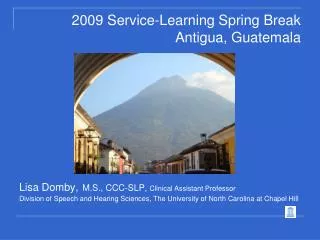
Antigua, Guatemala. A Virtual Field Trip by Julie Peters. Background information.

E N D
Antigua,Guatemala A Virtual Field Trip by Julie Peters
Background information • The purpose of this VFT is for students to be able to locate and appreciate the unique aspects of Antigua, Guatemala. They will gain this knowledge/insight through small group activities, class discussions, and individual reading that will require them to utilize various maps, construct a memorable example of Mayan culture (Trouble Doll), and engage in meaningful discussions. • The objectives are that all students should be able to: 1) locate Antigua on a map of Guatemala; 2) describe the industry and agriculture for Antigua and its bordering area; 3) describe the geography of Antigua and its bordering area; and 4) state at least three facts about Antigua and/or Guatemala (e.g., national instrument, national bird, etc.)
Grade Level Content Expectations • 2-G1.0.2 Use maps to describe the spatial organization of the local community by applying concepts including relative location and using distance, direction, and scale. • 2-G4.0.1 Describe land use in the community (e.g., where people live, where services are provided, where products are made).
Antigua is in Guatemala ; Guatemala is in Central America. Can you locate Central America on this map of the world?
Before we can find Antigua, we need to find Guatemala. Can you locate Guatemala on this map of Central America?
Did you know? Guatemala has beautiful weather all year round. That is why it is known as “The Land of Eternal Spring”
Antigua is near Guatemala City, the capital of Guatemala. Can you locate Antigua on this map of Guatemala?
Form small groups of approximately four students. Each group should discuss what they notice about Antigua on the map shown. List as many things as possible. Then we will discuss as a whole group. Near several volcanoes Near Guatemala City (capital of Guatemala) Near Lake Atitlan (it’s not the largest, but it is the deepest lake in Central America) Near Mayan ruins Somewhat near Mexico Somewhat near Pacific Ocean What do you notice about Antigua on this partial map of Guatemala?
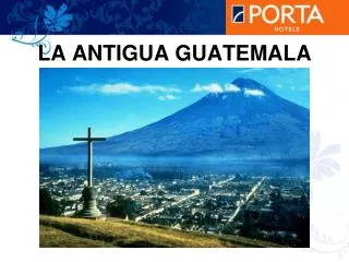
Did you know? There are more than 33 volcanoes in Guatemala. Antigua is nestled among three of them: Aqua, Fuego, and Acatenango.
Did you know? About 60% of the people in Guatemala speak Spanish. The other 40% speak a Mayan language. There are more than 20 Mayan languages in Guatemala.
Did you know? The national currency in Guatemala is called a quetzal. It comes from the name of their official bird, the Quetzal. That’s because the ancient Mayan people used the feathers of the Quetzal as currency.
Did you know? Weaving is very much a part of the culture in Guatemala. Girls learn this skill at a very early age. Click here to watch a video of a girl weaving.
Did you know? The national instrument in Guatemala is the marimba. Click here to hear what a marimba sounds like.
Think. Pair. Share. Think on your own, then pair up with another person and compare answers. Afterwards, we will share and discuss our answers as a whole group. What is special about the areas where coffee is grown? Did you remember from the previous map that volcanoes are nearby? How do you think this affects the soil? The agriculture changes almost in layers or steps. Why do you think that is? Looking at the agricultural areas on the map, what is the agriculture of Antigua and its bordering area?
Think. Pair. Share. Think on your own, then pair up with another person and compare answers. Afterwards, we will share and discuss our answers as a whole group. Do the streets seem more compact near the Plaza Mayor? Why do you think that is? Do the streets seem more spread out away from the Plaza Mayor? Why do you think that is? How is the Plaza Mayor similar/ different than the Downtown area of a city in Michigan? What types of things do you think are in the Plaza Mayor? Plaza Mayor means “main square” in Spanish. What conclusions can you draw from looking at the Plaza Mayor on the map of La Antigua?
Did you know? The people who live in Antigua often come to Plaza Mayor to sell their goods or even wash their clothes. How is this similar or different from the people in Michigan?
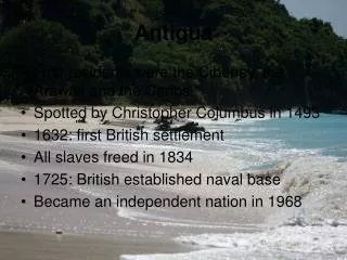
Did you know? The Spanish began settling in Antigua as early as 1524 and made it the capital of Guatemala. In 1773, Antigua was destroyed by an earthquake, so they moved the capital. Even though they moved the capital, many of the buildings are still there today!
Mayan Trouble Dolls of Guatemala Click here to read The story of the Mayan Trouble Dolls of Guatemala
Follow-up Activities Make your own Trouble Doll: Click here for instructions How Well Do You Remember? (a whole group exercise): • Locate Central America on a map of the world • Locate Guatemala on a map of Central America • Locate Antigua on a map of Guatemala • Describe the industry and agriculture for Antigua and its bordering area • Describe the geography of Antigua and its bordering area • State at least three facts about Guatemala (or specifically, Antigua) Presentations of the Trouble Dolls: • Present your Trouble Doll to the class • State what trouble(s) of yours you would like it to take away.
References ScienceJoyWagon: http://www.sciencejoywagon.com/kwirt/mayan/index.htm National Geographic Kids: http://kidsblogs.nationalgeographic.com/you-are-here/guatemala/ LaRutaMayaOnline: http://www.larutamayaonline.com/guatemala/maps/index.php Adventure Learning Foundation: http://www.larutamayaonline.com/guatemala/maps/index.php Infoplease: http://www.infoplease.com/atlas/ 18DAO Online Reference Service: http://en.18dao.net/Map/Guatemala Go Currency: http://www.gocurrency.com/countries/guatemala.htm Bank Notes: http://www.banknotes.com/gt.htm Classical Journal Phonic Blogspot: http://classicaljourneyphonic.blogspot.com/2011/04/classical-journey-tuesday-12-april.html Around Antigua: http://www.aroundantigua.com/antigua Guatemala on the Web: http://www.guatemalaontheweb.com/index.php World Weather and Climate Information: http://www.weather-and-climate.com/uploads/average-temperature-guatemala-gautemala-city-fahrenheit.png Google Images: http://www.google.com/imghp?hl=en&tab=wi Summer Institute of Linguistics: http://www.sil.org/mexico/maya/00i-maya.htm eHow: www.ehow.com/ (Trouble Doll activity contributed by Kristi Roddey) Youtube: http://youtu.be/QOQbTtti-Wc