Download
1 / 42
430 likes | 570 Views
Seeking the Longitude 300 BC-AD 1675. Reading 2004 Spring. Questions:. The Difficulty of Determining Longitude? The methods of determining the longitude? What events about the story of longitude happened in the Middle Ages?. Latitude/ longitude.

E N D
Seeking the Longitude300 BC-AD 1675 Reading 2004 Spring
Questions: • The Difficulty of Determining Longitude? • The methods of determining the longitude? • What events about the story of longitude happened in the Middle Ages?
Latitude/ longitude • In contrast to latitude, the means of accurately calculating longitude at sea was long elusive. • Not until 1714 was there an accurate way of determining longitude even on land, let along at sea where waves made accurate measurements difficult.
Sailing in the uncharted ocean The best that sailors could do was to calculate their displacement east-west by using a process of intelligent guess work called "dead-reckoning." Given that this ‘reckoning’ had to be adjusted for the effects of wind and sea in carrying a ship off-course and that these effects (called leeway and drift respectively) could not be accurately and reliably measured it was, as Quill (1966:2) observes, "a most hazardous way of navigating."
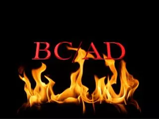
longitude ("meridians") • On the globe, lines of constant longitude ("meridians") extend from pole to pole, like the segment boundaries on a peeled orange. • Longitude lines or "meridians"
Greenwich Meridian: Meridian comes from a word meaning "Middle". The Greenwich Meridian was set at the Greenwich observatory, in Greenwich, England to be the geographic point for where East and West meet. Therefore, Greenwich Meridian is indicated as 0 ° latitude. The world time standard is set at Greenwich observatory, and all other time offsets (in terms of time zones) are calculated from Greenwich Mean time (GMT), or Universal Time (UT), as it is often called . http://www.adventist.org/sun/help/#7
Explore the Ocean • The oceanographic metaphor • The ocean, literally the unknown world of the earth the unknown world of the cosmos macro-cosmos and macro-cosmos
Time and space • In Hellenistic times, these geographic quantities were usually thought of in terms of time, in number of daylight hours on the longest day of the year in the difference in local time between two places for longitude differences east or west.
Babylonian clay tablet world map, 600 B.C http://www.henry-davis.com/MAPS/Ancient%20Web%20Pages/103.html
History • Ancient (Greek or classical) • Ptolemy: Almagest and Geography • Hipparchos: The Lunar-eclipse method • The Middle Ages • The age of discovery • Compass and navigation • The chronometer method
Geography in the Middle Ages • China continues to be far ahead of Christian Europe • Geography a vehicle for Christian propaganda in Europe • Muslim translation of Greek works • The Norse sailing to Iceland, Greenland, North America
Ancient Influences on Medieval Geography • Plato (428 - 348 BCE) • Aristotle (384 - 322 BCE) • climatic zones • Ptolemy (85 - 165 CE) • geocentric model of the universe
Ptolemy's map of the world. • Now the main part of Geography consisted of maps but Ptolemy knew that although a scribe could copy a text fairly accurately, there was little chance that maps could be successfully copied. • He therefore ensured that the work contained the data and the information necessary for someone to redraw the maps. He followed previous cartographers in dividing the circle of the equator into 360 and took the equator as the basis for the north-south coordinate system.
Paucity of Geographic knowledge in the Middle Ages • During the Dark Ages, those five centuries that followed the destruction of the Roman Empire, only very limited, if any, information is available about the navigation techniques of the time. It is presumed that sailors relied on their powers of observation and sea-crafts. Their skills are exemplified by great navigational feats by Vikings and Irish.http://rubens.anu.edu.au/student.projects97/naval/
1493 T - O Map Translation The Deterioration of Mapping
Mappae mundi • Medieval world maps are mental maps. • They are composed by geographical experience, literary knowledge and philosophical speculation. • The three continents of medieval world, Asia, Europe, and Africa,
8 separate crusades between 1096 & 1270 Extensive travel over sea & land from all parts of Europe to the Holy Land Popular description & travel was geography The Crusades
2 brothers & a son Nicolo & Marco Maffeo Traders, not Geographers 1271 - 1295 To China by land To Venice by sea Marco Polo
Bright Spots in Medieval Geography • William of Conches (1080-1154) • philosopher & theologian • translated Arabic work • modern ideas concerning • heating of the atmosphere from below • formation of clouds by cooling air • Robert Grosseteste, Bishop of Lincoln (1175-1253) • also an Arabic speaker • refuted Aristotle’s climatic zones • taught Roger Bacon
Of course the Mercator projection has the property that distances near the poles are greatly distorted so it was not easy to use the map to measure distances. Gerardu Mercator gave instructions on the map so that for two places if one knew any two of the following four pieces of data: • difference on longitudes,difference in latitudes,direction between them,distance between them,
From “portolani” pilots or rutters Portolan chart network of lines coastlines place names scale of distance compass shoals, reefs, islands List of places distances directions conditions at sea port dangers safe anchorages Portolan Charts
Map of Medieval Universities • http://historymedren.about.com/library/atlas/blatmapuni.htm • http://historymedren.about.com/library/atlas/natmapuni.htm • This map is from the Historical Atlas by William R. Shepherd, published in 1923; p. 100.
Olaus Magnus, 16th century1st large scale map of a European Region
Longitudes • http://rubens.anu.edu.au/student.projects97/naval/
more web pages. . • http://www-gap.dcs.st-and.ac.uk/~history/HistTopics/Longitude2.html • http://www-gap.dcs.st-and.ac.uk/~history/HistTopics/Longitude1.html