Download
1 / 57
570 likes | 681 Views
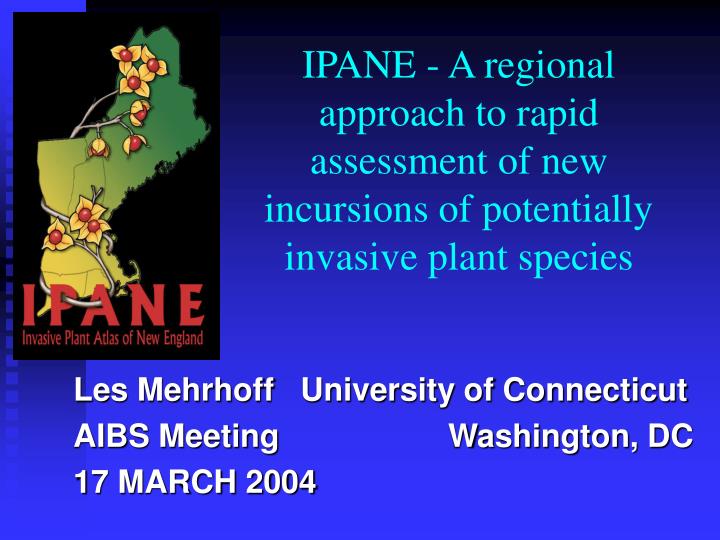
IPANE - A regional approach to rapid assessment of new incursions of potentially invasive plant species. Les Mehrhoff University of Connecticut AIBS Meeting Washington, DC 17 MARCH 2004. Dedication. To Field Botanists past and present -.

E N D
IPANE - A regional approach to rapid assessment of new incursions of potentially invasive plant species Les Mehrhoff University of Connecticut AIBS Meeting Washington, DC 17 MARCH 2004
Dedication To Field Botanists past and present -
IPANE Project Participants • Department of Ecology & Evolutionary Biology, University of Connecticut Homer Babbidge Library Center for Cartographic Analysis • New England Wild Flower Society • Silvio O. Conte National Fish and Wildlife Refuge, US F&WS
Primary Start-up Funding: • United Stated Department of Agriculture –Cooperative State Research, Education, and Extension Service Initiative for Future Agriculture and Food Systems
FWS USDA USGS-BRD NIISS NBII NPS FS FICMNEW NEWFS NIPGro TNC FNA NATURESERVE NEBIS CIPWG MNLA MASS DF&W Some Project Partners
IPANE Goals • New England Early Detection Network • Gather current & historic distributional data • Make information available • Conduct & encourage scientific research • Increase public awareness • Train volunteer spotters • “Interoperability”
IPANE Project Components • Atlas of invasive or potentially invasive plants and noxious weeds in New England • Interactive website • Volunteer training - NEWFS • Research – UCONN • Outreach - NIPGro • Regional Early Detection Network
User Community • Academia • Conservationists • Land Managers • Government Agencies • Regulators & Legislators • Green Industries • Public
Data Warehouse IN • Herbarium records • Current field data • Current research • Invasive species information OUT • Species Catalog • Collections databases • Maps • Invasive species information
NEBC, GH, A MAINE NHA VT MASS KIRI CONN YU HCOA NHNE LSC NASC SSHN WSCH BRU NCBS CCNL BLK NY others Participating Herbaria
Volunteer Network • 450 in 3 years – 25 per state per year • Volunteer coordinator • Staff-run training sessions • Advanced training workshops • Terrestrial and Aquatic species • On-line reporting forms • Verification and Quality Control • Early detection species training
The Invasive Plant Atlas for New England Website • http:// invasives.eeb.uconn.edu/ipane • Maps & database • Catalog of species • Project information • Announcement and unmoderated lists • Noxious weed information • Volunteer support • Quizzes and “Weed Wisdom!”
Spontaneous & Unsolicited Reports • “Report sighting” button on website • Verification IPANE staff Regional herbaria FNA authors • Initiate Rapid Assessment process
IPANE Catalog of Species • Scientific and common names • Diagnostic & incursion photographs • Descriptive text • Historical information • Similar species • Hard copy references and hot links • Management links
IPANE Databases • Herbarium specimen database • +/- 20 regional herbaria • Capture all label data • Georeferenced: 35 K georeference points • Current field data • Field data from trained volunteers • Georeferenced from GPS or maps • Verified by IPANE staff • Other existing databases ??
IPANE Maps • Occurrences • Herbarium records, current reports, or both • State, county, town, & site occurrence • Different scales; different kinds of maps • ?? Automated
IPANEThe Invasive Plant Atlas of New England ProjectAn Early Detection and Rapid Assessment Network for New England
In theory, it’s simple • Detect new, potentially invasive incursions early • Assess the situation rapidly • Respond quickly and effectively • Establish long-term monitoring
IPANE Early Detection Aids • List of “Early Detection Species” • Database of status in all 6 New England states • Easy online reporting mechanism • Early detection protocols • IPANE volunteer network • Predictive modeling • Invasive Species Alerts • Public awareness information
Rapid Assessment Scenario • Early detection of potential incursion • Confirmation of species identification • Site visit; assessment of situation • Preparation of action plan • Management, control, or eradication? • Monitor the site
Rapid Assessment Tools • Guidelines for rapid assessment developed with USGS • Botanists on call for verification • Knowledgeable Rapid Assessment Team • Person responsible for preparing an Action Plan • Management and control expertise • Committed long-term monitors
The importance of herbarium specimens… G. Safford Torrey Herbarium
Identification & Verification • Identification tools – XID Program • IPANE staff • Participating state & regional herbaria • Flora of North America Project authors
IPANE Website - Rapid Assessment Page • List of “Early Detection Species” • Database of status in all 6 states • Early detection protocols • “Report sightings” buttons - How to easily report a possible new incursion
Predictive Modeling • Using known distribution and existing ecological data • Predict distribution or habitats in order to focus further field work • Field checked by trained volunteers
Stinking Willie Seneciojacobaea L. A TEST CASE
Native to Europe • New England (ME, MA) • NY, NJ, PA, IL, MI, MT, ID • Canadian Maritime Provinces • Pacific States & adjacent Canada • Australia, New Zealand, Japan
Seneciojacobaea in New England • 1903 Portland, Maine
Seneciojacobaea in New England • 1903 Portland, Maine • 1910 Danvers, Massachusetts
Seneciojacobaea in New England • 1903 Portland, Maine • 1910 Danvers, Massachusetts • 1938 Brookfield, Massachusetts
Seneciojacobaea in New England • 1903 Portland, Maine • 1910 Danvers, Massachusetts • 1938 Brookfield, Massachusetts • 1968 Newbury, Massachusetts
Seneciojacobaea in New England • 1903 Portland, Maine • 1910 Danvers, Massachusetts • 1938 Brookfield, Massachusetts • 1968 Newbury, Massachusetts • 2000 Bar Harbor, Maine
Seneciojacobaea in New England • 1903 Portland, Maine • 1910 Danvers, Massachusetts • 1938 Brookfield, Massachusetts • 1968 Newbury, Massachusetts • 2000 Bar Harbor, Maine • 2002 Barre, Massachusetts
Specimen Collected Verification
Rapid Assessment Team • Landowner • Botanist • Weed scientist • Control expert • State (or federal) regulatory official • Other stakeholders - NRCS
Rapid Assessment Team site visit
Some questions for the Rapid Assessment Team • Is the plant identified correctly? • What is its historic, current, and predicted distribution at different scales? • What are the biological attributes that make it invasive? • History and vectors; where did it come from and how did it get here? • What is its expected potential for dispersion to other sites?
More Questions • What elements of biodiversity might be affected by its spread and establishment? • Can it be controlled effectively? • What will it cost to control? • Who will be responsible for its control at this site? at new incursions? • Are there problems created by control? • What happens if we don’t take action now?
Assessment Recommendations • Site and incursion specific • Attempt to determine the history of the incursion • Check surrounding land for additional incursions • Check status of other New England occurrences • Control, aimed at removal • Neighboring landowner education; outreach