Download
1 / 21
210 likes | 237 Views
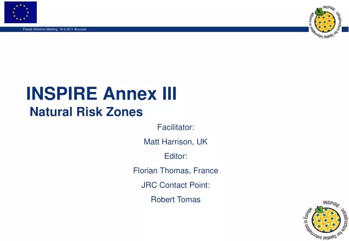
INSPIRE Annex III Natural Risk Zones. Facilitator: Matt Harrison, UK Editor: Florian Thomas, France JRC Contact Point: Robert Tomas. Outline. Robert Tomas - INSPIRE process and comments and testing Matt Harrison - Presentation of the Natural Risk Zones theme Input documents

E N D
INSPIRE Annex III Natural Risk Zones Facilitator: Matt Harrison, UK Editor: Florian Thomas, France JRC Contact Point: Robert Tomas
Outline • Robert Tomas- INSPIRE process and comments and testing • Matt Harrison- Presentation of the Natural Risk Zones theme • Input documents • Philosophy and scope • Use cases • Presentation of the core model • Florian Thomas- Presentation of example application schema- Floods • Remaining questions
Steps • Analysis of input documents • Production of use cases • « Flood » (Cross Thematic) • « Landslide » • « Forest fire» • « Earthquake » • Setup of the model • V1.0 internal only, V2.0RC and V2.0 Public 20th June
Presentation of the theme • Definition : « Vulnerable areas characterised according to natural hazards (all atmospheric, hydrologic, seismic, volcanic and wildfire phenomena that, because of their location, severity, and frequency, have the potential to seriously affect society), e.g. floods, landslides and subsidence, avalanches, forest fires, earthquakes, volcanic eruptions. »
Presentation of the theme • Risk is defined as: Risk = hazard x exposure x vulnerability. • Natural risk: • Not technological risk
Presentation of the theme • Overall philosophy: « A risk zone is the spatial intersection of a hazard area with Exposed elements some of which may have increased or lowered vulnerability to this hazard » Hazard area Risk zone Vulnerability A Exposed elements
Input documents • 32 reference documents • The Floods Directive • Work carried out by « Plan4All » • Annex I : Hydrography TWG has defined an « InundatedLand » feature class
Model v2.0 • 3 packages : • 1 core package • 1 coverage package • 1 package dedicated to flood risk • Objective : • Design a generic core model to all natural risks • Apply it to all types of data (vector and coverage) • As an example, apply this core model to flood risk
Model v2.0: Core package Risk zone • The model in a nutshell: « 3 feature classes » + « 1 association » class Hazard area Vulnerability Exposedelement
Model v2.0 Hazard modelling • NZ and other themes Exposed Element modelling Land use Buildings Utilities / public services Hydrology Stat. Units / Pop. distribution Administrative boundaries Geology Elevation Natural risk zones Parallel Environmental monitoring facilities Consequences on land use planning Area management Land use
Floods Application Schema Florian Thomas, IGN, France
Model v2.0 : Flood Package • « Why floods and no other hazard? » • Flood Directive 2007/60/CE • Overall idea: • Take the core model, eventually specialize it, to make it meet Flood Directive’s requirements • Use the navigability of the links to avoid redundances, and the constraints to ensure the coherence of the model
Model v1 : Flood Package Flood hazard map Hazard area Potential flooded area Flood risk map Risk zone Preliminary flood risk assessment Inundated Land (Ann I Hydrographie) Exposed element
Model v2.0 : Flood Package • New classes compared to the generic package : • « Potential flooded area » : specialized from « hazard area » • Flood hazard map • Flood risk map • Preliminary flood risk assessment • « inundated land » : specialized from « hazard area » • Some concepts : • The « potential adverse consequences » are « exposed elements » • The « flood hazard maps » must contain 3 flood scenarios they contain 3 features from the « Potential flooded area » feat. class
Model v1 : Flood Package • New associations: • Flood hazard map Flood risk map • Flood risk map Exposed element • Preliminary flood risk assessment Exposed element • New constraints • « the potential flooded areas that are on a flood hazard map are linked to the risk zones that are on the flood risk map (which itself is linked to the same flood hazard map ) • « The exposed elements that are associated to a risk map are also associated to the risk zones that are on the risk map »
Open Questions • Generic Core model- useful/ useable? • More specific hazardTypes codelist? • exposedElements codelist? • Floods Schema • Doesn’t address your detailed requirements? • Can you identify how you could extend it further? • Does it demonstrate harmony between FD and INSPIRE? • More application schemas as examples? • Example implementation e.g. in major GIS software? • Geometry of risk zones / coverages Currently model vector data model and coverage separately • Portrayal rules/ guidelines • DQ & MD Chapters still require work