Download
1 / 15
150 likes | 381 Views
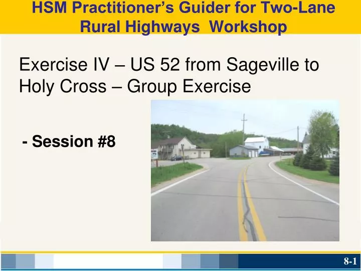
HSM Practitioner’s Guider for Two-Lane Rural Highways Workshop. - Session #8. Exercise IV – US 52 from Sageville to Holy Cross – Group Exercise. Compute combined predicted safety performance of x-section, grade, curvature, and intersections

E N D
HSM Practitioner’s Guider for Two-Lane Rural Highways Workshop - Session #8 Exercise IV – US 52 from Sageville to Holy Cross – Group Exercise
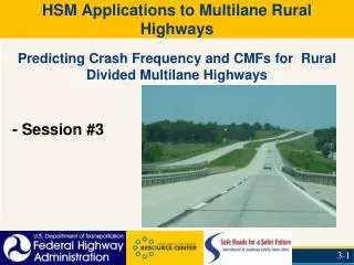
Compute combined predicted safety performance of x-section, grade, curvature, and intersections • Compare predicted safety performance to actual safety performance • Identify greatest safety shortfall • Identify priorities for improvement Exercise IV: US 52 from Sageville to Holy Cross Learning Outcomes:
Exercise IV: US 52 from Sageville to Holy Cross – Segments/Grade/Curves Crashes by location
Exercise I – US 52 from Sageville to Holy Cross Geometric Information: • Length: 13.0 miles • AADT: 2,500 • Lane Width: 11 feet • Shoulders: Paved 0 feet Gravel 4 feet • Hazard Rating: 5 • Driveways: 91 on level tangent segments • Total Length of Curves = 4,826 ft or 0.914 mi • Total Length of Grades = 13,400 ft or 2.54 mi
Exercise I – US 52 from Sageville to Holy Cross Geometric Information Grades: Total Length = 13,400 feet or 2.54 miles 3%< All Grades <6%
Exercise II: US 52 from Sageville to Holy Cross Geometric Information Curves: Total Length = 4,826 feet
Exercise III – US 52 from Sageville to Holy Cross Intersections on US 52: (AADTmaj = 2500)
Exercise IV: US 52 from Sageville to Holy Cross Discussion • Compute the combined predicted safety performance (x-section + curves + intersections) and compare to actual safety record • Identify priorities areas for improvements • Use Worksheet Exercise IV
Exercise IV – US 52 from Sageville to Holy Cross From the US 52 corridor crash information, perform the following tasks: • Compute the combined predicted crash frequency performance (x-section + curves + intersections) and compare to actual crash record • - Where is the greatest safety shortfall? • a. Lane and Shoulder Width • b. Driveway Density • c. Roadside Design • d. Curves • e. Intersections
Exercise IV – US 52 from Sageville to Holy Cross From the US 52 corridor crash information, perform the following tasks: • Identify priorities as to improvements • - where is the greatest shortfall (at 2,500 AADT)? a. Lane and Shoulder Width (yes/no) (___%) b. Driveway Density (yes/no) (___%) c. Roadside Design (yes/no) (____%) d. Curves (yes/no) (___%) e. Intersections (yes/no) (___%)
Exercise IV – US 52 from Sageville to Holy Cross • Computed combined predicted safety performance of x-section, grade, curvature, and intersections • Compared predicted safety performance to actual safety performance • Identified greatest safety shortfall • Identified priorities for improvement Learning Outcomes:
Safety Effects Calculations Rural Two-Lane Roads Too Time Consuming for Calculations and Organizing Results? CONCERNS: Excel spreadsheet facilitates calculations and delivers results in an organized format! GOOD NEWS:
HSM Practitioner’s Guider for Two-Lane Rural Highways Workshop Questions and Discussion