Download
1 / 24
240 likes | 455 Views
Seismic Activity. Daily Homework: Plot the seismic activity (earthquakes) that occur each day from the following website: www.iris.edu/seismon/last30.html. Seismic Activity. Longitude: Lines that run vertical on a map. Meridian (semi-circle) lines that extend to each pole.

E N D
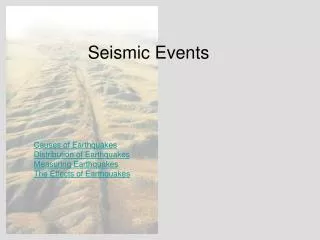
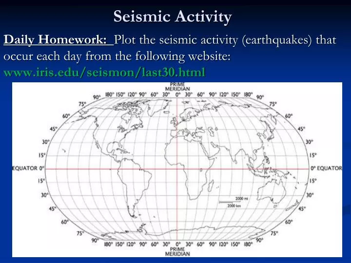
Seismic Activity Daily Homework: Plot the seismic activity (earthquakes) that occur each day from the following website: www.iris.edu/seismon/last30.html
Seismic Activity Longitude: Lines that run vertical on a map. Meridian (semi-circle) lines that extend to each pole. Prime Meridian is the central line that divides the east from the west hemisphere. (Greenwich, England) Time zones are located near meridian lines.
Seismic Activity Latitude: Lines that run horizontal on a map. Parallel lines that run parallel to the equator. The equator divides the north hemisphere from the south hemisphere.
Earth Life123.com
What branch(es) of Earth Space studies the composition and processes of Earth? Earth Life 123.com
Earth’s Layers geo.rhul.ac.uk
The Formation of Earth’s Four Layers • Earth was created approximately 4.5 billion years ago. • As the Earth began to cool some parts of it became dense and heavy. • Crust is made of the lightest materials (rock- basalts and granites) • Core consists of heavy metals (nickel and iron). • Geologist have determined there are four layers.
Earth’s Layers Crust- 5-40 kilometers thick 2,900 kilometers thick (solid state) 2,250 kilometers thick 1,300 km thick
The Crust • Earth’s crust is very thin. (5 -40 km thick) • Temperature range: 98F (air temp.) - 1600 F) • Crust Types: Continental and Oceanic • Continental crust: Composed of granite rock. • Oceanic crust : Composed basalt rock (volcanic rock). • *Basalt rock is denser than granite rock. * • The crust is broken into pieces called plates. geology.about.com geology.com
The Mantle • Layer located under the crust. • Largest layer of the Earth’s crust, 2900km thick. • Temperature range: 1600 F at top – 4,000 F at bottom • Composed of hot dense rock that circulates throughout this layer due to a large temperature range. • Convection currents: Currents that cause the rock movement in the mantle. Currents are produced by the changes in temperature throughout the mantle. • !
Convection Currents What else does convection currents move?
Convection Current Connection:Lava Lamps • Sketch a lava lamp. • Draw a convection current in your lava lamp showing the temperature changes that occur in the lamp. • Illustrate temperture differences with colored pencils.
The Core • A ball of very hot metals. • Temperature Range 4,000 F – 9,000F
Outer Core • 1,800 miles below the crust. • 2,250 km thick • Metals are in the liquid state. 2,250km
Inner Core 4,000 miles below the earth’s surface. 1300 km thick. Metals are in solid state.
Bell Ringer: Modeling Earth’s Layers (5-40 km thick) (2,900 km) (2,250 km) Using the thickness of each layer and the diagram to the right determine the distance each layer is from the surface of the Earth. *core: *mantle: *outer core: *inner core: (1,300 km)
Bell Ringer: Modeling Earth’s Layers (5-40 km thick) (2,900 km) (2,250 km) Identify the four layers of the Earth and include the thickness of each layer in kilometers (km). Using the thickness of each layer and the diagram to the right determine the distance each layer is from the surface of the Earth. (1,300 km)
A SCALE MODEL • Now it’s your turn to create your own scale model of Earth’s layers. Accuracy, neatness, and creativity will be taken into account when grading your model.
The Crust • The crust is apart of the Lithosphere. • The crust is broken up into pieces called plates.