Download

1 / 55
550 likes | 667 Views
GNSS POSITIONING- STATIC & REAL-TIME SEMINAR. REAL TIME NETWORKS AND THE ROLE OF NGS. Bill Henning Geodesist, PLS. IN TEN YEARS……. 115+ SATELLITES 1.5 DM AUTONOMOUS POSITIONING

E N D
GNSS POSITIONING- STATIC & REAL-TIME SEMINAR REAL TIME NETWORKS AND THE ROLE OF NGS Bill Henning Geodesist, PLS.
IN TEN YEARS……. • 115+ SATELLITES • 1.5 DM AUTONOMOUS POSITIONING • NEW GEOMETRICAL DATUM – ITRF ALIGNED GEOCENTER BUT PROBABLY FIXED ON NORTH AMERICAN PLATE. NSRS ENTIRELY REALIZED BY ACTIVE STATIONS OF THE FOUNDATION CORS • NEW NATIONAL GEOPOTENTIAL DATUM – 1 CM GRAVIMETRIC GEOID, ORTHOMETRIC HEIGHT SITE CONTROL TO 2 CM RELATIVE TO THE NATIONAL DATUM. • MORE REMOTE SENSING: 2 - 3 DM SATELLITE IMAGERY /MAPPING POSITIONS , Mobile Mapping Systems • INDOOR AND UNDERGROUND POSITIONING
DATUM DEFINITIONS IN THE USA HORIZONTAL/ GEOMETRIC: VERTICAL/GEOPOTENTIAL: • NAD 83 • ITRS • WGS 84 • NAD 22 (?) • NGVD 29 • NAVD 88 • NAVD 22 (?) PROJECTIONS FROM DATUMS: • SPC • UTM • LDP
Z • DATUM= • SURFACE • ORIENTATION • SCALE • ORIGIN • + GRAVITY Zero Meridian -X - -Y AUTONOMOUSGNSS POSITIONS ARE ECEF, XYZ IN WGS 84 (~ITRF) X Y Mean Equatorial Plane -Z
Earth-Centered-Earth-Fixed Coordinates Conventional Z Axis Terrestrial Pole P (X,Y,Z) Earth’s Surface Zero Meridian Z Origin Y Axis (0,0,0) Center of Mass X Y Mean Equatorial Plane X Axis
X,Y,Z TO ,,h Z Axis P (X,Y,Z) = P (,,h) h Earth’s Surface Zero Meridian Reference Ellipsoid Y Axis Mean Equatorial Plane X Axis
NEW GEOMETRICAL DATUM WILL ALIGN TO AN EPOCH OF ITRF, BUT WILL BE PROBABLY BE FIXED ON NA PLATE h83 h00 Earth’s Surface ITRF 00 ORIGIN (WGS 84 IS WITHIN A COUPLE OF CENTIMETERS IN REALIZATION) 2.2 meters NAD 83 Origin
NAD 83 (2011) EPOCH 2010.0 MINUS NAD 83 (CORS 96) EPOCH 2002
NEW NATIONAL VERTICAL DATUM:2022(?)WHY ISN’T NAVD 88 GOODENOUGH ANYMORE? • NAVD 88 suffers from use of bench marks that:Are almost never re-checked for movement • Disappear by the thousands every year • Are not funded for replacement • Are not necessarily in convenient places • Don’t exist in most of Alaska • Weren’t adopted in Canada • Were determined by leveling from a single point, allowing cross-country error build up(Has been proven to be ~ 1 meter tilted across CONUS (again, based on the independently computed geoid from the GRACE satellite) RE-LEVELING WOULD COST 200 MILLION TO 2 BILLION $$
NEW NATIONAL VERTICAL DATUM • A PURELY GRAVIMETRIC SURFACE • BASED ON A HIGH RESOLUTION, 1 CM GEOID FROM GRAV-D PROGRAM • ACCURATE TO 2 CM (ALLOWING FOR GNSS ERROR) • ACCESSABILITY: BROUGHT TO A PROJECT SITE VIA ACTIVE REFERENCE STATIONS (NATIONAL CORS), DENSIFIED TO PROJECT ACCURACY NEEDS. (ALTERNATIVE: USE BMs PREVIOUSLY TIED TO THE DATUM-CAVEAT EMPTOR) • ETD: 2022?
GRAVITY FOR ORTHOMETRIC HEIGHTS (“ELEVATIONS”) A HIGH ACCURACY SNAPSHOT OF THE NATION + A MOVIE OF CERTAIN AREAS NO GRAVITY = NO HEIGHTS KNOW GRAVITY = KNOW HEIGHTS GRAV-D PROGRAM NEW VERTICAL DATUM AROUND 2018 http://www.ngs.noaa.gov/GRAV-D/pubs/GRAV-D_v2007_12_19.pdf
FUTURE OF PASSIVE/ACTIVE MONUMENTATION • NAD 83 REALIZED THROUGH NATIONAL CORS • NAVD 88 REALIZED FROM PASSIVE MARKS • NGSIDB HAS 1,000,000 PASSIVE MARKS-PASSIVE MARKS IN STATES HAVE MANY CAMPAIGNS OVER MANY YEARS WITH MANY ACCURACIES IN MANY SEPARATE ADJUSTMENTS. RTN MAY NOT AGREE WITH THESE REQUIRING CONSTRAINTS TO THE MONUMENTS FOR PROJECT WORK. • PASSIVE MARKS COORDINATES ARE A SNAPSHOT IN TIME AND CAN BE RELIED ON TO BE ACCURATE ONLY AT THE RECORDED OBSERVATION TIME. • 2022 = NEW GEOMETRIC DATUM / NEW GEOPOTENTIAL DATUM BASED ON 1 CM GRAVIMETRIC GEOID, POSITION VELOCITIES ON A GEOCENTRIC DATUM • THE METHOD OF CHOICE TO ACCESS THE NSRS IS ACTIVE MONUMENTATION (CORS, OPUS, RTN)
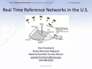
RTN AND NGS “FOUNDATION CORS” WILL BE THE PRIMARY ACCESS TO THE NSRS CORS Network continued growth • Active sites 1750+ • 1250 used in NAD 83(2011)
FOUNDATION CORS • Link to ITRF at sites co-located with VLBI, SLR, DORIS, then geographic gaps • ~10 in CONUS + AK, HW and US terr. Limited international • Drilled braced monuments • Time-line: ~2 sites/year start FY10-11 Possible sites = magenta ovals NGS WILL NOT PROVIDE CORRECTORS!
2022 NEW PROJECT CONTROL – ACCESS TO NSRS RTN ALIGNED TO CORS AT 1 CM IN EACH COMPONENT (X,Y,Z) & 2 CM ORTHOMETRIC 100 KM (NOT TO SCALE) 20 KM NEW PROJECT CONTROL EXISTING PASSIVE MARKS- HORIZONTAL WITH OR WITHOUT VERTICAL EXISTING PASSIVE BENCH MARKS 70 KM (NOT TO SCALE) NATIONAL CORS = GEOMETRICAL & GEOPOTENTIAL TRUTH
THE ROLE OF NGS INTO THE FUTURE “NOAA’s National Geodetic Survey provides the framework for all positioning activities in the Nation. The foundational elements – latitude, longitude, elevation, and shoreline information – contribute to informed decision making and impact a wide range of important activities including mapping and charting, flood risk determination, transportation, land use and ecosystem management. NGS’ authoritative spatial data, models, and tools are vital for the protection and management of natural and manmade resources and support the economic prosperity and environmental health of the Nation.” This means that the geodetic latitude, longitude and height of points used in defining the NSRS should have an absolute accuracy of 1 millimeter at any time. Obviously, such points will be actively monitored points, not passive monuments.
MAJOR RTN IN THE USA (MARCH 2011) ≥200 RTN WORLDWIDE≥107 RTN USA≥35 DOT • ACADEMIC/SCIENTIFIC • SPATIAL REFERENCE CENTERS • VARIOUS DOTS + MACHINE GUIDANCE • COUNTY • CITY • GEODETICSURVEYS(NC,SC) • MANUFACTURERS • VENDOR NETWORKS • AGRICULTURE • MA & PA NETWORKS
RTK vs. RTN Cell technology -Half the equipment or double the production -No monument reconnaissance/ recovery - No set/break down time -No base baby sitting RTN Plus: Easy alignment to the NSRS No ppm (1ST ORDER) ERROR Extended range Homogeneous Data Easy datum updates RTK
SO – WHAT CAN I EXPECT FROM A RTN? MOST RTN PRODUCE “GOOD” HORIZONTAL VALUES. OUR HORIZONTAL SYSTEM IS BASED ON ACTIVE REFERENCE STATIONS (NGS CORS), AS ARE THE RTN STATIONS. BECAUSE ORTHOMETRIC HEIGHTS (‘ELEVATIONS’) ARE BASED ON PASSIVE MONUMENTS (NAVD 88), THE RTN USER SHOULD, FOR THE MOST PART, CONSTRAIN THE PASSIVE MARK VALUES IN A LOCALIZATION. CHOOSE THE RTN WITH A BUSINESS MODEL THAT BEST FITS YOUR NEEDS.
SOME RTN ADMINISTRATOR CONCERNS Reference Station Spacing. E.g, for a 200 Km x 200 Km area:46 stations at 30km spacing 39 stations at 40km spacing22 stations at 50km spacing 14 station s at 70km spacingDifference could be a million dollars! • $$$$$$$$$$$$/ Business Model/ Partnerships • Seasonal movement • Integrity Monitoring • Spacing • IT set up- Communication/ latency • OPUS vs. CORS RTN adjustment • Upgrade? GNSS? • Velocity models for RTN stations (not CORS) • Velocity for CORS-HTDP, monthly CORS or wait till tolerance exceeded? • What formats will be provided? Orthos? • Datum/adjustment- when should coordinates be changed? • Supplements- weather sensors ($2K) for tropo (humidity) modeling (not upper atmosphere)
- Multipath • - Position Dilution of Precision (PDOP) • - Baseline Root Mean Square (RMS) • - Number of satellites • - Elevation mask (or cut-off angle) • - Base accuracy- datum level, local level • - Base security • - Redundancy, redundancy, redundancy • - Part(s) Per Million Error (ppm) – iono, tropo models, orbit errors • - Space weather- sunspot numbers, solar maximum • - Geoid quality • - Site calibrations (a.k.a. Localizations) • - Bubble adjustment • - Latency, update rate • -- Accuracy versus Precision • - Signal to Noise Ratio (S/N or C/N0) • - Float and Fixed Solutions • - Carrier phase precisions • - Code phase precisions • - VHF/UHF radio communication • - GSM/CDMA/SIM/Cellular TCP/IP communication • WGS 84 versus NAD 83, or other local datums • GPS, GLONASS, Galileo, Compass Constellations SOME RT FIELD CONSIDERATIONS
NGS GOALS FOR RTN’s • All real-time positioning services available in the U.S. provide coordinates that are consistent with the National Spatial Reference System, and hence, with each other • User equipment can operate with services from different RTN’s to the greatest extent possible. Promote the use of NTRIP software and RTCM 3.x format • Reference stations contained in each RTN meet prescribed criteria in terms of stability and data quality. CORS guidelines: http://www.ngs.noaa.gov/PUBS_LIB/CORS_guidelines.pdf • Best methods for RTN users may be advanced
RTN GUIDELINES FOR GNSS POSITIONING–WILL NOT SPECIFY OR DEFINE A STANDARD, BUT WILL HELP ADMINISTRATORS AND USERS TO BE AWARE OF ALL THE ISSUES INVOLVED WITH THIS NEW TECHNOLOGY • 60+ CONTRIBUTORS: • NGS ADVISORS • DOT • STATE GEODETIC SURVEYS • GNSS MANUFACTURERS • SRCs • BLM, NPS http://www.ngs.noaa.gov/PUBS_LIB/NGS.RTN.Public.v2.0.pdf
ALIGNING RTN TO THE NSRS: #1 Include a subnetwork of the RTN into the NGS CORS network. This would be three stations If RTN has less than 30 stations, 10% of RTN with greater than 30 stations. #2 Align all RTN reference stations coordinates to the CORS network at 2-cm horizontal and 4-cm vertical #3 For each reference station in the RTN, use the some version of the Online Positioning User Service (OPUS) at http://www.ngs.noaa.gov/OPUS/ to test for the CONTINUED CONSISTENCY of its adopted positional coordinates and velocity on a daily basis, and revise the station’s adopted coordinates and/or velocity if the tests reveal a need to do so.OPUS-PROJECTS looks promising #4 NGS encourages each RTN to provide access to users of all major GNSS manufacturers’ equipment #5 NGS promotes the use of RTCM format data via NTRIP communication protocol application.
PRECISION/ACCURACY Typical RTN precisions at the 95% confidence level are: horizontal 2-3 cm , vertical (ellipsoid) 3-5 cm, orthometric heights 5-7 cm (typical-using the NGS hybrid geoid model). Exceptional RTN derived precisions are at the current limit of the RT technology: horizontal : ≤ 1 cm, vertical (ellipsoid) ≤ 1 cm, possible orthometric height ≤ 2 cm. Since RTN positioning is a differential solution from a base station to a point of interest, the results are displayed in the data collector as measures of the precision, or repeatability, of the solution. On the other hand, the alignment of the base station to the user-selected datum (as part of the NSRS or otherwise) can be considered the level of accuracy. Accuracy is a measure of how the positions are aligned to “truth”. NGS wishes to encourage all RTN to provide users with alignment to the NSRS as the representation of truth.
OVERLAPPING RTN- NSRS?, HOMOGENEOUS?, USES ALL GNSS GEAR? TRIMBLE TRIMBLE LEICA LEICA LEICA TOPCON TRIMBLE TRIMBLE TRIMBLE LEICA TOPCON LEICA TRIMBLE TOPCON TRIMBLE
REFERENCE STATION COORDINATE DERIVATION: ALL CORS FIXEDALL CORS WEIGHTEDOPUS (Average of 10 days of 24 hour data sets)OPUS + HARNBEST FIT TO ONE MASTER STATION THE NGS RECOMMENDATION: Process at least 10 days of GPS data from all RTN stations using a simultaneous network adjustment while “constraining” several CORS coordinates with weights of 1 cm in each horizontal dimension and 2 cm in the vertical dimension. USE OF OPUS-PROJECTS?
SUGGESTIONS FOR DETERMINING VELOCITIES FOR RTN STATIONS • Use the HTDP (Horizontal Time-Dependent Positioning) software to predict velocities for new RTN stations. (The predicted vertical velocity will be zero.) • After 3 years, use GPS data from the RTN station to produce a time series of the station’s coordinates, then use this time series to estimate a velocity for the RTN station. • TDP (3-D) will allow for initial vertical velocities. To be released in the near future.
USING AN OPUS TOOL TO MONITOR RTN ANTENNAS EXAMPLE SUBSIDENCE ≈ 6 MM / YEAR ENGLISH TURN CORS
WHEN SHOULD RTN COORDINATES BE UPDATED?VELOCITIES SHOULD BE KEPT IN THE METADATAVERTICAL MOVEMENT IS MORE DYNAMIC AND NOT CURRENTLY MODELED FOR THE CORSSOME MOTION IS NEITHER LINEAR NOR REGULARLY CYCLICAL RTN ANTENNA MOVEMENT
WHEN WAS THE PASSIVE MARK ACCESSED? 1957 1991
Position Time Series (long-term) earthquake 2002 2003 2004 2005 2006 2007 2008 2002 2003 2004 2005 2006 2007 2008 seasonal variation 2002 2003 2004 2005 2006 2007 2008
POSSIBLE REASONS FOR CYCLICAL MOVEMENT • FLUID WITHDRAWAL/INFUSION • OCEAN LOADING • ATMOSPHERIC LOADING • RECEIVERS • PROCESSING • IONO MODELING • VOLCANIC “BREATHING” • INTERMITTENT ELECTRICAL INTERFERENCE • SNOW
SILVER SPRING, MD ITRF 2000 NAD 83
SANTA CRUZ, CA NAD 83 VELOCITIES (GOLD) ITRF 2000 VELOCITIES (BLUE)
RTCM Paper 014-2007-SC104-462 Positioning Error Comparison – Height Error • Standard Solution (RMS:21 mm) • Optimized Solution (RMS:13 mm) • Quality measures for network corrections can improve the rover performance • Positioning improved by up to a factor of 2 • Initialization time reduced by 30% • A standardization by RTCM will help to get the method implemented in existing and new RTN networks
NGS IS WORKING THROUGH THE DECISION MAKING PROCESS THAT WILL RESULT IN HOW IT WILL “VALIDATE” THE ALIGNMENT OF A RTN TO THE NSRS
HOW WILL NGS VALIDATE RTN? NGS 2011 STRATEGIC PLAN / 1.7 & 1.8: “Develop guidelines for both the administration and use of real-time GNSS networks and especially for ensuring that these networks are compatible with the NSRS.” 1. TOP DOWN: OPUS POSITIONS ON RTN REFERENCE STATIONS AT APPROPRIATE INTERVALS COULD PRODUCE GRAPHICS THAT WOULD SHOW BIASES AT A GLANCE. RTN 2. USER UP: PHYSICAL MONUMENTATION, ESTABLISHED WITH BEST TECHNOLOGY, COULD BE USED AS FIDUCIAL STATIONS TO HELP THE USER VERIFY THAT RTN ARE PRODUCING ACCURATE COORDINATES,
ALIGNING RTN TO THE NSRS: #1 Include a subnetwork of the RTN into the NGS CORS network. This would be three stations If RTN has less than 30 stations, 10% of RTN with greater than 30 stations. #2 Align all RTN reference stations coordinates to the CORS network at 2-cm horizontal and 4-cm vertical #3 For each reference station in the RTN, use the some version of the Online Positioning User Service (OPUS) at http://www.ngs.noaa.gov/OPUS/ to test for the CONTINUED CONSISTENCY of its adopted positional coordinates and velocity on a daily basis, and revise the station’s adopted coordinates and/or velocity if the tests reveal a need to do so.OPUS-PROJECTS looks promising #4 NGS encourages each RTN to provide access to users of all major GNSS manufacturers’ equipment #5 NGS promotes the use of RTCM format data via NTRIP communication protocol application.
FIDUCIAL PASSIVE MARKS IN A RTN • OBSERVED WITH HIGH PRECISION GNSS FOR NAD 83 • GEODETICALLY LEVELED FOR NAVD 88 • PUBLISHED IN NGS DATABASE • ENSURES THAT USER CAN USE ALL BRANDS OF GNSS GEAR TO COMPARE RTN AND NSRS POSITIONS. • COULD BE USED FOR FEMA COMMUNITY BM DATA • STUDY AREAS: LSRC (C4G), FL, OR, CT, TX
POSSIBLE METHODS OF RTN VALIDATION • OPUS-PROJECTS – Ngs approved program to validate a rtn adjustment that was perhaps accomplished with gnss manufacturer’s software or another program. • OPUS-S – 3 or 10% of rtn are ngs cors which then generate opus-s solutions on all other rtn reference stations. These can be pushed to ngs and published as 60 day plots, or maintained on a public site at the rtn administration locale. • FIDUCIAL STATIONS - High stability marks are constructed within a rtn. Gnss static provides x,y,z. Geodetic leveling provides navd 88. Stations may be blue booked. Users can then test their rovers at the marks to compare their results from the RTN with the published values. Pilot programs planned in Oregon, Florida, Connecticut and Louisiana. • LETTER OF CERTIFICATION- RTN administrator sends a statement certifying that as of a particular date the rtn is aligned to the national datum at a certain level (2 cm lat/long, 4 cm h ?) • NGS REVIEW- NGS does a periodical review of the RTN stations and adjustments
USING OPUS-PROJECTS SHOW FOR EACH RTN: -MAX. RESIDUALS TO NSRS -AVG. RESIDUALS -LINK TO STATIONS 60 DAY PLOTS?