Download
1 / 66
680 likes | 997 Views
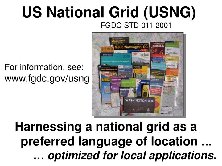
US National Grid (USNG) FGDC-STD-011-2001. For information, see: www.fgdc.gov/usng. Harnessing a national grid as a preferred language of location ... … optimized for local applications. Please note, there are many ways to

E N D
US National Grid (USNG) FGDC-STD-011-2001 For information, see: www.fgdc.gov/usng Harnessing a national grid as a preferred language of location ... … optimized for local applications.
Please note, there are many ways to describe a location with coordinates. The US National Grid being discussed here is just one of them.
Non-Standard Grids Problems & Impact We’ve long used map grids. We simply haven’t used a standard map grid until now, one that works with GPS, GIS, etc! Same street names, but different grids. A Survey of Washington, DC Commercial Street Maps Found 35 different maps… … with 31 different grids. None worked with GPS receivers.
Telephone: (202) USNG Grid: 18S UJ Point of Interest Street Address Subway Sandwich & Salads 2030 M St., NW 2256 0826 223-2587 Subway Sandwich & Salads 430 8th St., SE 2698 0567 547-8200 Subway Sandwich & Salads 3504 12th St., NE 2740 1120 526-5999 Subway Sandwich & Salads 1500 Benning Rd, NE 2815 0757 388-0421 A Standard Grid... …a consensus based standard. • - A communications enabler. • - Geoaddress on maps. • - Universal Map Index • An enabler… a bridge between • hardcopy maps and digital. • - Frictionless interoperability … a nationally consistent language of location.
USNG… framing issues. • USNG is an FGDC process standard • - It is a presentation process standard. • It is not intended to define internal storage structure • of any GIS or to the transfer of coordinates between • databases or appliances. • Intended for ground operations. For the general public, • public safety, and commerce. • - For maps generally >1:1,000,000-scale. • Not applicable to aeronautical and nautical operations • as such.
From research into, “Why not lat/long instead of plane coordinates.” 120.0% 100.0% 13% 32% 13% 66% 80.0% 150+m = blunders 15m to <150m ~ NMAS <15m 60.0% 73% 57% 40.0% 34% 20.0% 12% 0.0% UTM full grid UTM tic marks Lat/long full graticule 08/27/98 Pos Errors - Type & % Human factors: Types & Percentages of Positional Errors Green (15m) equates approximately to (12m) the National Map Accuracy Standard (NMAS). Terry, 1994, Photogrammetric Engineering & Remote Sensing, Vol 63, No. 4, Apr 1997, p.381 - 383.
Meets National Map Accuracy Standard 08/27/98 Terry, 1994, Photogrammetric Engineering & Remote Sensing, Vol 63, No. 4, Apr 1997, p.381 - 383. Pos Accuracy Bullseye
08/27/98 Terry, 1994, Photogrammetric Engineering & Remote Sensing, Vol 63, No. 4, Apr 1997, p.381 - 383. User’s Preference (91%)
Often asked question: Why not use Lat/Long, state plane, 5’ grids, 2.5’ grids, etc, instead of UTM/USNG, etc….? 1. Latitude / Longitude a. Many different position reporting formats. b. Just how far is 1 minute of longitude anyway? c. Ever tried to accurately fix a position to within 10-m using a paper map and lat/long? 10 out of 12 authors of GPS “How to” books recommend UTM over Lat/Long., Ease of use, fewer human errors. 2. But we have GPS!!! a. GPS is wonderful at providing a position (PNT). b. As a map… not so good! Small GPS screen: 1,600-mm2 Small, low resolution screen Large 7.5’ quad: 256,000-mm2 Large synoptic, high res view. c. Applying GPS position to map in the field. – See 1.c. above. Map and GPS same relative size. - But the # 1 REASON IS THAT THE US NATIONAL GRID IS A NATIONAL STANDARD! Why? See Reason 1.c. above!
08/27/98 UTM or SPCS?
The Requirements of a United States National Grid (USNG) NPCRS Requirements for Geoaddressing... Public Domain Geodetically Referenced Plane Coordinate System Seamless at Political Boundaries Possess Powerful Truncation Features 08/27/98
USNG = UTM?MGRS/NAD 83 - Why? Off the Shelf MGRS SPCS Options Lat/Long PLSS UTM Public Domain Proprietary Geodetically Referenced PLSS Plane Coordinate Latitude/ Longitude Seamless at Political SPCS Boundaries Filtering Requirements Simple/Powerful UTM Truncation Now on consumer GPS receivers 08/27/98 UTM/MGRS UTM/MGRS/NAD 83 = Why?
Example: dcgis.dc.gov/mar_client_sample/ Low-end High-end
“Problems/Issues/Gaps: • Responders’ lack ability to share information between the MAC (Multi-Agency Coordination Entities) and • area command posts is partially due to weak communications and interoperability standards. • This is evidenced by situations where MAC and area commands may both be utilizing digital maps, but with different indexing standards. The result may be an inability to easily exchange map coordinates.” • AProjectResponderReport: TechnologyOpportunitiesforImplementingtheNationalIncidentManagementSystem (NIMS) • Of October 2005, p. 31, by Hicks and Associates, Inc., for The Memorial • Insitute for the Prevention of Terrorism and the United States Department of Homeland Security.
“Lack of a uniform method for describing incident locations has long been a major impediment to rapid and effective emergency response in diverse metropolitan and rural areas... …the immediate impact of USNG will be to ensure that GPS is directly usable with properly gridded map products to quickly enable multi-agency and multi-jurisdictional emergency responders, and the public in general, to precisely identify geolocations in the real world. …the USNG will be a principal integrating mechanism to create spatial interoperability nationwide...among multi-jurisdictional civil emergency response organizations and when necessary, between those organizations and the military to support any and all domestic emergency response and disaster relief operations.” - Appendix E Spatial Interoperability Defense Science Board Task Force on the Future of the Global Positioning System, October 2005.
One approach: Cartographic anarchy. Many non-standard grids & spatial ref. systems. Many civil sector polygon and reference systems in Hurricane KATRINA 2005 Local areas by geographic features is good, but no standard spatial reference grid.
Multiple non-standard reference systems: = Not compatible with GPS, C2 systems, etc. = Does not enable trained forces or interoperability. = Operational friction during mutual assistance. Local (state) quadrangle reference system.
Grids are good but... ...a standard grid reference system is essential. The alternative is operational friction.
Location, location, location... What exactly is a 911 Grid Map?
Lat/Long increases: Alpha characters increase: Common Ground Alliance “Miss Utility” map reference system - Nonstandard notations - Adds operational friction
A Brief MGRS - USNG History MGRS 1914 - WW I: Convergence of technologies. Necessity mother of invention. French develop use of grids. Lat/Long too hard for average soldier. WW I Lesson: Grids are great. Everybody develops one. 1940’s WW II: Many different grids in use. Projection issues. Operational friction. WW II Lesson: Get everyone on standard grid. 1945 - 1949: US and British armies develop and implement UTM and Military Grid Reference System (MGRS). Great success story; Used in combat ever since. USNG Mid - 1990’s: No standard civil grid equiv. GPS arrives. 9/11. USNG development at FGDC. MGRS could answer the requirement, no need to be original… but NAD27 US issue. USNG/WGS84 = MGRS/WGS84 USNG/NAD27 not = MGRS/27
The value of an alternative approach: Results of Research at an ABCA Conference Hypothesis: Standards, doctrine, and training based on a standard grid will substantially reduce operational friction and improve operational effectiveness. Scenario: Disaster has struck Blues City in Blue Land, requiring formation of a coalition to support civil authorities in disaster response. Part I: Without prior notice or special training coalition officers are provided a 1:50,000 topographic map of Blues City, romer scale, and requested to locate features provided by USNG/ MGRS grid coordinates. Part II: Given rapid planning requirements, coalition countries must produce their own maps of Blues City located on a UTM zone junction.
The value of an alternative approach: Results of Research at an ABCA Conference Part I:Without prior notice or special training coalition officers are provided a 1:50,000 topographic map of Blues City, romer scale, and requested to locate features provided by USNG/MGRS grid coordinates. Results: Of 64 attempts, 63 points located.
Part II: Given rapid, disbursed planning requirements, coalition countries must produce their own maps of Blues City located on a UTM zone junction. Results: Within an hour street data had been downloaded from Blues City web site and a properly gridded map prepared per normal procedures.
KATRINA Lessons Learned in Mississippi: “3. The implementation of a standardized reference system. We recommend the use of the US National Grid (USNG). We made the mistake of initially improvising a search and rescue grid and then modifying that grid for local use. Hundreds of copies of each were published. The USNG is a readily available standard that is yet to be adopted by emergency response agencies due to lack of education.” From proposed: Joint Emergency Mapping System for Mississippi (JEMS), Center for Interdisciplinary Geospatial Information Technologies Delta State University, Mississippi 19 November, 2005
FGDC-STD-011-2001 United States National Grid www.fgdc.gov/usng “We should promote voluntary standards that enhance the effective coordination of disaster responses, such as the U.S. National Grid map standard for geospatial information system;” - The Honorable John H. Marburger, III Director, Office of Science and Technology Policy. Testimony of Dec 5, 2001 before the Subcommittee on Science, Technology and Space Committee on Commerce, Science, and Transportation, United States Senate.
How to read the USNG… U UTM/USNG Grid Zone Designations 48°N 126° 66° 96° 102° 84° 120° 108° 90° 78° 72° 114° T 40°N S 18S 32°N R 24°N 10 19 11 18 12 17 13 16 14 15 08/27/98 Jefferson Pier: 18S UJ 2337 0651 (NAD 83) MGRS Grid Zone Designations
Jefferson Pier:18S UJ 2337 0651 U.S.National Grid 100,000m Square Identification 78°W GZD: 17T GZD: 18T GZD: 17S GZD: 18S 600 400 700 300 4400 4400 PD UJ QD TJ 500 4300 4300 NC VH PC QC TH UH 300 400 4200 4200 KB LB MB VG NB PB QB TG UG 4100 4100 KA LA MA VF UF NA TF PA QA 4000 4000 300 400 500 400 600 700 300 Grid Zone Designation 18S Grid Zone Designation 17S 78°W
The Power of Truncated USNG Values Jefferson Pier, Washington, DC Grid: UJ23370651 = repeat of UJ23370651 Each 2 letter/8 digit USNG value (10-m posting) in the outlined area is unique.
Reading Grid Coordinates… “ Read Right, Then Up.” The Jefferson Pier is located at grid 2337 0651 18SUJ23370651 (think 2337 / 0651) Principal Digits 4-digit: 23 06 = 1,000m 6-digit: 233 065 = 100m 8-digit: 2337 0651 = 10m 10-digit: 23371 06519 = 1m precision 24 22 23 07 07 Grid: 2337 0651 Read RIGHT to grid line 23 Then measure right another 370-meters. Jefferson Pier 06 06 Grid: 2306 4305000mN 18S UJ 2337 0652 05 24 23 322000mE Datum: NAD 83 USNG: 18S UJ UTM values. 0 1,000-m Scale Then, read UP to grid line 06, and measure UP another 510-meters.
US National Grid TJ UJ 10 35 95 15 20 25 30 40 05 300 90 285000mE 4325000mN 25 20 20 15 15 10 10 05 05 UJ TJ TJ UJ 4300 4300 UH TH TH UH 95 95 90 90 85 4285000mN 90 95 05 10 15 30 300 85 20 25 35 345000mE TH UH Datum: North American Datum 1983 (NAD 83) Scale: Grid Zone Designation: 18S Jefferson Pier: 18S UJ 2337 0651
YP BU YP BU
Organization of UTM zone 18 84° N 500,000-mE 78° W 72° W 75° W 0-mN 10,000,000-mN 0° EQUATOR 500,000-mE 80° S
UTM Zone Junction - Zones 15 - 16 Zone 16 Zone 15 84° N 500,000-mE 500,000-mE 7.5’ quads 7.5’ quads UTM grid lines 96° W UTM grid lines 84° W 93° W 87° W 90° W 0-mN 10,000,000-mN 0° EQUATOR EQUATOR 0° 500,000-mE 500,000-mE 72° W 78° W 80° S 80° S
UTM Zone Junction - Zones 15 - 16 84° N Zone 15 Zone 16 500,000-mE 500,000-mE 7.5’ quads 84° W 96° W 87° W 0-mN UTM grid lines 93° W 0° EQUATOR 0° Point of tangency 500,000-mE 90° W 90° W 80° S
DC GIS users can 1) lookup the USNG value for a street address or 2) zoom to a location with a USNG value. Auto-complete capability. Data is in MD SPCS, USNG functions for public.
Relevant URLs DC Master Address Repository http://dcatlas.dcgis.dc.gov/MAR/ USNG: 2331 0803 1620 L St NW DC GIS http://dcgis.dc.gov St. Louis, MO Parcel Data by Address http://stlcin.missouri.org/citydata/newdesign/index.cfm http://stlcin.missouri.org/citydata/newdesign/addressparser.cfm?addresssearch=&previouspage=data The National Map http://nmviewogc.cr.usgs.gov/viewer.htm FGDC US National Grid resource site: http://www.fgdc.gov/usng
USNG geoaddress and universal map index value.
St. Louis, MO GIS Web Site Street address look up... Functions like a Universal Map Index
“Turn right at 438 Northing.” 83 84 44 438n 43 “Street Sign-in-a-Box” concept
Think of it as a “street sign-in-a-box” Threshold Automobile GPS Initiative TAGI
Arlington Co. VA 9-1-1 Operator; ‘We can’t use a GPS coordinate.” Motorcycle accident, Sept 10, 2003, 7:55AM. USNG readout for cursor
Legend Four Pillars of Implementation • Maps • with USNG grids. • (hard copy • & digital) - Education. Community Consensus Done FGDC’s US National Grid (Public/Business/Government) - User Friendly GPS/ Internet and Wireless Connectivity - Geoaddress Availability US National Grid
Questions? Comments? Analog-----------------Bridge--------------------Digital For information, see: www.fgdc.gov/usng
USNG Zone Junction New Orleans, LA • GIS technician training requirements emerge from Hurricane KATRINA, 2005. • Additional issue. It has been suggested that MGRS/USNG cannot be used by aircraft supporting ground operations. FGDC US National Grid (WG84) = Military Grid Reference System (WGS84) See www.fgdc.gov/usng for additional information