Download
1 / 42
430 likes | 656 Views
Transient Atmospheric Flows and Disturbances. Chapter 7. Impact of Storms on the Landscape. Storms influence our lives everyday Storms impact the landscape Negative effect Accelerate erosion, Flood valleys, Destroy buildings Decimate crops Positive effect

E N D
Impact of Storms on the Landscape Storms influence our lives everyday Storms impact the landscape Negative effect Accelerate erosion, Flood valleys, Destroy buildings Decimate crops Positive effect Promote diversity in vegetative cover Increase the size of lakes and ponds Stimulate plant growth with moisture
Characteristics Must be large More than 1000 miles across and several miles deep Must have uniform properties in the horizontal dimension Must be a recognizable entity and travel as one Air Masses
Origin Develops its characteristics by remaining over a uniform land or sea surface long enough to acquire the temperature, humidity, and stability characteristics of the surface. The air is usually stable stagnate air Form in anti-cyclonic conditions called source regions Ideal regions are ocean surfaces and extensive flat land areas that have a uniform covering of snow, forest, or desert. Air Masses
Air Masses Classification of Air Masses Arctic/Antarctic AAntarctica, arctic Ocean and fringes, and Greenland Very Cold, Very Dry, Very Stable Continental Polar cPHigh-latitude plains of Eurasia and North America Cold, dry, very stable Maritime Polar mPOceans in vicinity of 50 – 60 latitude Cold, moist, relatively unstable Continental tropical cTLow-latitude deserts Hot, very dry, unstable Maritime tropical mTTropical and subtropical oceans Warm, moist, or variable stability Equatorial EOceans near the equator Warm, very moist, unstable
Fronts Boundary between a two unlike air masses Not two dimensional boundary at the surface, but a three dimensional zone of discontinuity Warm, Cold, Stationary, Occluded fronts
Forms by advancing warm air Slope is gentle, ascends over treating cool air , decreasing adiabatically as the air rises Clouds form slowly and not much turbulence (High cirrus clouds, moving towards a altocumulus or altostratus Broad precipitation, protracted and gentle Warm Fronts
Cold Fronts Forms by advancing cold air Is a steeper front than a warm front with a “protruding nose” Moves faster than a warm front Rapid lifting, unstable air, blustering and violent weather Vertically developing clouds If unstable air, precipitation can be showery or violent Precipitation along the leading edge and immediately behind the ground-level position of the front.
Stationary and Occluded Fronts Stationary front – gently rising warm air, limited precipitation Occluded front – when a cold front overrides a warm front.
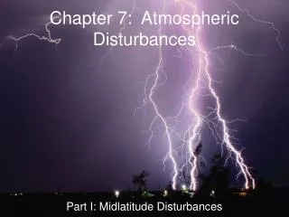
Mid latitude Disturbances – mid latitude cyclones and anti-cyclones Tropical Disturbances – monotonous, same daily, monthly, yearly. Tropical cyclones (hurricanes or cyclones on easterly waves Localized Sever Weather Thunderstorms and tornadoes. Atmospheric Disturbances
Mid Latitude Cyclones Characteristics Diameter – 1000 miles or so Ground level center pressure 990 – 1000 Millibars Clear-cut pressure trough extends southwesterly from the center Counter-clockwise circulation pattern in the Northern Hemisphere Two fronts, warm and cold, with a cool sector north and west of the center and warm sector to the south and east. Clouds – cumuliform clouds yield shower precipitation , originates in the warm air rising about the fronts and falls down through the front to reach the ground in the cool sector
Passing of the Front Temperature decreases sharply Winds shift from southerly ahead of the front to the northwesterly flowing it The front is in a pressure trough, so pressure falls as the front approaches and rises after it passes Clear skies are replaced by cloudiness and precipitation of the front Similar changes but to a lesser magnitude occur when the warm front passes Movements Generally moves west to east. Taking about 3 to 4 days to cross the U. S. System has a cyclonic wind circulation with converging counterclockwise from all sides Cold front normally advances faster than the storms moves swinging it counterclockwise around the pivot center increasingly moving and displacing the warm sector Warm front usually advances more slowly than the storm Mid Latitude Cyclones
Cyclogenesis Develop in 3 to 6 days to maturity, and about the same length to dissipate Start as “waves” or wave cyclone along the polar front. Occurrence and Distribution At any given time from 6 to 15 mid latitude cyclones exist in the Northern Hemisphere Occur at scattered but irregular intervals through the zone of the Westerlies. Life of Mid Latitude Cyclones
Life Cycle of the Mid Latitude Cyclones Front develops Wave appears along the front Cyclonic circulation is well developed Occlusion begins Occluded front is fully developed Cyclone dissipates Remember this
Life Cycles of the Mid Latitude Cyclones Remember this
Here is another version of the life cycle of a mid latitude cyclone
Mid Latitude Anti-cyclones – High Pressures Characteristics High pressure – has air converging into it from above, subsiding, and diverging at the surface, clockwise rotation. No air-mass conflict or surface convergence is involved No fronts involved Weather clear and dry with little or no opportunity for cloud formation Wind movement very limited near the center, increases progressively outward Very low temperatures in the winter Prone to stagnate and remain over the same region for several days
Minor Tropical Disturbances: Easterly Waves Long but weak migratory low-pressure system Occurs between 5 to 30 degrees of latitude Tropical disturbances Hurricanes, typhoons, Baguio, or cyclones Develop from incipient low-pressures perturbations in trade-wind flow, called tropical disturbances. Tropical depression – wind speed of less than 38 mph but has closed wind circulation pattern Tropical Storm– winds between 39 to 73 mph Hurricanes – winds greater than 74 mph
Hurricanes Characteristics Prominent low-pressure centers that are essentially circular with steep pressure gradient outward from the center Converging cyclonic wind pattern “fuel” that powers the storm Warm, water vapor-laden air spirals into a storm Intense updrafts within towering cumulonimbus clouds Eye of the Hurricane, walls of rain bands
Hurricanes Origin Form only over warm oceans in the tropics at least a few degrees north or south of the equator Mechanism of formation not fully understood Always develop out of a preexisting disturbance in the tropical troposphere. Easterly waves provide low-level convergence and lifting that catalyze the develop Less than 10% of all easterly waves grow into hurricane Movement Stay within the trade-winds moving east to west. Damage and Destruction Saffir-Simpson Hurricane Scale 1-5 in intensity Storm Surge -- Ocean bulge – wind driven water that pounds into a shoreline
1 2 3 4
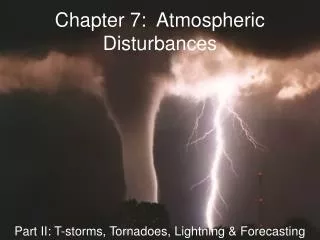
Localized Severe Weather Thunderstorms Defined as a violent convective storm accompanied by thunder and lightning Found frequently found in conjunction with other kinds of storms Triggered by unstable uplift Formation called the cumulus stage Mature stage – in which updrafts and downdrafts coexist as the cloud continues to enlarge – heavy rain accompanied with hail, blustery winds, lighting, and the growth of the anvil top Dissipating stage -- with light rain ending the turbulence.
Tornadoes Very small and localized Most destructive of all atmospheric disturbances Most intense vortex in nature , deep low pressure cell surrounded by a violently whirling cylinder of wind Less than a quarter of a mile in diameter but most extreme pressure gradients known (100-millibar difference from the center to the edge. Upswept water vapor condenses into a funnel cloud Advances along an irregular track that generally extends from southwest to northeast in the US Fujita tornado intensity scale for intensity Formation – develop in the warm moist unstable air associated with a mid latitude cyclone, along the squall line Develops out of mesocyclone, but only about half of all mesocyclones formed result in a tornado More than 90 % of tornadoes happen in the US in Tornado Alley