Download
1 / 17
170 likes | 367 Views
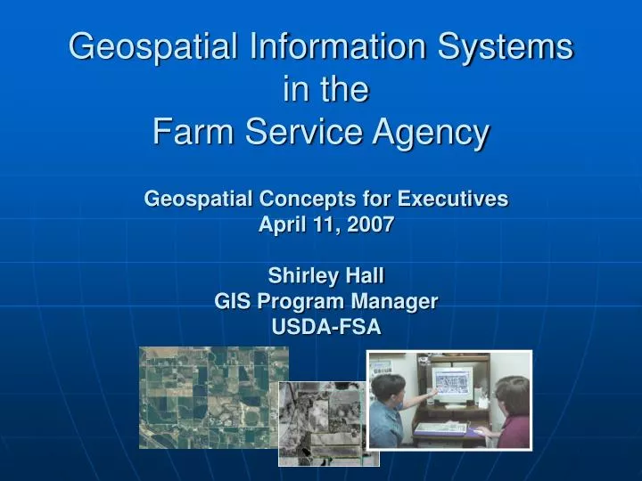
Geospatial Information Systems in the Farm Service Agency . Geospatial Concepts for Executives April 11, 2007 Shirley Hall GIS Program Manager USDA-FSA.

E N D
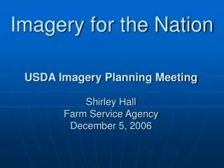
Geospatial Information Systems in the Farm Service Agency Geospatial Concepts for Executives April 11, 2007Shirley HallGIS Program ManagerUSDA-FSA
FSA’s mission isto stabilize farm income, help farmers conserve land and water resources, provide credit to new or disadvantaged farmers and ranchers, and help farm operations recover from the effects of disasters. FSA is using Geospatial Information Systems (GIS) to optimize its shrinking human and programmatic resources.
FSA’s GIS Implementation • Replaced paper maps with digital photography • Replaced pencils and pens with PCs and GIS software • Replaced wheel and chains to measure fields with GPS • Replaced 35 mm compliance slides with digital imagery
What Needed to Be in Place? • Digital orthophotography mosaicked into a seamless county view • Digitized farm field boundaries called Common Land Units (CLU) • Yearly digital compliance imagery • Hardware, software and applications
What Could Happen Then? • Digital updates for farm makeup changes and land use • GIS based crop reporting and compliance applications • Identification and tracking of disaster events • Conservation planning and tracking • Producer and partner direct access to information.
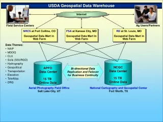
Common Land Unit (CLU) Soils Demographics Orthophotograhy (MDOQ) Key Data Components FSA Has Put in Place National Agriculture Imagery Program • Mosaicked Digital Orthophotography (MDOQ) • Common Land Unit (CLU) • National Agriculture Imagery Program (NAIP)
Common Land Units • digitized farm and field boundaries • locally maintained • the key building block of FSA’s integrated Geographic Information System.
Geodata Warehouse • Deploying software which will pass CLU updates to the Geodata Warehouse on a regular schedule • Having the data in the GDW will allow QC process for creating a seamless national CLU database • Near real time data can then be linked to e-Gov applications like the USDA Customer Statement
Land Use Application Allows Service Center staff to record the customer’s commodity information linked to individual fields and sub-fields.
Land Use Application • ArcGIS/SDE Software • Integrated with National Name and Address Web Service, Farm/Tract Web Service (crop report data), and Legacy System data • Multi-user software • Everyone in the Service Center may use simultaneously • 200+ Service Centers Piloting
FSA’s Imagery Acquisition Strategy • Annually acquires 1 and 2 meter resolution digital ortho imagery. • Flown during the summer growing season. • Base replacement updates on a 5 year cycle. • Approximately twenty percent 1 meter and eighty percent 2 meter resolution imagery each year.
National Agriculture Imagery Program (NAIP) began it’s first year of major acquisition was in 2003. 2007 will complete Phase 1 of the Program. NAIP is breaking barriers in GIS imagery acquisition: • dual imagery acquisition program (1 meter replacement and 2 meter resolution compliance imagery products) • amount of imagery flown in one year • extremely quick product delivery for not only the compliance product, but also the 1 meter replacement product (less than 1 year as apposed to 2-3 years with previous acquisition programs.) • FSA’s replacement imagery strategy is to fly 20% (approximately10 States) each year. • Establishment of joint performance targets with USGS.
How FSA Integrates NAIP Imagery • 1 Meter Replacement Imagery • Farm and field record maintenance • Crop measurement work • Land use • Accurate damage assessment in the event of disasters • 2 Meter Compliance Imagery • Effectively monitor program compliance • Verify planted and reported acres • Interim change detection, updates and day-to-day operations
Just a Few of the NAIP Benefits • Significantly reduces the time it takes FSA local offices to complete compliance tasks • Used to support day-to-day program administration (farm maintenance, crop reporting, change detection, disaster events, etc.) • Provides effective central acquisition program management using a best value, multi-year contract • Used by Federal, State and local partner agencies in agriculture, conservation, property, and law enforcement programs. • Used by non-contributing agencies in USDA, other Federal, State and local entities.
What are the benefits of GIS to FSA? • Positive impact to producer business practices • Improved Program response time • Improved response to natural disaster events • Positive impacts to e-File requirements • Creates Technology Assets – tools that provide fast, effective service and reduce over-all program cost • Migration from outdated legacy systems • Ability to Data Share – Increased cooperation and integration partner agencies • Compliance with Federally mandated requirements • And much more…
FSA Contacts Shirley Hall FSA GIS Program Manager (202) 720-3138 Shirley.Hall@wdc.usda.gov Jim Heald Director, FSA/ITSD Geospatial Information & Executive Management Systems Center (202) 720-0787 Jim.Heald@wdc.usda.gov Aerial Photography Field Office NAIP Program Manager Kent Williams (801) 975-3500 X261 Kent.Williams@slc.usda.gov