Download
1 / 28
300 likes | 382 Views
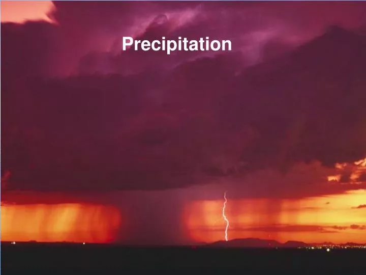
Precipitation. So far we’ve seen how air gets saturated with water vapor, causing some to condense into droplets or sublimate into ice crystals. Is is simply a matter of the water droplets combining to form raindrops?.

E N D
So far we’ve seen how air gets saturated with water vapor, causing some to condense into droplets or sublimate into icecrystals. Is is simply a matter of the water droplets combining to form raindrops?
Answer: No, Cloud droplets are TINY! It would take thousands of them happening to combine to form a single raindrop. But clouds are filled with millions of droplets. Couldn’t they combine a few at at time to form large droplets, then raindrops?
That process is called collision and coalescence. Here’s how it might work: Here’s a typical cloud. Let’s look inside, just in the section in the black box.
Enlarged many times, there are small cloud droplets and some larger ones. The larger droplets fall faster then the lighter, small droplets. So the large droplet collides and coalesces with the small ones under it.
Looking at several slices at successive times, the large cloud droplet grows by colliding and coalescing (acquiring) the smaller droplets. Eventually, it grows large enough to be a raindrop.
The problem with this process is that clouds in the U.S. don’t have enough small droplets. Each one must form around a “condensation nucleus”, usually a bit of dust. Studies show it takes far too long to form rain this way (about 20 hours), EXCEPT in the tropics. That’s where collision and coalescence works well.
So, how does precipitation in mid-latitude places like the U.S. form? As Snowflakes!
Let’s look at another slice, this one in a cold cloud. Somewhere up there, the temperature falls below 32°F (remember temperature falls with height)
In this slice, water droplets have formed but ice crystals (snowflakes!) also form because it’s cold. There’s always water vapor molecules so in this slice you have all 3 phases of water.
The water vapor molecules can condense into the water droplets and also evaporate from them. But they can only sublimate onto the ice crystals. Early time A few minutes later After 10-20 minutes So, the ice crystals can only grow larger! Eventually they fall. This is known as the Bergeron-Findeisen process. Amazingly, this one is fast enough to produce precipitation in minutes, just what we observe in nature.
It turns out ALL the precipitation we experience in mid-latitudes starts as snow. After it falls, the lapse rate determines what happens.
We detect precipitation while it is falling by means of Radar (Radio Detection and Ranging). The Radar dish sends out a pulse of energy. The target might be a raindrop.
The target reflects back (scatters) some energy back to the dish. Computers then calculate the direction and distance of the target. Direction is easy. Which way is the dish pointed? To get the distance, we actually measure the tiny time it takes for the pulse to get to the target and return!
Everyplace where you see green, yellow, and red colors, targets are scattering back Radar pulses.
Binghamton Radar This is the scale we use. Blues and greens are weak or light precipitation. Yellow is moderate. Orange and red are heavy. Warnings are shown as colored polygons (shapes)
We plot precipitation and all other weather observations using numbers and symbols on the weather map.
Pressure is actually abbreviated. If the full pressure is, say 1016.2 mb, you would see the report as 162: Conversely, if you were to read 998.3 mb on the barometer, you would report 983. Use only the last three digits with no decimal: The decoding procedure is: Put a decimal to the right of the last digit, then add 900 or 1000, whichever one gets you closest to 1000 mb. So, choose between 1098.3 and 998.3 and you get 998.3
You must know six basic weather symbols. Most of these (but not all) are for precipitation. We call it “present weather”. It means anything falling out of the sky or hanging in the air.
Two other types that are good to know: Freezing rain ( ) and sleet ( )
When rain freezes on contact, that’s called freezing rain. When you get a lot of freezing rain, that’s an Ice Storm.
A heavy ice storm is a significant weather event. When tree limbs break, they inevitably fall on the wires and cause power outages. Downed wires are live and dangerous!
We detect precipitation while it is falling by means of Radar (Radio Detection and Ranging). The Radar dish sends out a pulse of energy. The target might be a raindrop.
The target reflects back (scatters) some energy back to the dish. Computers then calculate the direction and distance of the target. Direction is easy. Which way is the dish pointed? To get the distance, we actually measure the tiny time it takes for the pulse to get to the target and return!
Everyplace where you see green, yellow, and red colors, targets are scattering back Radar pulses.
Bottom line: All clouds and precipitation form due to upward vertical motion in a humid atmosphere. How do we get upward vertical motion? We need to look at what makes the air move upward.