Download
1 / 46
670 likes | 1.58k Views
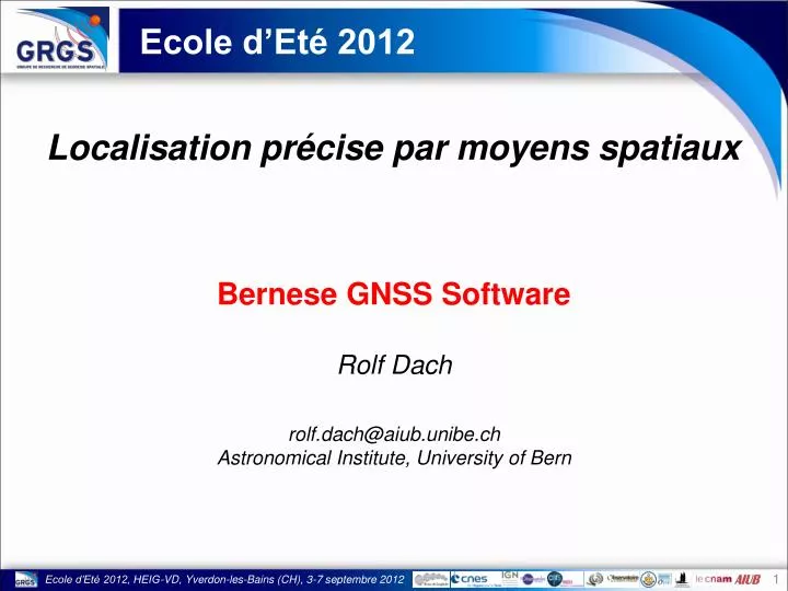
Ecole d’Eté 2012. Localisation précise par moyens spatiaux. Bernese GNSS Software Rolf Dach rolf.dach@aiub.unibe.ch Astronomical Institute, University of Bern. Ecole d’Eté 2012, HEIG-VD, Yverdon-les-Bains (CH), 3-7 septembre 2012. The Bernese GNSS Software.

E N D
Ecole d’Eté 2012 Localisation précise par moyens spatiaux Bernese GNSS Software Rolf Dach rolf.dach@aiub.unibe.ch Astronomical Institute, University of Bern Ecole d’Eté 2012, HEIG-VD, Yverdon-les-Bains (CH), 3-7 septembre 2012
The Bernese GNSS Software • It is developed, maintained and used at the Astronomical Institute of the University of Bern since many years. • The Bernese GNSS Software is online at • http://www.bernese.unibe.ch . • The Bernese GNSS Software is • a scientific software package • for multi-GNSS data analysis • with highest accuracy requirements • in regional to global scale networks.
Milestones in the development Summer 1983 to Autumn 1984: visit of Gerhard Beutler in Canadastart of the first routines for the Bernese GPS Software 21. June 1992: the AIUB/CODE starts the activities as an analysis center of the IGS 1988 to 1995: release of version 3.0 to 3.5 in short intervals September 1996: version 4.0 with ADDNEQ and BPE is published November 1999: version 4.2 contains capabilities for GLONASS processing and comparison of SLR measurements with GNSS orbits May 2003: start of GPS/GLONASS combined solutions for the IGS April 2004: version 5.0 with new BPE and GUI based on QT is released Summer 2012: version 5.2 is prepared for the release
Users of the Bernese GNSS Software Total: 542
Bernese GNSS Software, Version 5.2 • rapid processing of small-size single and dual frequency surveys(static as well as kinematic stations — even LEOs), • automatic processing of permanent networks (BPE), • processing of data from a large number of receivers, • combination of different receiver types, taking receiver and satelliteantenna phase center variations into account, • combined processing of GPS and GLONASS observations, • ambiguity resolution on long baselines (2000 km and longer), • generation of minimum constraint network solutions, • ionosphere and troposphere monitoring, • precise point positioning, • clock offset estimation and time transfer, • orbit determination and estimation of Earth orientation parameters. • . . . The Bernese GNSS Software is particularly well suited for:
Bernese GNSS Software, Version 5.2 • compliant to the IERS2010 and IGS standards • ambiguity resolution not only for GPS but also for GLONASS • estimation of clock corrections from GLONASS data (IFB) • extensive use of normal equation operations(much more efficient for starting each operation on observation level) • automated analysis of time series (FODITS) • intensive check of meta-data when importing observation files Highlights of the Bernese GNSS Software:
Bernese GNSS Software, Version 5.2 • receiver/satellite antenna model estimation • GLONASS-GPS translation bias to compensate for antenna model deficiency • State-of-the-art modelling for • troposphere modeling: GMF/GPT, VMF1 • ionosphere modeling: higher order ionosphere correction • introducing corrections for up to three loading effects from grid files(on observation level with scaling factor) • handling (estimation) of repositioining events of GPS satellites Highlights of the Bernese GNSS Software:
Bernese GNSS Software, Version 5.2 • RINEX for observations, navigation messages, meteo data (input) • SP3cfor precise orbits (input/output) • IGS/IERSfor pole information (input/output) • Clock RINEX for satellite and station clocks (input/output) • IONEXfor regional and global ionosphere models (output) • SINEXfor solutions and meta–information (input/output) • Troposphere SINEX for troposphere parameter estimates (output) • ANTEXfor antenna phase center offsets and variations (input) • Vienna Grid Files coefficients for VMF1 corrections (input) The Bernese GNSS Software supports all important international formats:
Bernese GNSS Software, Version 5.2 • GPS-data from Low Earth Orbiters (LEOs) may be processed. • Orbits can be computed on a few cm level. • kinematic as well as a reduced–dynamic orbit determination • CHAMP, GRACE, GOCE, but also MetOp, JASON, SAC–C, . . . • For the GOCE mission the AIUB is responsible for the Precise Science Orbit. • Full consistency of the models for the IGS-product generation and their use for LEO orbit determination. The Bernese GNSS Software is not only designed for “classical”, geodetic, ground-based applications.
Bernese GNSS Software, developments • full consistency with IGS- and LEO-orbits • gravity field determination based on kinematic LEO trajectories,K-band (GRACE), and gradiometer (GOCE) measurements.CHAMP, GRACE, GOCE, Based on the Bernese GNSS Software a special environment for gravity field determination has been developed.
Bernese GNSS Software, developments Monthly mean geoid heights from CHAMP from years 2002-2009, Prange : Geodätisch-geophysikalische Arbeiten in der Schweiz, vol. 81
Bernese GNSS Software, developments Monthly mean geoid heights from CHAMP from years 2002-2009, Prange : Geodätisch-geophysikalische Arbeiten in der Schweiz, vol. 81
Bernese GNSS Software, developments Monthly mean geoid heights from CHAMP from years 2002-2009, Prange : Geodätisch-geophysikalische Arbeiten in der Schweiz, vol. 81
Bernese GNSS Software, developments Monthly mean geoid heights from CHAMP from years 2002-2009, Prange : Geodätisch-geophysikalische Arbeiten in der Schweiz, vol. 81
Bernese GNSS Software, developments Monthly mean geoid heights from CHAMP from years 2002-2009, Prange : Geodätisch-geophysikalische Arbeiten in der Schweiz, vol. 81
Bernese GNSS Software, developments Monthly mean geoid heights from CHAMP from years 2002-2009, Prange : Geodätisch-geophysikalische Arbeiten in der Schweiz, vol. 81
Bernese GNSS Software, developments Monthly mean geoid heights from CHAMP from years 2002-2009, Prange : Geodätisch-geophysikalische Arbeiten in der Schweiz, vol. 81
Bernese GNSS Software, developments Monthly mean geoid heights from CHAMP from years 2002-2009, Prange : Geodätisch-geophysikalische Arbeiten in der Schweiz, vol. 81
Bernese GNSS Software, developments Monthly mean geoid heights from CHAMP from years 2002-2009, Prange : Geodätisch-geophysikalische Arbeiten in der Schweiz, vol. 81
Bernese GNSS Software, developments Monthly mean geoid heights from CHAMP from years 2002-2009, Prange : Geodätisch-geophysikalische Arbeiten in der Schweiz, vol. 81
Bernese GNSS Software, developments Monthly mean geoid heights from CHAMP from years 2002-2009, Prange : Geodätisch-geophysikalische Arbeiten in der Schweiz, vol. 81
Bernese GNSS Software, developments Monthly mean geoid heights from CHAMP from years 2002-2009, Prange : Geodätisch-geophysikalische Arbeiten in der Schweiz, vol. 81
Bernese GNSS Software, Version 5.2 • independent validation of estimated orbits for GNSS and LEO satellites • Project with BKG, Frankfurt a. M.: • extended to process LAGEOS/ETALON satellites • ILRS analysis center at BKG is using the software for their activities(ILRS-Banchmark test passed in 2010) • meanwhile further extended to other (lower) geodetic laser satellites The Bernese GNSS Software can also process SLR measurements.
Bernese GNSS Software, Version 5.2 microwave solutionfor GNSS satellites SLR solutionfor LAGEOS/ETALON GNSS stations SLR stations GNSS satellite orbit LAGEOS/ETALONorbit ERP/geocenter ERP/geocenter solution specific parameters solution specific parameters
Bernese GNSS Software, Version 5.2 microwave solutionfor GNSS satellites SLR solutionfor LAGEOS/ETALON local tie GNSS stations SLR stations GNSS satellite orbit LAGEOS/ETALONorbit ERP/geocenter solution specific parameters solution specific parameters
Bernese GNSS Software, Version 5.2 microwave solutionfor GNSS satellites SLR solutionfor GNSS satellites SLR solutionfor LAGEOS/ETALON SLR stations GNSS stations SLR stations GNSS satellite orbit GNSS satellite orbit LAGEOS/ETALONorbit ERP/geocenter ERP/geocenter ERP/geocenter solution specific parameters solutionspecific parameters solution specific parameters
Bernese GNSS Software, Version 5.2 microwave solutionfor GNSS satellites SLR solutionfor GNSS satellites SLR solutionfor LAGEOS/ETALON GNSS stations SLR stations GNSS satellite orbit GNSS satellite orbit LAGEOS/ETALONorbit ERP/geocenter solution specific parameters solutionspecific parameters solution specific parameters
Bernese GNSS Software, Version 5.2 microwave solutionfor GNSS satellites SLR solutionfor GNSS satellites SLR solutionfor LAGEOS/ETALON GNSS stations SLR stations GNSS satellite orbit LAGEOS/ETALONorbit ERP/geocenter solution specific parameters solutionspecific parameters solution specific parameters
Bernese GNSS Software, Version 5.2 • With the Bernese GNSS software we can provide the following three fully consistent solutions: • microwave GNSS solution • SLR solution for geodetic SLR satellites • SLR solution for GNSS satellites • Alternative to local ties are space ties: • uncertainty of the knowledge of the local tie is replaced by the problem of the location of the sensors at the satellite.
Bernese GNSS Software some facts PANIC – Bernese, never again! • The software package counts today: • 108 processing programs and 1329 subroutines, functions, and modules • nearly 425,000 lines of source code (including comment lines), • the GUI/BPE-program with 17500 lines of source code • supported my an online-help system, a 600 pages user manual, and a one week introductory course in Bern. • 5875 input/output filenames and processing options • The software package consists of: • a QT-based graphical user interface • a set of fortran (F90) processing programs • the Bernese Processing Engine (BPE) for automated processing
Processing examples The distribution of the software package contains ready-to-use examples: PPP_BAS.PCFStandard PPP for coordinate, troposphere, and receiver clock determination based only on GPS data or a combined GPS/GLONASS solution PPP_DEMO.PCFPPP containing several extended processing examples, like pseudo-kinematic, high-rate troposphere, or ionosphere solutions
Processing examples The distribution of the software package contains ready-to-use examples: RNX2SNX.PCFStandard double-difference network solution based only on GPS data or a combined GPS/GLONASS solution with an extended ambiguity resolution scheme CLKDET.PCFZero-difference network solution based only on GPS data or a combined GPS/GLONASS solution providing clock corrections (e.g., w.r.t. an existing coordinate and troposphere solution)
Processing examples The distribution of the software package contains ready-to-use examples: LEOPOD.PCFPrecise Orbit Determination for a Low Earth Orbiting Satellites based on on-board GPS-measurements (e.g., for GRACE) SLRVAL.PCFValidation of an existing GNSS or LEO orbit using SLR measurements
Program flow chart orbit data e.g., precise orbits, navigation RINEX EOP data IERS or Bernese format observation data observation RINEX meta data e.g., SINEX containing ITRF resp. Station information, ANTEX etc. ORBIT SIMULATION TRANSFER/CONVERTION EOP preparation orbit generation simulation of observations import/export of observations extraction of meta-information from external sources (iteration) PROCESSING preprocessing of observations SERVICE • tools to • manage observation files • browse/analyse residual files • manipulate/verify coordinate files session solution multi-session solution result files
User 1 User 2 User 3 Directory structure Program area Program files Help files General Files General Files User area Data area Campaign B Campaign D Campaign A Campaign C Campaign E
Realization of the processing scheme • This processing scheme is realized in the ready-to-use example: RNX2SNX.PCF (full description in RNX2SNX.README) • PCF stands for Process Control Fileto be used by a BPE for automated processing. • At the end of the BPE a protocol file summarizes the main results from the run (e.g., R2S102070.PRC) • The BPE needs to know: • what is to do: user scripts • there are any dependencies in the order of running the scripts • where a script can be started (CPU)
RNX2SNX.PCF # ============================================================================ # RNX2SNX.PCF # ============================================================================ # # Purpose: RINEX-TO-SINEX (RNX2SNX): standard double difference # processing for regional networks for static, dual-frequency # stations. # # ---------------------------------------------------------------------------- # PID SCRIPT OPT_DIR CAMPAIGN CPU F WAIT FOR.... 3** 8******* 8******* 8******* 8******* 1 3** 3** 3** 3** 3** 3** 3** 3** 3** 3** # # Copy required files # ------------------- 001 R2S_COP R2S_GEN ANY 1 002 ATX2PCV R2S_GEN ANY 1 001 003 COOVEL R2S_GEN ANY 1 001 004 COOVEL R2S_GE2 ANY 1 001 005 CRDMERGE R2S_GEN ANY 1 003 004 011 RNX_COP R2S_GEN ANY 1 001 021 OBSMRGAP R2S_GEN ANY 1 011 022 OBSMRG_P R2S_GEN ANY 1 021 031 ION_MRG R2S_GEN ANY 1 011 099 DUMMY R2S_GEN ANY 1 002 005 022 031 # # Prepare the orbits # ------------------ 101 POLUPDH R2S_GEN ANY 1 001
R2S102070.PRC ================================================================================ RNX2SNX BPE PROCESSING SUMMARY FOR YEAR-SESSION 10-2070 ================================================================================ Summary file generated at 07-Aug-2012 13:59:51 by R2S_SUM General files: Antenna phase center eccentricity file: PCV.I08 Satellite information file: SATELLIT.I08 Satellite problem file: SAT_2010.CRX Orbit, ERP and clock products used from: ${D}/COD Observation file selection: RINEX files copied from: ${D}/RINEX/ Station selection: all stations Reference frame and station related files: Station related files used from: ${D}/REF52/ External reference frame file series: IGS08_R.(CRD|VEL) Project specific station file series: EXAMPLE Station information file: STA/EXAMPLE.STA RINEX inconsistency file: Ocean tidal loading table: STA/EXAMPLE.BLQ Atmosphere tidal loading table: STA/EXAMPLE.ATL Other options from PCF: Antenna phase center model was not updated. Satellite system(s) included: GPS/GLO
IGS processing • Different BPEs are running daily at AIUB for the IGS activities: • ultra-rapid (several times per day for orbits/EOP) • rapid (orbits/EOP, clocks, ionosphere products) • final (orbits/EOP, clocks, ionosphere, weekly coordinate products) • EUREF (weekly coordinate solutions)
What do we expect in the future? • Today we have 32 GPS and 24 GLONASS satellites. • Modernization programs: • GPS third frequency (first Block IIF since May 2010) • GLONASS third frequency, FDMA to CDMA(first GLONASS-K since Feb. 2011) • New GNSS: • Galileo a new GNSS with up to five frequencies(2011: launch of IOV satellites, 2013: FOC) • Compass, and other GNSS
Bernese GNSS Software in future Flexible handling of observation types is necessary: • All observations types from RINEX3 are kept together in one Bernese observation file per station and session. • A complex set of modern F90 modules guarantees a flexible access to the measurements with individual linear combinations for each GNSS. • The use of these modules simplifies the observation handling within the processing programs. • New linear combinations may be easily implemented at one place for the entire software package.
Bernese GNSS Software in future New file formats are necessary: • Bernese observations files(may contain all types of observations in one (common)file) • Bernese residual files(considering the new linear combinations) • Differential code biases(many new DCBs have to be expected with the new signal types) • Receiver information file(receiver type: which signal andpriority lists for observ. selection) • Antenna phase center corrections(GNSS-dependent receiver antenna PCV information)
Bernese GNSS Software in future Further developments to get a multi—GNSS software: • more satellites have to be processed together(32 GPS + 30 GLONASS + 36 Galileo 100 satellites) • input/output IDs for each GNSS for all external files(e.g., precise orbit file, clock RINEX file, ...) • GNSS dependent parameter setup(e.g., receiver antenna phase center offsets/variations, Earth rotation parameters, ...) • dynamic memory allocation in the processing programs
Thank you for your attention Hurra – Bernese is cool!