Download
1 / 26
290 likes | 500 Views
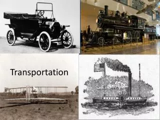
TRANSPORTATION + ITS + REMOTE SENSING. Pitu Mirchandani Professor and Director, ATLAS Research Center Systems and Industrial Engineering Department The University of Arizona, Tucson, Arizona 85721 September, 2002. OVERVIEW OF TALK. Transportation systems with ITS and Remote Sensing.

E N D
TRANSPORTATION+ ITS+ REMOTE SENSING Pitu Mirchandani Professor and Director, ATLAS Research Center Systems and Industrial Engineering Department The University of Arizona, Tucson, Arizona 85721 September, 2002
OVERVIEW OF TALK • Transportation systems with ITS and Remote Sensing • Transportation systems with ITS, especially sensor and communication technologies • Provide a framework to discuss transportation systems • Transportation service systems before ITS We will discuss:
Transport Planning& Network design Transport Planning& Network Design MANUAL SURVEYS& TRAFFIC COUNTS MANUAL SURVEYS& TRAFFIC COUNTS TRANSPORTATION PLANNING TRANSPORTATION PLANNING(before ITS)
OPTIMIZATION/SIMULATION MODELS DOWNLOAD OF TIMING PLANS TRANSPORTATION MANAGEMENT(before ITS)
BEFORE ITS OPTIMIZATION/SIMULATION MODELS Transport Planning& Network design MANUAL SURVEYS& TRAFFIC COUNTS DOWNLOAD OF TIMING PLANS TRANSPORTATION PLANNING TRANSPORTATION MANAGEMENT
AN INCIDENT AT I6TH & CONN.AVE MAP TRAVELER INFORMATION(before ITS)
BEFORE ITS AN INCIDENT AT I6TH & CONN.AVE OPTIMIZATION/SIMULATION MODELS Transport Planning& Network design TRAVELER INFORMATION MANUAL SURVEYS& TRAFFIC COUNTS DOWNLOAD OF TIMING PLANS MAP
Decision System Equipment Processing Data Gathering Sensors Feedback & decisions FRAMEWORK FOR ITS data flow Sensor media Transportation Flows
GPS-BASEDLOCATOR CELLPHONES MANUAL SURVEYS& COUNTS INDUCTIVELOOP DETECTORS SENSORS in TRANSPORTATION • OTHER DETECTORS • VIDEO DETECTORS • SONAR DETECTORS • RADAR DETECTORS • OTHER SENSORS • TRAVEL PROBES • DRIVER INPUTS • ROADSIDE BEACONS
FRAMEWORK FOR ITS Sensors Data flow Transportation Systems Sensor media Feedback & Actions Transportation Flows
Sensors Data flow Transportation Systems Sensor media Transportation Flows FRAMEWORK FOR ITS Wire Telephone line Fiber Wireless (analog) Wireless (digital) Internet Wireless Internet
FRAMEWORK FOR ITS Sensors data flow Transportation Systems Sensor media Feedback &Actions Transportation Flows
FRAMEWORK FOR ITS Sensors data flow Transportation Systems Transportation Networks Sensor media Transportation Flows
TRANSPORTATION PLANNINGWITH ITS PLANNING & SIMULATION TOOLS (E.G., DTA) Transport Planning& Network Design Decisions MANUAL SURVEYS Sensor data
FRAMEWORK FOR ITS Sensors data flow Transportation Systems Transportation Networks Traffic Signals Traffic Adaptive Signals ** Sensor media Transportation Flows
ON-LINE OPTIMIZATION/SIMULATION MODELS AUTOMATIC DOWNLOADING OF PHASE TIMES AUTOMATIC UPLOADING OF SENSOR DATA TRAFFIC MANAGEMENT WITH ITS “RHODES”Adaptive Traffic Control
FRAMEWORK FOR ITS Sensors data flow Transportation Systems Transportation Networks Traffic Signals Traffic Adaptive Signals ** Sensor media Adaptive Ramp Meters * Variable Message Signs * Highway Advisory Radio ** Congestion Information (WWW) * Transit Information (WWW)* Transportation Flows
A COMMUTER CHECKING TRAFFIC CONDITIONS BEFORE LEAVING GPS-BASEDLOCATOR CELLPHONE WWW A TRAFFIC/SYSTEMS ENGINEER MONITORING TRAFFIC CONDITIONS EN-ROUTE WIRELESS INFORMATION Sensor data TRAVELER INFORMATION WITH ITS
FRAMEWORK FOR ITS Sensors data flow Transportation Systems Transportation Networks Traffic Signals Traffic Adaptive Signals ** Adaptive Ramp Meters * Variable Massage Signs * Highway Advisory Radio ** Congestion Information (WWW) * Transit Information (WWW)* Sensor media Signal Preemption/Priority (Buses, EMUs, trains) * Transportation Flows Speed Advisory Signs * In-vehicle Route Guidance Congestion Pricing CVO Fleet Operations/Tracking *
FRAMEWORK FOR ITS + REMOTE SENSING Sensors data flow Transportation Systems Sensor media Feedback &Actions Transportation Flows
Remote Sensor media FRAMEWORK FOR ITS + REMOTE SENSING Remote Sensors data flow Image acquisition Image processing Transportation Systems Pattern recognition Feedback &Actions Transportation Flows
OTHER DETECTORS • VIDEO DETECTORS • SONAR DETECTORS • RADAR DETECTORS GPS-BASEDLOCATOR CELLPHONES REMOTE SENSORS MANUAL SURVEYS& COUNTS MAGNETICLOOP DETECTORS • OTHER SENSORS • TRAVEL PROBES • DRIVER INPUTS • ROADSIDE BEACONS SENSORS in TRANSPORTATION
FRAMEWORK FOR ITS + REMOTE SENSING • Each sensor is not constrained to be located at one point • can move with the “flow” (in security applications the sensor can follow suspicious movements) SO, HOW DOES REMOTE SENSING HELP? • can re-locate sensors where most needed (in case of monitoring congestion points) • Can provide up-to-date traveler information, especially at disruptions and incidents • can provide information on the WWW • can provide information to en-route motorists in • in-vehicle ATIS
FRAMEWORK FOR ITS + REMOTE SENSING SO, HOW DOES REMOTE SENSING HELP? (contd.) • Can get better spatial measures such as turning ratios platoon dispersion, discharge rates, and travel times • better measures for wide-area dynamic traffic management (DTA-ATIS) • even better OD route volumes for transportation planning • Can be deployed and re-deployed when fixed detectors fail • for incident management • for evacuation management during floods and disasters
CHALLENGES • There are three major challenges • Technical -- to integrate these sensors, computers, communication systems, people, infrastructure • Cost: Will the benefits justify the costs? • Acceptance -- by users, by providers, by operators.