Download
1 / 22
220 likes | 513 Views
Geostationary Operational Environmental Satellite (GOES) User’s Conference Current Status of the NOAA GOES Direct Services. Paul Seymour – Broadcast Services Manager Marlin Perkins, Kay Metcalf and Tom Renkevens Santos Rodriguez and Rob Wagner

E N D
Geostationary Operational Environmental Satellite (GOES) User’s Conference Current Status of the NOAA GOES Direct Services Paul Seymour – Broadcast Services Manager Marlin Perkins, Kay Metcalf and Tom Renkevens Santos Rodriguez and Rob Wagner Office of Satellite Data Processing and Distribution November 03, 2009
Purpose of Briefing - Provide the latest status of GOES services • GOES VARiable (GVAR) • Low Rate Information Transmission (LRIT) • Direct Collection Services (DCS) • Emergency Managers Weather Information Network (EMWIN) • Search And Rescue Satellite Aided Tracking (SARSAT) System • http://www.osdpd.noaa.gov/ml/svcs/index.html
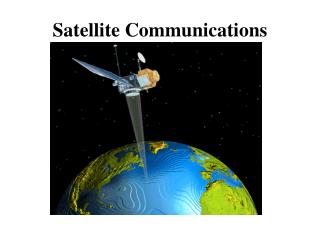
What is GOES VARiable (GVAR) - Overview • GVAR primarily used to transmit Imager/Sounder data from GOES Satellites • Also includes: telemetry, calibration data, text msgs, spacecraft navigation data, and auxiliary products. • GOES I-P (8-15): • 1685.7 MHz • 2.11 Mbps • BPSK Modulation • L-Band • http://www.osdpd.noaa.gov/ml/info/index.html#GOES • http://www.oso.noaa.gov/goes/index.htm
Changes for GOES-14 GVAR Overview • GOES-14 & GOES-P Imagers have an 8th IR detector • Starting with GOES-14, all IR channels at 4km resolution at nadir • Imager factory coefficients were replicated to Block 11 beginning with GOES-12 (GVAR Version 2) • GVAR format was modified to accommodate the additional detector data – added to Block 0 while removing imager factory coefficients (GVAR Version 3) • However, plan is to replicate Instrument Nadir and Detector Offsets to currently unused space at the end of Block 0 in addition to the Block 11 position • White Paper “Copying the Instrument Nadir and Detector Offsets from Block 11 to Block 0 for GOES O and Beyond” published at conference http://www.osd.noaa.gov/gvar/gvardownload.htm
Changes to GVARSummary • GOES- 8 through 11: • Instrument Factory Coefficients in Block 0 (GVAR Version 1) • GOES- 12 and 13: • Instrument Factory Coefficients both in Block 0 and Block 11 (GVAR Version 2) • GOES-14 and 15 (GVAR Version 3): • The data for the 8th detector have been added to block 0 • Instrument Factory Coefficients are located in Block 11 • Instrument Nadir and Detector Offsets located in Block 11 but will also be located in Block 0 • Detector Offsets to be located in block 0, words 7933 to 8028 • Instrument Nadir to be located in block 0, words 8033 to 8038 • Requirement: have guaranteed delivery of Detector Offsets + Instrument Nadir in the start of a frame to ensure proper INR operations in the RPM system. • Published at: http://www.osd.noaa.gov/gvar/gvardownload.htm
GVAR Web Links • NOAA/NESDIS/OSDPD: • http://www.osdpd.noaa.gov/ml/info/index.html#GOES • NOAA/NESDIS/OSO: • http://www.oso.noaa.gov/goes/index.htm • NOAA/NESDIS/OSO/GVAR Download Site • http://www.osd.noaa.gov/gvar/gvardownload.htm • GOES I/M (8-12) Databook: • http://rsd.gsfc.nasa.gov/goes/text/goes.databook.html • GOES N/O/P (13-15) Databook: • http://goes.gsfc.nasa.gov/text/GOES-N_Databook_RevC/Databook_RevC.pdf
What is GOES Data Collection Service (DCS) - Overview • GOES data service for collection of environmental data in real-time from > 30,000 remote data collection platforms located across the GOES Footprint • GOES 11-14 • Uplink at 401.7-402.1 MHz at 100/300/1200 BPS • Downlink at 1694.5 MHz • Frequency Share/Time Share System • Approximately 200 Channels • Normal transmissions hourly for 5 to 10 seconds • Data available from NOAA or through direct broadcast • GOES Direct Broadcast (large antenna, by channel) • DOMSAT (commercial satellite, small antenna, one stream) • Internet connection • LRIT
What is GOES Data Collection Service (DCS) - Overview • Critical infrastructure for real-time data collection • Many Emergency warning systems in the U.S. and other countries rely on GOES DCS • Examples of GOES DCS User Community: • National Weather Service/National Ocean Service • USGS • U.S. Forest Service • International Hydrometeorological Offices • Examples of Applications of DCS Data • Tsunamis and other sea level information • Floods, earthquakes, volcanoes • Fire (fuel temperatures, wind directions and speed) • Meteorological observations
GOES DCS Current System Improvements New ground system (DADDS) in operation New transmitters to cut channels in half, double capacity coming soon Finishing conversion to faster transmitters, eliminating slower (100 bps) transmitters Future implementation of available 2-way communication capability Allowing more frequent observations (1 hour instead of 3 or 4 hour repeat cycle) http://www.noaasis.noaa.gov/DCS/ 3/12/2014 9
What is Search And Rescue Satellite Aided Tracking (SARSAT) System - Overview 3/12/2014 10
Footprints of GOES 11 and GOES 12 satelliteswith Local User Terminal Locations http://www.sarsat.noaa.gov/ 3/12/2014 11
What is Low Rate Information Transmission (LRIT) - Overview Delivery of Imagery Products to Comparably Low Cost Receive Systems Products include: GOES images: Visible, Infrared and Water Vapor Environ. Products including tropical storms Graphic images of MTSAT/MSG in JPEG, Copy of DCS and EMWIN Stream, Administrative Text Msgs GOES 11-14 at 128 Kbps / 1691.0 KHz / BPSK Ground systems $10K and up Receive antenna - Approximately 1 Meter 3/12/2014 12
Upgrades to Low Rate Information Transmission (LRIT) Advances in LRIT system / Reliability increased New DCS delivery application fm LRGS’s at Wallops Island New Imagery Processing Hardware New Domain 4 communications module hardware and updated application Redundant system in place by Dec 09 CDA Wallops Island http://www.noaasis.noaa.gov/LRIT http://www.osdpd.noaa.gov 3/12/2014 13
What is Emergency Managers Weather Information Network (EMWIN) - Overview EMWIN is a reliable, low cost, weather warning and data broadcast system providing free and rapid dissemination of warnings, forecasts, graphics and imagery in the Americas, the Caribbean and Pacific Rim that has been in operation for over 14 years The Goal - to inform emergency managers and the public as quickly as possible of pending weather threats, increasing the likelihood of sparing lives and property EMWIN is a National Weather Service Network disseminated via GOES and the Internet 3/12/2014 14
What is Emergency Managers Weather Information Network (EMWIN) - Overview Ground systems $1800 to $2500 Receive antenna – approx. 1 meter GOES 11-12 at 9.6 Kbps / 1690.725 MHz / DFSK GOES 13-14 at 19.2 Kbps / 1692.725 MHz / OQPSK Data rate doubles Forward error correction (FEC) Enhanced data stream More information is available on the EMWIN website at http://www.weather.gov/emwin/index.htm 3/12/2014 15
HRIT/EMWIN Demonstration Reminder: Please come to the HRIT/EMWIN Demonstration during the poster session 3/12/2014 16
Questions and Comments Northern Hemisphere Composite Sector (IR Ch 4)Brought to you by the National Oceanic and Atmospheric Administration (NOAA)
Direct Services Contact Information • Kay Metcalf • GOES DCS Program Manager • kay.metcalf@noaa.gov • 301-817-4558 • Paul Seymour • Broadcast Services Program Manager • Paul.Seymour@noaa.gov • 301-817-4521 • Marlin O. Perkins • Direct Readout Program Manager • Marlin.O.Perkins@noaa.gov • 301-817-4523 • William Johnson • EMWIN Program Manager • William.Johnson@noaa.gov • 301-713-0864 x133 • Chris O’Connors - SARSAT Program Manager • Christopher.O’Connors@noaa.gov • 301-817-3846