Download
1 / 26
260 likes | 408 Views
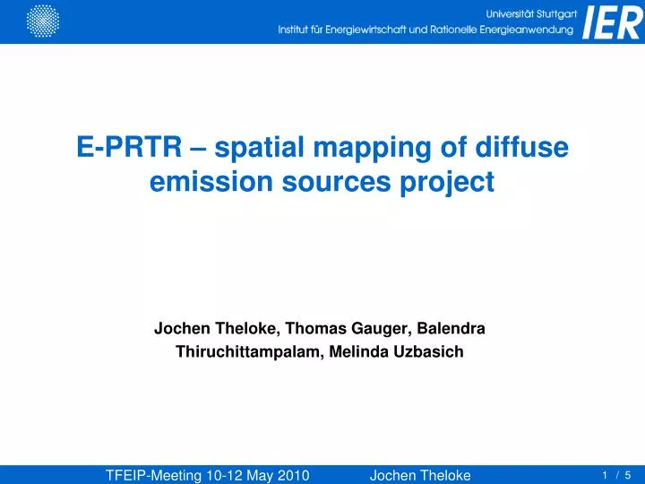
E-PRTR – spatial mapping of diffuse emission sources project. Jochen Theloke, Thomas Gauger, Balendra Thiruchittampalam, Melinda Uzbasich. Legal basis: article 8 of E-PRTR Regulation. Article 8 Releases from diffuse sources

E N D
E-PRTR – spatial mapping of diffuse emission sources project Jochen Theloke, Thomas Gauger, Balendra Thiruchittampalam, Melinda Uzbasich / 5
Legal basis: article 8 of E-PRTR Regulation • Article 8 • Releases from diffuse sources • The COM, assisted by the EEA, shall include in E-PRTR information on releases from diffuse sources where such information exists and has already been reported by MS. • 2. The information referred to in par. 1 shall be organised such as to allow users to search for and identify releases of pollutants from diffuse sources according to an adequate geographical disaggregation and shall include information on the type of methodology used to derive the information. • 3. Where COM determines that no data on the releases from diffuse sources exist, it shall take measures to initiate reporting on releases of relevant pollutants from one or more diffuse sources in accordance with the procedure referred to in Article 19(2), using internationally approved methodologies where appropriate.
Previous studies • 2006 • DG ENV Study: Pilot inventory of releases from diffuse sources (air + water) • http://www.bipro.de/__prtr/sub/purpose_scope.htm • 2007 • EEA Feasibility Study on releases from diffuse sources in E-PRTR • Water releases • Air releases • ~ 2009 • DG JRC EDGAR project (v4.0) • http://edgar.jrc.ec.europa.eu/ • Dataset with a detailed overview of air emissions from 1970-2005, global scope • Methodological findings useful for E-PRTR
EEA’s Study: some ideas taken into account • Main challenges • Source definition: need to link Annex I of E-PRTR Regulation with the categorizations of the available Datasets (NFR) • Inconsistencies between E-PRTR and national inventories: sometimes emission reported in EPER exceeds the emissions as reported in national inventories significantly for a number of Member States • Resources: sometimes data are not fully available or the cost of gathering these data is high (specially in the case of proxy data) • Methodology: further work needed to compile a fully operational methodology
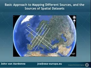
Contract on diffuse emissions 2010 Contract on Diffuse Emissions to air on the basis of already reported information under various reporting obligations • Steering committee JRC (IES), EEA and DG ENV • Link point sources data and national totals (e. g. CLRTAP) • Improvement by EDGAR proxies • EMEP layers for key air pollutants re-projected and adapted to E-PRTR map tools (50km X 50km) • Develop a methodology to grid emissions per sector (Transport, Domestic heating, Agriculture,..)
Aim of the project • Gathering of available data on diffuse releases to air for • NOx, SO2, PM10, CO and CO2 emissions released by • Transport (on-road, shipping, domestic aviation) • Stationary combustion sources, which are not covered by Annex 1 • Industrial releases from activities which are not covered by the E-PRTR regulation (Annex 1 and 2) • NH3, PM10 emission from agriculture activities • Underlying proxy data to be used for gridding diffuse emissions for each pollutant and each sector • Methodology development for gridding emission data • Derive gridded emission map layers covering EU27 + EFTA for selected sectors and pollutants with as a minimum a 5x5 km
Tasks • Methodology development • Methodology to incorporate EMEP grids for integration into the E-PRTR website • Methodology for disaggregating the National totals to EDGAR level of resolution • Methodology for gridding the industrial releases not covered by E-PRTR => Development of a subtraction methodology • Development of a methodology for disaggregating national total emissions to a higher resolution of at least 5x5 km. • Data Gathering • Emissions (NOx, SO2, PM10, NH3, CO, CO2) • Proxy data compilation
Tasks 3) Data processing and gridding • Creating a comprehensive set of databases to store original data (spatial and non-spatial), incl. meta data description, intermediate derived data and final data sets • Compiling of gridded emission maps with metadata based on INSPIRE-compliant templates 4) Public Accessibility of the outcomes of the project • Make public of emission maps compiled in task through the E-PRTR web-interface (not in ToR of this project) • Dissemination document • Preparing of short text for each layer
Remaining NOX diffuse emissions in relation to the national total of sectors with point sources
Methodology of the spatial distribution Source: Wickert 2001
Distribution parameters for Germany Line sources Area sources Point sources 18
Methodology of the spatial distribution • Visualisation of line sources Streets Railways Rivers
Methodology of the spatial distribution • Visualisation of polygon sources
Member state Involvement • Questionnaire to the Member states • Overview about existing proxies on national level • Overview about existing spatial data sets on national level • Taking into account addtional info from the MS • Response from 13 (of 31) Countries => Deadline 30 april 2010 • Workshop with the Member states (5 October) • Presentation of the methodology


![[CII] mapping of the diffuse ISM with SPICA / SAFARI](https://cdn1.slideserve.com/3129875/slide1-dt.jpg)