Download
1 / 4
40 likes | 204 Views
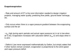
Gapfilling of SLC-off LS7 after Retrieval of Evapotranspiration. Rick Allen, Univ. Idaho Oct 2009 Landsat Science Team mtg., Boston. Gapfilling of Evapotranspiration, expressed as relative ET (ET r F) after processing for ET. The Natural Neighbor tool of ARC-View was used to fill the gaps.

E N D
Gapfilling of SLC-off LS7 after Retrieval of Evapotranspiration Rick Allen, Univ. Idaho Oct 2009 Landsat Science Team mtg., Boston
Gapfilling of Evapotranspiration, expressed as relative ET (ETrF) after processing for ET. The Natural Neighbor tool of ARC-View was used to fill the gaps. Conclusion: When gap size is less than about 20% (~200 m), filling accuracy is good, especially when gap is interior to a field. ETrF on 8/31/06 path 40 row 30, Landsat 7 SLC-off (NE of Twin Falls, Idaho) before (left) and after (right) filling of SLC-gaps in Landsat 7, for an area about 1/3 in from the image edge. Dark green represents high ET and tan represents low ET. The aqua color in the image center is a regulating reservoir.
Gapfilling of Evapotranspiration, expressed as relative ET (ETrF) after processing for ET. The Natural Neighbor tool of ARC-View was used to fill the gaps. Conclusion: When gap size is 30-40% (~300-400 m), filling accuracy deteriorates, especially when gap covers parts of multiple fields. Product may still be useful for ET quantification. ETrF on 8/31/06 path 40 row 30, Landsat 7 SLC-off (NE of Twin Falls, Idaho) before (left) and after (right) filling of SLC-gaps in Landsat 7, for an area at the image edge. Dark green represents high ET and tan represents low ET. The aqua color in the image center is a regulating reservoir.
Previous work entailed 2004-05 work by Univ. Idaho with Susan Maxwell of EROS to test the use of an agricultural field polygon layer to direct the sampling of Ts (and other) data. Polygons were buffered 30, 60 and 90 m to insure sampling of 60 m band 6 from field interiors. Accuracy was best for large fields where source Ts pixels remained after the buffering. Overall, error in final ET derived from the completed image was as large as when ET values were randomly generated for the gaps using a mean and standard deviation of ET from the nongapped portions of the subimages. Therefore, polygon based approach was abandoned. Natural neighbor approach is now used. No error analysis has yet been completed.