Download
1 / 35
350 likes | 494 Views
EnviroGrids : Sustainable Development of the Black Sea Catchment. Nicolas Ray, Gregory Giuliani , Anthony Lehmann University of Geneva / Climate Change and Climatic impacts / enviroSPACE group and United Nations Environment Programme / DEWA / GRID-Europe &

E N D
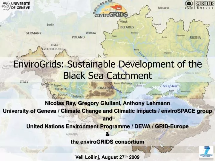
EnviroGrids: Sustainable Development of the Black Sea Catchment Nicolas Ray, Gregory Giuliani, Anthony Lehmann University of Geneva / Climate Change and Climatic impacts / enviroSPACE group and United Nations Environment Programme / DEWA / GRID-Europe & the enviroGRIDS consortium Veli Lošinj, August 27th 2009
WhatisenviroGRIDS about? …exploring the past, present and future (hydrology) of the Black Seacatchment
Role of human activities IPCC 2007 Observations Natural forcings 1.0 Natural + anthropogenic forcings DT with respect to 1961-1990 [°C] 0.5 0.0 2000 1950 1900
Scenarios of climate change 6.0 IPCC, 2007 A2 5.0 4.0 3.0 DT respect to 20th century means [°C] B2 2.0 1.0 0.8 0.6 0.4 0.2 0 -0.2 -0.4 1000 1100 1200 1300 1400 1500 1600 1700 1800 1900 2000 2050 2100
Changes in heatwave days Mean 90% quantile (june-july-august) (Differences between 2071-2100 and 1961-1990)(HIRHAM RCM, A2 Scenario) Beniston, 2004: Geophysical Research Letters +2 +4 +6 +8 +10 +12°C
Changes in summer precipitation (june-july-august) (Differences in % between 2071-2100 and 1961-1990) (A-2 Scenario) Events greater than 50 mm/day Seasonal precipitation Christensen and Christensen, Nature, 2003 % change -40 -30 -20 -10 0 +10 +20 +30 +40
The enviroGRIDS project – facts Founded by the European Commission FP7 framework (Theme 6:environment) April 2009 – March 2013 Total budget of €8.1 mio. (€6.2 EC contribution) and 1367 man-months 27 partners, coordinated by University of Geneva
gap analysis developing a grid-enabled Spatial Data Infrastructure (SDI) spatially explicit regional scenarios of development modeling of large scale, high resolution distributed hydrologic processes develop access to real time data from sensors and satellites develop early warning and decision support tools at regional, national and local levels Build capacities in the implementation of many new standards and frameworks Generic technical objectives • gap analysis • developing a grid-enabled Spatial Data Infrastructure (SDI) • spatially explicit regional scenarios of development • modeling of large scale, high resolution distributed hydrologic processes • develop access to real time data from sensors and satellites • develop early warning and decision support tools at regional, national and local levels • Build capacities in the implementation of many new standards and frameworks
What is a Spatial Data Infrastructure? • SDI provides a basis for spatial data discovery, evaluation, and application. • Includes the following elements: - Geographic data, - Metadata, - Services, - Clearinghouse, - Standards, - Partnerships.
Challenges when sharing data • Many “islands” of data of different formats and quality. • Finding existing geospatial data is difficult. • Spatial data from different sources cannot be integrated due to: - Incompatible information models & encodings. - Non-interoperable information systems. - No harmonization between datasets at different geographical scales.
Challenges when sharing data • Re-use of spatial data is actually hard to achieve: - Complex data integration procedures. - Costly reproduction and redundancy. • Data policy restrictions: - Unclear access rights and licensing policies. - Missing pricing models. SDIs are about facing the challenges and connecting heterogeneous data sources.
Hydrologic Balance Evaporation and Transpiration Precipitation Surface Runoff Root Zone Infiltration/plant uptake/ Soil moisture redistribution Lateral Flow Vadose (unsaturated) Zone Revap from shallow aquifer Percolation to shallow aquifer Shallow (unconfined) Aquifer Return Flow Confining Layer Flow out of watershed Deep (confined) Aquifer Recharge to deep aquifer
Lake Balaton catchment Models
We plan to: gridify SWAT to run on the EGEE infrastructure as a geoprocessing service to be called from various clients such as SWAT users or web clients. Use ganga to easily switch among computational resources Gridification of SWAT easy-to-use frontend for job definition and management, implemented in Python
Gridification of SWAT-CUP Program for sensitivity analysis, calibration, validation, and uncertainty analysis of a SWAT model
Grid-enabled SDI • SWAT input data sets may: • be stored on a local SDI • stored and replicated in a distributed filesystem on the grid • called through web services at run time • SWAT output data sets may be stored on the grid for future use
The grid-enabled SDI, will push for standardization among all countries within the Black Sea catchment A strong objective of EnviroGRIDS is to build capacities in the implementation of many new standards and framework Pushing for standardization
Pushing for standardization INSPIRE Infrastructure for Spatial Information in the European Community a European Commission initiative to build a European spatial data infrastructure beyond national boundaries.
GEOSS www.earthobservations.org
Ensuring long term access to data EnviroGrids VO? Starting to build our pool of resources: • At partners sites • Using forthcoming desktop grid at university of Geneva 1500+ PCs Alternatives: -joining existing VO (e.g. ES VO, biomed VO)
IBM World Community Grid (volunteer computing) A good way of having the public of the region participating Challenge Needs to find the good application (jobs needing small amount of input/output data) Involvement of the public
Talking about Landsat (satellite) data: “In spite of the great need for that information, the vast majority of those images have never fired a single neuron in a single human brain. Instead, they are stored in electronic silos of data.” The Digital Earth (Al Gore, 1998)