Download
1 / 1
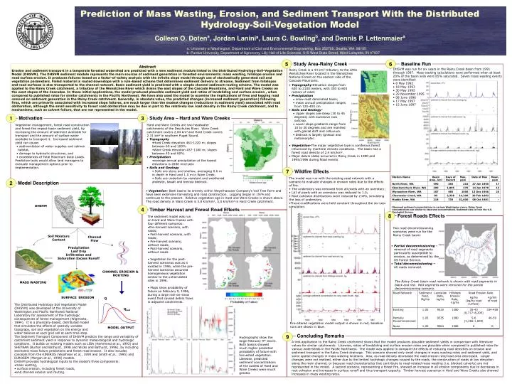
10 likes | 123 Views
Q. Q sed. Prediction of Mass Wasting, Erosion, and Sediment Transport With the Distributed Hydrology-Soil-Vegetation Model Colleen O. Doten a , Jordan Lanini a , Laura C. Bowling b , and Dennis P. Lettenmaier a

E N D
Q Qsed Prediction of Mass Wasting, Erosion, and Sediment Transport With the Distributed Hydrology-Soil-Vegetation Model Colleen O. Dotena, Jordan Laninia, Laura C. Bowlingb, and Dennis P. Lettenmaiera a. University of Washington, Department of Civil and Environmental Engineering, Box 352700, Seattle, WA 98195 b. Purdue University, Department of Agronomy, Lilly Hall of Life Sciences, 915 West State Street, West Lafayette, IN 47907 5 6 Study Area-Rainy Creek Baseline Run Abstract Erosion and sediment transport in a temperate forested watershed are predicted with a new sediment module linked to the Distributed Hydrology-Soil-Vegetation Model (DHSVM). The DHSVM sediment module represents the main sources of sediment generation in forested environments: mass wasting, hillslope erosion and road surface erosion. It produces failures based on a factor-of-safety analysis with the infinite slope model through use of stochastically generated soil and vegetation parameters. Failed material is routed downslope with a rule-based scheme that determines sediment delivery to streams. Sediment from hillslopes and road surfaces is also transported to the channel network. Basin sediment yield is predicted with a simple channel sediment routing scheme. The model was applied to the Rainy Creek catchment, a tributary of the Wenatchee River which drains the east slopes of the Cascade Mountains, and Hard and Ware Creeks on the west slopes of the Cascades. In these initial applications, the model produced plausible sediment yield and ratios of landsliding and surface erosion , when compared to published rates for similar catchments in the Pacific Northwest. We have also used the model to examine the implications of fires and logging road removal on sediment generation in the Rainy Creek catchment. Generally, in absolute value, the predicted changes (increased sediment generation) following fires, which are primarily associated with increased slope failures, are much larger than the modest changes (reductions in sediment yield) associated with road obliteration, although the small sensitivity to forest road obliteration may be due in part to the relatively low road density in the Rainy Creek catchment, and to mechanisms, such as culvert failure, that are not represented in the model. DHSVM was run for six years in the Rainy Creek basin from 1991 through 1997. Mass wasting calculations were performed when at least 20% of the basin soils were 85% saturated. Seven mass wasting events were identified: Rainy Creek is a 44 km2 tributary to the Little Wenatchee River located in the Wenatchee National Forest on the eastern side of the Cascade Mountains. • 8 May 1992 • 18 May 1993 • 30 May 1995 • 29 November 1995 • 08 June 1996 • 17 May 1997 • 15 June 1997 • Topography-Elevation ranges from 630 to 2100 meters, with 300 to 600 meters of relief. • Precipitation • snow-melt dominated basin; • mean annual precipitation ranges from 125-400 cm • Soils and Geology- • Upper slopes are steep (30 to 45 degrees) with excessive rock outcrop. • Lower slope gradients range from 10 to 30 degrees and are mantled with glacial drift and colluvium. • bedrock is largely igneous and metamorphic. 1 3 Motivation Study Area – Hard and Ware Creeks • Vegetation management, forest road construction and forest fire impact basin sediment yield, by increasing the amount of sediment available for transport and the amount of surface water available to transport it. Increased sediment yield can cause: • sedimentation of water supplies and salmon habitat, • damage to hydraulic structures, and • exceedances of Total Maximum Daily Loads. • Predictive tools would allow land managers to evaluate management options prior to implementation. • Hard and Ware Creeks are two headwater catchments of the Deschutes River. Ware Creek catchment covers 2.84 km2 and Hard Creek covers 2.31 km2 in southern Puget Sound. • Topography • Hard Creek elevation 463-1220 m; slopes between 60 and 100%. • Ware Creek elevation 457-1180 m; slopes between 40 and 60%. • Precipitation • average annual precipitation at the lowest elevations is 2600 mm/year. • Soils and Geology • Soils are stony and shallow, averaging 0.6 m in depth in Hard and 1.0 m in Ware Creek. • Soils are underlain by resistant and weathered andesite, basalt and breccia bedrock. • Vegetation-The major vegetative type is coniferous forest influenced by maritime climatic conditions. The basin has a forest road density of 2.4 km/km2. • Major debris slides occurred in Rainy Creek in 1990 and 1995/1996 during flood events 7 Wildfire Effects • The model was run with the existing road network with a scenario to evaluate changes in erosion rates due to the effects of fire. • The understory was removed from all pixels with an overstory; • LAI of pixels with an overstory was reduced to 1.0; • Root cohesion distributions were reduced by 2 kPa, simulating the loss of understory. • These modifications were held constant throughout the six-year simulation. 2 Model Description • Vegetation- Both basins lie entirely within Weyerhaeuser Company’s Vail Tree Farm and have seen extensive harvesting and road construction. Logging began in 1974 and continues to the present. Relative vegetation age in Hard and Ware Creeks is shown above. The road density in Ware Creek is 3.8 km/km2, 5.0 km/km2 in Hard Creek catchment. DHSVM 4 Observed sediment concentrations in various Washington rivers. Rainy Creek concentrations are similar to observed concentrations. Sediment data is from the U.S. Geological Survey. Timber Harvest and Forest Road Effects 8 Forest Roads Effects • The sediment model was run on Hard and Ware Creeks with four different scenarios: • Pre-harvest scenario, with roads; • Post-harvest scenario, with roads; • Pre-harvest scenario, without roads; • Post-harvest scenario, without roads. • Vegetation for the post-harvest scenarios was as it existed in 1996, while the pre-harvest scenarios assumed homogeneous vegetation similar to the unharvested sites in 1996. • Maps show probability of failure on February 9, 1996, during a large rain-on-snow event that caused debris flows in adjacent catchments. Two road decommissioning scenarios were run for the Rainy Creek basin: Soil Moisture Content Channel Flow • Partial decommissioning - removal of road segments particularly susceptible to erosion, as determined by the US Forest Service. • Total decommissioning –All roads removed. Precipitation Leaf Drip Infiltration and Saturation Excess Runoff CHANNEL EROSION & ROUTING The Rainy Creek basin road network is shown with road segments in black and red. Red segments were removed for the partial decommissioning scenario. MASS WASTING SURFACE EROSION The Distributed Hydrology Soil Vegetation Model (DHSVM) was developed at the University of Washington and Pacific Northwest National Laboratory for assessment of the hydrologic consequences of forest management (Wigmosta, 1994). It is a physically-based, distributed model that simulates the effects of spatially variable topograpy, soil and vegetation on the energy and water balance at each grid cell at each time step. Fire-altered vegetation model output is shown in red; baseline runs are shown in blue. MODEL OUTPUT 9 Concluding Remarks • The Sediment Transport Component of DHSVM predicts the range and variability of catchment sediment yield in response to dynamic meteorological and hydrologic conditions. It builds on existing models such as LISA (Hammond et al., 1992) and SHETRAN (Burton and Bathurst, 1998 and Wicks and Bathurst, 1996), by including stochastic mass failure predictions and forest road erosion. It also includes concepts from the KINEROS (Woolhiser et al., 1990 and Smith et al., 1995) and EUROSEM (Morgan et al., 1998) models. • DHSVM provides hydrological inputs to the model’s three components: • mass wasting, • surface erosion, including forest roads, • and channel erosion and routing. Hydrographs show the large February 9th storm. Both basins showed much higher predicted probability of failure with harvested vegetation. Likewise, predicted sediment concentrations at the outlets of Hard and Ware Creeks were much greater. A test application to the Rainy Creek catchment shows that the model produces plausible sediment yields in comparison with literature values for similar catchments. Likewise, ratios of landsliding and surface erosion rates are plausible when compared to published rates for various watersheds in the Pacific Northwest. The model was applied to compare the effects of reducing road densities on erosion and sediment transport in the Rainy Creek drainage. This scenario showed only small changes in mass wasting rates and sediment yield, and some spatial changes in mass wasting locations. Also, as road density decreased the road erosion rate/road area decreased. Larger changes were not realized, either due to the limited hydrologic changes caused by the roads, the construction of roads at low elevation along the main channel, or because road characteristics that contribute to road-related mass wasting (i.e. blocked culverts) are not represented in the model. A second scenario, representing a forest fire, showed an increase in all erosion components due to decreases in root cohesion and increases in surface runoff and thus transport capacity. Timber harvest scenarios in Hard and Ware Creeks also showed increases in mass wasting rates.