1 / 2

Fikspunkter og geogis

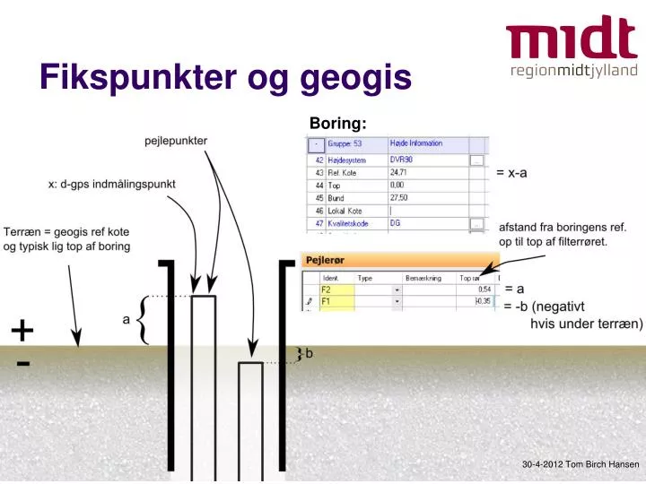
Fikspunkter og geogis. Boring:. 30-4-2012 Tom Birch Hansen. Fikspunkter og geogis. top af boring er lig terræn top af rør angives som: afstanden fra borings-top (dvs. terræn) til top af rør. pejlepunkter er: top af rør

Download Presentation

Fikspunkter og geogis

An Image/Link below is provided (as is) to download presentation Download Policy: Content on the Website is provided to you AS IS for your information and personal use and may not be sold / licensed / shared on other websites without getting consent from its author. Content is provided to you AS IS for your information and personal use only. Download presentation by click this link. While downloading, if for some reason you are not able to download a presentation, the publisher may have deleted the file from their server. During download, if you can't get a presentation, the file might be deleted by the publisher.

E N D

Presentation Transcript


  1. Fikspunkter og geogis Boring: 30-4-2012 Tom Birch Hansen

  2. Fikspunkter og geogis • top af boring er lig terræn • top af rør angives som: • afstanden fra borings-top (dvs. terræn) til top af rør. • pejlepunkter er: top af rør • pejlepunktskoter kan undlades i geogis, da top automatisk benyttes ved udregning af vandspejlskoter. 30-4-2012 Tom Birch Hansen

More Related