Download
1 / 40
400 likes | 574 Views
Oregon Department of Aviation (ODA). Chris Cummings Aviation Planner. April 18, 2008. “ SUPPORTING OUR COMMUNITIES BY PRESERVING AND ENHANCING AVIATION”. Oregon Department of Aviation (ODA).

E N D
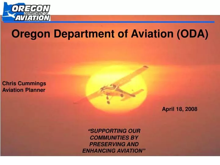
Oregon Department of Aviation (ODA) Chris Cummings Aviation Planner April 18, 2008 “SUPPORTING OUR COMMUNITIES BY PRESERVING AND ENHANCING AVIATION”
Oregon Department of Aviation (ODA) • Serves the state of Oregon through a three-fold focus of advocating for the growth, improvement and safe operation of aviation in Oregon. • Committed to the development and realization of its strategic plan by: • addressing statewide aviation issues, • participating in multi-modal coordination, • carefully coordinating and managing aviation-related legislation, • providing assistance to aviation constituents, airport owners/sponsors and aviation system users throughout Oregon.
Joseph State Airport • 99 Public Use Airports in Oregon • 28 are State Sponsored • 357 Private Use Airports • 8 Air Carrier Airports Oregon’s System of Airports • 8800 Registered Aircraft • 9000 Pilots McKenzie Bridge State Airport
Airport Value • Important Uses include: • Community access • Emergency Services • Fire suppression (U.S Forest Service, BLM, ODF) • Medical Evacuation (Medevac and Air Ambulance) • Forced/precautionary landing strip • Oregon Emergency Management Search & Rescue • Staging area for Disaster Relief (FEMA) • Law Enforcement (OSP, DHS, TSA, FBI, etc.) • Recreation • Tourism • Business (air freight, air taxi, etc.) • Agriculture • Government agencies (USGS, USDA, ODFW, etc.)
Tall Tower Evaluation Program • Airport Licensure and Registration • Aircraft Operations Counting Program • Oregon Pilot & Aircraft Registration • Aviation Safety Program • Conduct FAA mandated airport Inspections • Technical Assistance • Airport Compatibility/Land Use Planning ODA Duties & Roles
System Planning • 2007 Aviation System Plan • Modal element of Oregon Transportation Plan • Role of each airport in Oregon’s system • Economic Impact Analysis of each airport and entire system • Individual Airport Reports • http://www.oregon.gov/Aviation/docs/system_plan/2007_oregon_system_plan_details.shtml
Economic Contribution of Aviation Industry to the Oregon Economy # of Jobs Wages Business Sales Grand Total Airport and Aviation Activity 197,040 $6,754,986,000 $24,371,049,000 2007 Oregon Aviation Plan (System Plan) http://www.oregon.gov/Aviation/docs/system_plan/2007_oregon_system_plan_details.shtml
Easements and Agreements • ODA recommends that planning jurisdictions require that new construction within airport impact boundaries file the following in favor of the airport sponsor. • Avigation easements • Hold harmless agreements • Noise impact acknowledgements • Impact areas include airport approach zones and transitional surfaces. • ODA will not sign easements or agreements. • Not required as part of airport planning rule.
Easements and Agreements Continued • Easements/Noise/Hold Harmless should include: • Agreement to not allow structures and natural growth to exceed airport imaginary surfaces. • Agreement to remove objects of natural growth that become an aviation obstruction or to allow airport sponsor to enter property to remove at airport cost. • Agreement not to file suit against airport sponsor for noise, property damage, or personal injury.
Airport Planning Rule The Airport Planning Rule was established under ORS 836 & OAR 660-013 as a means of protecting the future use and growth of Oregon’s airports. This was accomplished through the establishment of rules mandated upon local jurisdictions to provide for the protection of airport imaginary surfaces, aviation related uses, airport growth, and incompatible land uses. The Rule established 5 separate airport categories with category specific protections: Publicly - owned / Public use / 3+ aircraft – Exhibit 1 Privately - owned / Public use - meet specific criteria >trans links/safety/economic - Exhibit 1 Privately - owned / Private use - 3+ aircraft – Exhibit 2 Publicly - owned / Public use - less than 3 aircraft – Exhibit 3 Privately - owned / Public use – Did not meet criteria for >trans links/safety/economic – Exhibit 2 Non Protected Privately - owned / Private use – less than 3 aircraft - Airports not specifically listed in numbers 1 through 5 above are not offered any protections.
Publicly-Owned, Public Use Airports with 3 or more based a/c as of 12/31/94 Privately Owned, Public Use Airports That Meet 3 Criteria: > Provide Links in Air Traffic in the State, > Provide Essential Safety or Emergency Services, > Are of Economic Importance to the County. Exhibit 1
(Public/Public w/ 3+) Exhibit 1
(Public/Private-Public that meet 3 criteria) • OAR 660-013-0040 • Aviation Facility Planning Requirements • Airport Layout Plan • Includes existing & planned facilities • Noise impact boundaries • Compatible land use • OAR 660-013-0070 • Local Gov’t Safety Overlay Zones for Imaginary Surfaces
OAR 660-013-0070 Public Use Airport Overlay Zone (Public/Private-Public that meet 3 criteria) (FAA – Part 77 Surfaces) List location or contact for specification (or other related documents) here
(Public/Private-Public that meet 3 criteria) OAR 660-013-0070 (Dimensions)Public Use Airport Overlay Zone
(Public/Private-Public that meet 3 criteria) • OAR 660-013-0080 • Local Gov’t Land Use Compatibility Requirements for Public Use Airports • Prohibit new residential development and public assembly within Runway Protection Zone (RPZ).
(Public/Private-Public that meet 3 criteria) OAR 660-013-0080 Runway Protection Zone
(Public/Private-Public that meet 3 criteria) • OAR 660-013-0080 • Local Gov’t Land Use Compatibility Requirements for Public Use Airports • Limit the establishment of uses identified within a noise impact boundary, consistent with identified levels.
(Public/Private-Public that meet 3 criteria) OAR 660-13-0080 Noise Compatibility
(Public/Private-Public that meet 3 criteria) • OAR 660-013-0080 • Local Gov’t Land Use Compatibility Requirements for Public Use Airports • Regulates industrial smoke, dust, etc. • Regulates outdoor lighting • Regulates radio/television facilities & electrical transmission lines • Regulates water impoundments • Regulates new landfill establishment
(Public/Private-Public that meet 3 criteria) • OAR 660-013-0100 - Airport Uses Allowed at Non-Towered Airports • Customary Aviation Related Activities, i.e., takeoffs, landings, aircraft hangars, FBO’s, etc., and aviation activities incidental to normal airport operations. • Emergency Medical Flight Services • Law Enforcement and Firefighting Activities • Flight Instruction and related facilities • Aircraft Service, Maintenance and Training, but not including facilities for manufacture of aircraft or related products for sale to the public. • Aircraft Rental and Sales. • Aeronautic Recreational Activities including fly-ins, glider flights, ballooning, etc.; with certain limitations and subject to approval of airport sponsor. • Crop Dusting, Agricultural and Forestry Activities • Air Passenger and Air Freight services and facilities at public use airports.
(Public/Private-Public that meet 3 criteria) • OAR 660-013-0110 • Other Uses Within Airport Boundary • A Local Government may authorize commercial, industrial, manufacturing and other uses in addition to those listed in 0100 within the airport boundary where such uses are consistent with applicable provisions of the acknowledged comprehensive plan, statewide planning goals and LCDC administrative rules and where the uses do not create a safety hazard or otherwise limit approved airport uses.
Airport Planning Rule Application Publicly-owned / Public use / 3+ aircraft Privately-owned / Public use - meet specific criteria >trans links/safety/economic Exhibit 1 • Height Restrictions • RPZ Protections • Light/Water/Glare/Bird Strike Restrictions • Compatible development within certain noise contours • Outright allowance of aviation uses
Privately-Owned / Private Use Airports with 3 or more based a/c as of 12/31/94 Exhibit 2 Privately owned / Public use – Did not meet criteria for >trans links/safety/economic
(Private/Private-Public that did not meet 3 criteria) • OAR 660-013-0070 Local Gov’t Safety Overlay Zones for Imaginary Surfaces
(Private/Private-Public that did not meet 3 criteria) • OAR 660-013-0155 • Planning Requirements for Small Airports • Recognize Airport Location in Planning Documents • Not Impose Limitations on 660-13-0100 Uses that existed during 1996 or that was approved by local govt prior to 1/1/1997. • Allow New 660-013-0100 uses subject to criteria. • Adopt Rules regulating height of structures to protect approach corridors.
Airport Planning Rule Application Privately-owned / Private use - 3+ aircraft Privately owned / Public use – Did not meet criteria for >trans links/safety/economic Exhibit 2 • Height Restrictions • Continued allowance of Landings/Take-offs/Tie-downs and Hangar construction. • Protection for uses that existed in 1996 • Allowance for new aviation uses
Publicly-Owned, Public Use Airports with less than 3 based a/c as of 12/31/94 Exhibit 3
(Public with less than 3 based aircraft) Exhibit 3
(Public with less than 3 based aircraft) • OAR 660-13-0070 Local Gov’t Safety Overlay Zones for Imaginary Surfaces
OAR 660-13-0070 Public Use Airport Overlay Zone (Public with less than 3 based aircraft) List location or contact for specification (or other related documents) here
Airport Planning Rule Application Publicly-owned / Public use - less than 3 aircraft Exhibit 3 • Local Government Safety Overlay Zones for Imaginary Surfaces
Tall Structure Evaluations • FAA and ODA both have full set of regulations for obstruction evaluation. • ODA’s criteria directly mirrors the FAA criteria with minimal exception. • Purpose is to protect FAA Part 77 surfaces, TERPS, traverse ways, traffic patterns, etc. • Studies determine whether or not proposed construction would pose a hazard to avigation
Notice Requirements • Any object that exceeds any one of the following, MUST submit a Form 7460-1 to the FAA and ODA for an obstruction evaluation. • 50:1 slope horizontal distance from nearest point of nearest runway with its longest runway no more than 3200’. • 100:1 slope horizontal distance from nearest point of nearest runway with at least 1 runway greater than 3200’. • 25:1 slope horizontal distance from the nearest point of the nearest landing or takeoff area of a heliport. • ANY construction or alteration of more than 200’ above ground level at its site. • Any interstate +17’, other public road +15’, private road plus the greater of 10’ or highest object that would traverse the roadway, Railroad +23’, or waterway or any other thoroughfare plus highest mobile object that would traverse it. • ALL Construction On Airport Property
Additional Information • Although FAA and ODA can determine where hazards would exist, they do not have the authority to regulate tall structures. • FAA and ODA rely on local jurisdictions to control land use concerning tall structures. I.e. Implement airport overlay, make determination of no hazard by ODA and FAA condition of local approval, etc. • Local 35’ Ordinance does not relieve proponent of notification to ODA and FAA.
Chris Cummings, Aviation Planner E-mail: Christopher.Cummings@state.or.us (503) 378-3168 Visit our Website At: http://www.oregon.gov/Aviation/index.shtml For further Information…