Download
1 / 22
220 likes | 221 Views
This study explores the relationship between landfalling tropical cyclones and droughts in the southeastern US, providing insights for future climate projections. The analysis includes both top-down and bottom-up approaches to understand the implications of large-scale climate variations and specific storm events. The research highlights the importance of cold equatorial Pacific and warm tropical Atlantic oceans in causing droughts in the southeastern US. The findings also indicate that landfalling tropical cyclones contribute significantly to rainfall in the region. The study emphasizes the need for water managers to consider these factors when planning for future climate patterns.

E N D
Reconciling droughts and landfalling tropical cyclones in the southeastern US Vasu Misra and Satish Bastola Appeared in 2015 in Clim. Dyn.
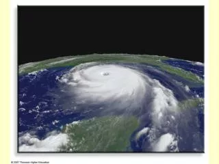
Motivation Landfalling tropical cyclones are important component of the hydrological cycle especially in the mitigation of droughts in the southeastern US! Is this really true? The answer may have implications for these water managers on their planning of how to work with future climate projections.
Outline • Top-down approach: Implications from the large-scale climate variations • Bottom-up approach: Examining from landfalling tropical cyclone events in the southeastern US • Discussion/Conclusion: Both approaches give answers for different reasons
Cold equatorial Pacific and warm tropical Atlantic Oceans is a recipe for drought in the continental US including over the Southeastern US From U.S. CLIVAR Drought working group
The annual and U. S. mean responses to eight combinations of Pacific and Atlantic patterns Warm tropical Atlantic and cold eastern equatorial Pacific shows a uniform response of dry and warm anomaly over the US From Schubert et al. 2009
Top panel: Average SST between May 1998-June 2002. Insets: are monthly mean time series of SST in western and eastern Pacific. Simulated annually averaged surface temperature (left) and precipitation (right) for May 1998-June 2002 from three different models (ECHAM4.5, NCEP, NASA). Hoerling and Kumar 2003
50% of spatial and temporal variance in multi-decadal drought frequency over the continental united states can be attributed to the pacific decadal oscillation and Atlantic multi-decadal oscillation. Warm North Atlantic warming (Positive AMO) and tropical pacific cooling (negative PDO) showed positive trend in drought frequency. A B C D From McCabe et al., 2004)
Conclusion of top down approach • Cold Pacific and warm Atlantic cause extensive droughts in the continental US including southeastern US from interannual to decadal time scales • A few caveats are: • The resolutions of the GCM’s used in these studies do not resolve tropical cyclones. • Annual averages of atmospheric responses are shown and not seasonal mean. In the southeastern US the dry season is in the winter and wet season is in the summer. But the SST teleconnections are strongest with winter precipitation in the southeastern US.
The Bottom Up Approach What really happens when we have landfalling tropical cyclones in the southeastern US?
Hurricane Landfall Probabilities For example, 3 or more hurricanes making landfall during cold ENSO years is 40% vs less than 5% in warm ENSO years Probability of landfall No. of hurricanes making landfall
Probabilities by Region Probability of land fall Probability of landfall No. of hurricanes making landfall There is appreciable drop in probability of landfalling hurricanes along Florida coast, Gulf coast, and along eastern seaboard during warm ENSO years relative to cold or neutral ENSO years No. of hurricanes making landfall
About 20% of summer rainfall seems to originate from landfalling TC! % of Jun-Nov rainfall that originated from Atlantic TC (1980-2000)
Yearly frequency is about 2 to 2.25 landfalls in the southeastern US Yearly climatology of the number of landfalling TC’s producing precipitation across the SEUS (Knight and Davis 2007).
Drought index at watershed scale based on conceptual hydrological model 28 small to medium size basin located within the southeast US region that has minimal human interventions. The calibration data for these basin were taken from Model Parameter experiment project (MOPEX) 28 SEUS Watersheds from MOPEX
Palmer Drought Severity Index HyMOD NAM TANK • Original PDSI is based on estimating soil moisture anomaly from a simple 2 layer bucket model. • In our PDSI (called DI), the soil moisture anomaly is based on mean of 3 calibrated hydrological models that have more complex hydrological cycle. These models have been calibrated to simulate the streamflow in the mouth of the 28 watersheds • Semi distributed Lump modeling • Based on subdivision of watershed into number of sub basin in order to account for the spatial variability in precipitation • The parameter are lumped over the whole watershed. • Parameter calibrated and validated using historical observation (MOPEX dataset) simulators simulators simulators ϕ
Experimental design 5 Day 71 Land falling Tropical storm; 1948-2006 from HURDAT2 database D1 (09/1/2009) D1 (09/1/2009) E1 E3 D1 (09/1/2009) In the experiment we recompute the drought index assuming that all 71 landfalling TC’s have identical tracks we zero out rainfall for 5 days from the date of landfall for all 28 watersheds. E2 Storm travel time (over SEUS watershed)=5day CPC Compare drought index CPC_mod: constructed by removing 5 day consecutive rainfall from the land falling date
Experiment design • Extract landfall dates (71 TC’s) • Remove 5 consecutive days of rainfall from the landfall date (assuming that the storm will reach the inland watershed from the coast within 5 day ). • Simulate hydrological model from 1948-2006 with CPC and revised CPC rainfall to estimate drought severity index.
The hydrological model uncertainty in estimating DI is around 8% while the impact of landfalling TC on DI is only 5%
Conclusion of bottom up approach • Landfalling tropical cyclones don’t provide relief from seasonal droughts as defined by soil moisture in the southeastern US • The sensitivity of the drought index to landfalling tropical cyclone is less than the uncertainty of the hydrological models • This is partly because • The timing of the landfalling TC event in relation to the overall soil moisture condition of the watershed in the 1948-2006 period is not conducive for drought mitigation. • The watersheds in the southeast US is relatively small and therefore the volume of rain from the TC appears very soon at the mouth of the outlet • No two tracks of landfalling tropical cyclones are alike. But in this study we assume it to be alike for all TC’s and yet the impact is negligible • When the southeast US is under drought the steering flow is not conducive for landfall (part of another study)