Download
1 / 19
200 likes | 351 Views
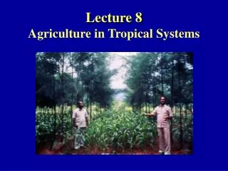
Copernicus Big EO data workshop, 2014. Monitoring Tropical Forests and Agriculture: the Roadmap for a Global Land Observatory. Gilberto Câmara National Institute for Space Research (INPE), Brazil Institute for Geoinformatics, University of Münster, Germany.

E N D
Copernicus Big EO data workshop, 2014 Monitoring Tropical Forests and Agriculture: the Roadmap for a Global Land Observatory Gilberto Câmara NationalInstitute for Space Research (INPE), Brazil Institute for Geoinformatics, Universityof Münster, Germany
“With LANDSAT-type data, the only model that makes sense is data free for all” (July 2006)
“A few satellites can cover the entire globe, but there needs to be a system in place to ensure their images are readily available to everyone who needs them. Brazil has set an important precedent by making its Earth-observation data available, and the rest of the world should follow suit.”
EO data is now free…and big Image source: NASA Sentinels: 3 Tb/day
Real-time Deforestation Monitoring Daily warnings of newly deforested large areas
Real-time Deforestation Monitoring: how to make progress? Evaluation of automated methods in one image only!
Real-time Deforestation Monitoring: how to make progress? The practices of the research community do not match the needs of the end-users!
Is free data download our answer? Currently, users download one snapshot at a time
Data Access Hitting a Wall How do you download a petabyte? You don’t! Move the software to the archive
Where we want to get to Big data EO management and analysis Remote visualization and method development 40 years of Earth Observation data of land change accessible for analysis and modelling.
Array databases: all data from a sensor put together in a single array t y y X result = analysis_function (points in space-time )
SciDB Architecture: “shared nothing” Large data is broken into chunks Distributed server process data in paralel
What’s in animage? “Remote sensing images describe landscape dynamics” data source: B. Rudorff (LAF/INPE)
Deforestation event detection: images and time series 2011 2010
Time series analysis of land change Pasture Forest Área 1 Forest Área 2 Forest Agriculture Área 3 Vegetation index time series source: Victor Maus (INPE)
Software goes where the data is! Global Land Observatory: describing change in a connected world R: Powerful data analysis methods SciDB: array database for big scientific data Free satellite images
Unique repository of knowledge and data about global land change Global Land Observatory: describing change in a connected world Methods for land change for foresty and agriculture uses 40 years of LANDSAT + 12 years of MODIS + SENTINELs + CBERS Free satellite images