Download

1 / 8
80 likes | 243 Views
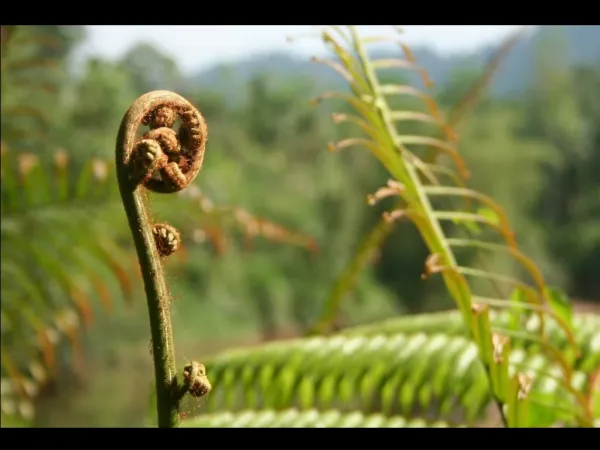
Pinga Oya Catchment Responses to Human Activity. Symposium on Pinga Oya 19-02-2013. Catchment as an Open System. River networks attempt to reach an equilibrium state with its environment

E N D
Pinga Oya Catchment Responses to Human Activity Symposium on Pinga Oya 19-02-2013
Catchment as an Open System • River networks attempt to reach an equilibrium state with its environment • A system that has reached an equilibrium can be disrupted by changes to the main controlling variables, such as forest cover change, tectonics, climate change, etc. • Among these controls what can be managed is the human activity not the other factors.
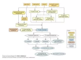
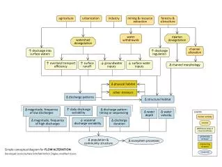
The Changes in Pinga Oya Catchment • Land use change: It has been observed in Sri Lanka that the runoff as a percentage of rainfall increases with land use change. Increases erosion and siltation. • Example Clearing of forests for coffee cultivation lead to the silting up of paddy lands, navigation problems in SitawakaGanga (Kelani) for the formation of sand bars and frequent floods • Increase in impervious surfaces: Paved areas, such as buildings, road surfaces, etc. reduce absorption of rainwater by the soil layer leading to increased runoff. • Urban construction: temporarily increases sediment discharge.
Construction of Dams • Dams lead to deposition of sediment on the channel bed above the dam and erosion below the dam. (Agradation above and degradation below) • Where reservoirs are constructed, channel may reduce it size by deposition to match with the reduced discharge.
Channel Geometry • The channel geometry is a function of the water discharge. Any change in the discharge is reflected in the channel cross-section • Chanelization of the Pinga Oya has reduced the channel’s capacity to safely remove the storm water runoff. Where chanelization has constrained the natural adjustment of the river to carry increased runoff .
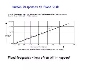
Study of the Changes • One way to study these changes is to use the satellite imageries obtained over given period. Although it is not always possible to identify all the houses in mid-country terrain due to the vegetation cover, it nevertheless give an approximate idea about the current situation. • A GPS survey can be done to supplement the Image data.