Download
1 / 7
140 likes | 391 Views
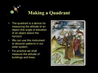
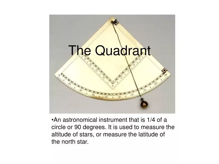
The Quadrant. An astronomical instrument that is 1/4 of a circle or 90 degrees. It is used to measure the altitude of stars, or measure the latitude of the north star. Early Examples.

E N D
The Quadrant • An astronomical instrument that is 1/4 of a circle or 90 degrees. It is used to measure the altitude of stars, or measure the latitude of the north star.
Early Examples • Describe as a ‘plinth’ around 150 A.D. by Claudius Ptolemy in his Almagest. The ‘plinth’ cast a shadow on to a 90 degree arc. • Islamic astronomers had mural quadrants that were fixed in the meridian plane and altazimuth quadrants that could be moved to determine altitude and azimuth of a celestial body. • Tycho Brahe completed large quadrants, up to 2 meters in radius, in the 1580s.
The Octant and Sextant • Both these instruments were used to get the same information as a quadrant with less accuracy. • The octant is a quadrant which is folded making it more compact and easier to use. Its accuracy is less because the scale markings are twice as close. • The sextant is 1/6 of a circle opposed to the 1/4 quadrant. Its is almost as accurate and easy to use, although it is light.
Columbus • On November 2, 1942, Columbus wrote in his log that he made a quadrant sighting of the North Star. • He used dead reckoning, deducing your position, and also used this with the quadrant to tell where he was on a map.
Drake • While Drake thought he was at 38 degrees 30 minutes he was probably closer to 38 degrees 19 minutes. • Most historians believe that he landed at 38 degrees 2 minutes, Marin County's Drakes Bay .
How to Use the Quadrant • Step 1: Line the sights up to North Star. • Step 2: Hold the plumb-line to the arc, and take the reading in degrees as close as you can. • Step 3: Read the angle and that would be the latitude.
Sources • Francis Drake’s determination of Latitudehttp://www.longcamp.com/nav.html • Epat: Scientific Instrumentshttp://www.mhs.ox.ac.uk/epact/ • National Maritime Museumhttp://212.219.145.16/searchbin/searchs.pl?exhibit=thumbs&axis=ic0080e&flash=false&dev • How Columbus Navigatedhttp://vesuvius.jsc.nasa.gov/er/seh/navigate.htm • Columbus Navigationhttp://www1.minn.net/%7Ekeithp/index.htm