Download
1 / 17
170 likes | 427 Views
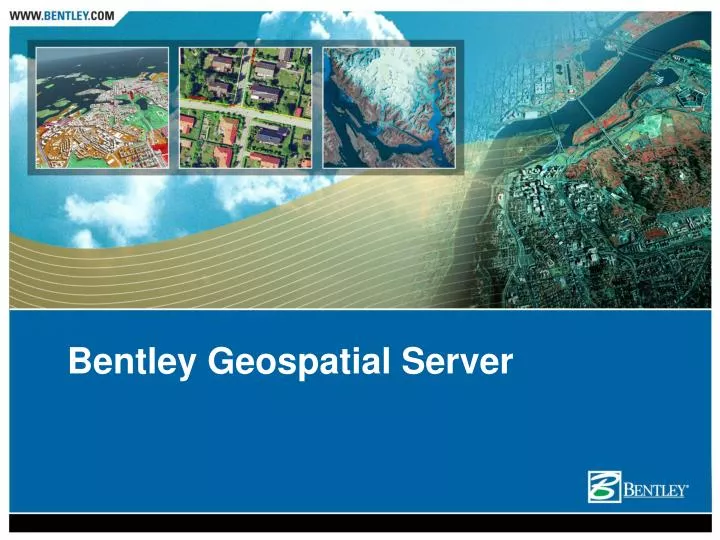
Bentley Geospatial Server. Bentley Geospatial Server. Value Proposition The Geospatial Server provides a secured centralized environment to contain the explosion of information in an organization by managing, indexing, editing, and plotting structured and unstructured data.

E N D
Bentley Geospatial Server Value Proposition • The Geospatial Server provides a secured centralized environment to contain the explosion of information in an organization by managing, indexing, editing, and plotting structured and unstructured data
Bentley Geospatial Server Key Innovations • Unique Federated Information Management Approach • Index rather than convert • Keep the richness and meaning of your information in your favorite formats (no conversion) • Find information via spatial or non-spatial criteria • View/Edit using your favorite viewing and editing tools, Applications can be launched directly from the map interface • Manage, index, edit, and printing/plotting • Structured Information with schemas such as spatial databases, XFM DGNs, Shapefiles • Unstructured information such as DGN, DWG, Word, Excel, Powerpoint, PDF
Bentley Geospatial Server Key Innovations • Document Service • Ability to store spatial and non-spatial files • Scalable solution • Ability to manage complex files with references • (e.g.: DGN, SHP, MXD, DWG) • CAD Standards Management • Multiple application integration • MicroStation v7, v8, XM • All app based on MicroStation • AutoCAD 2007, 2006, 2005, 2004, 2002, 2000 • ArcMap (ESRI) 9.X • Microsoft Office 2007, 2003, XP, 2000, 97
Bentley Geospatial Server Key Innovations • Spatial Indexing/Searching Service • Ability to quickly find files based on multiple spatial and non-spatial criteria • Background map support • Projection Management • Assigning spatial locations to documents and folders • Text Indexing (Office, DGN, DWG, PDF) • Feature indexing
Bentley Geospatial Server Key Innovations • Workflow Service • Organization members need to work together in a structured, secured, collaborative way • Workflow is a set of states (e.g. initial, design, 75% design, complete) successively traversed by an object • For each state different security can be enforced on objects stored in the system • For each state it is also possible to have specific communication enforced through emails. • The Federated System helps organization members get the right information at the right time in the right context
Bentley Geospatial Server Key Innovations • Spatial Database Service • Excellent Oracle Database Citizen • Multi-User Editing via Oracle Standard Versioning • Short and Long editing sessions using database standard Oracle database lock • Time Component Support • Data Loading Tool • Web Services Based
Bentley Geospatial Server Key Innovations • Plotting Service • Multi-format Plotting and Publishing support • Multiple Print Interfaces • Batch Plotting • Custom Presentation • Content Rich PDF Output • Digital Archiving • Detailed Design Comparisons • Plot Tracking • Full Featured Printer Drivers
Key Points to Remember • Geospatial Server functionality can be grouped into 5 services: • Document Service • Spatial Indexing/Searching service • Workflow Service • Spatial Database Service • Plotting Service
Key Points to Remember • Geospatial Server = Enterprise GIS • Using a unique Federated Information Management approach. • The idea is simple: • Index rather than convert • Find rather than search • Allows managing, indexing, editing, and plotting of : • Structured information, fixed schema • Spatial Database, DGN/XFM, Shapefile, … • Unstructured information, no schema • Raw DGN, DWG, Word, PowerPoint, …
Key Points to Remember Value Proposition • The Geospatial Server provides a secured centralized environment to contain the explosion of information in an organization by managing, indexing, editing, and plotting structured and unstructured data.