Download
1 / 28
300 likes | 484 Views
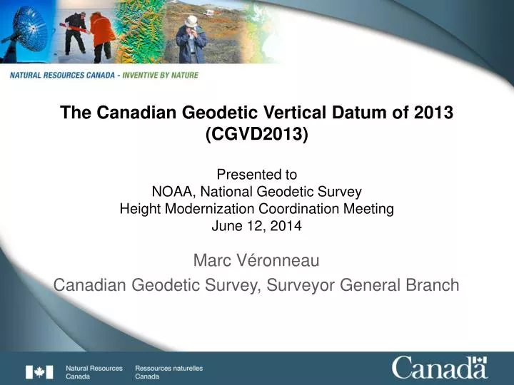
The Canadian Geodetic Vertical Datum of 2013 (CGVD2013) Presented to NOAA, National Geodetic Survey Height Modernization Coordination Meeting June 12, 2014. Marc Véronneau Canadian Geodetic Survey, Surveyor General Branch. OUTLINE. The Canadian Spatial Reference System (CSRS) … 3

E N D
The Canadian Geodetic Vertical Datum of 2013(CGVD2013)Presented toNOAA, National Geodetic Survey Height Modernization Coordination MeetingJune 12, 2014 Marc Véronneau Canadian Geodetic Survey, Surveyor General Branch
OUTLINE • The Canadian Spatial Reference System (CSRS) … 3 • WHAT - Canada’s Height Modernization … 4 • WHY - Canada’s Height Modernization … 5 • WHAT - Canadian Geodetic Vertical Datum of 1928 … 7 • WHAT - Canadian Geodetic Vertical Datum of 2013 … 11 • WHAT - Impact, Velocity, Labelling, Tools and Future … 21 • SUMMARY … 27
Canadian Spatial Reference System (CSRS) Horizontal network (f, l) 4-D Geometric frame Geopotential frame (f, l, h, H = h – N, t) 4-D Geometric frame (f, l, h, t) Dynamic coordinates NAD27 NAD83 NAD83(CSRS) Velocity models NAD83(CSRS) Velocity models Canada-USA Adopted Transformation ITRF96 NAD83(CSRS) CGVD2013 (CGG2013) 3-D Geometric frame (f, l, h) Vertical network (H) Adopted in U.S.A., but not in Canada CGVD28 NAVD 88
WHAT is Canada’s Height Modernisation? • It is the establishment of a new vertical datum for Canada that is integrated within the CSRS • The Canadian Geodetic Vertical Datum of 2013 (CGVD2013) • Released in November 2013 • It replaces the Canadian Geodetic Vertical Datum of 1928 (CGVD28) • Adopted in 1935 by an Order in Council • Three important changes: • New definition: from mean sea level at specific tide gauges to an equipotential surface • New realisation: from adjusting levelling data to integrating gravity data • New access: from benchmarks to a geoid model • CGVD2013 is compatible with Global Navigation Satellite Systems (GNSS) such as GPS Orthometric height determination by two techniques: levelling and combination of GPS measurements and a geoid model.
WHY Height Modernisation in Canada? • TECHNOLOGY, ACCESS & COST • Levelling is a precise technique that served Canada well over the last 100 years to realise and maintain the vertical datum, but for a country as wide as Canada … • It is prone to the accumulation of systematic errors over long distances; • It does not provide a national coverage (BMs only along major roads and railways); • It is a costly and time-consuming technique. Motorized Levelling
WHY Height Modernisation in Canada? • Modern technology in positioning • GNSS positioning is now mature and has gained widespread adoption by users. • It is a cost efficient technique in determining precise heights everywhere in Canada. • Satellite gravity missions offer unprecedented precision in the determination of the long and middle wavelength components of the geoid. • A geoid model realizes an accurate and homogeneous vertical reference surface all across Canada (land, lakes and oceans). GNSS GOCE GRACE
DH = BS - FS Foresight rod Backsight rod Levelling Backsight readingBS Foresight reading FS B DH WHAT is the Canadian Geodetic Vertical Datum of 1928 (CGVD28)? A
CGVD28: Levelling networks ? ~ 90 000 benchmarks Prince Rupert Pointe-au-Père Vancouver Halifax Yarmouth Rouses Point 1906-1928 1929-1939 1940-1965 1966-1971 1972-1981 1982-1989 1990-2007 Original constraints for Canada’s mainland Examples of later constraints
Levelling surveys over the years in Canada 1906-1928 1929-1939 1940-1965 1972-1981 1982-2012 1966-1971
WHAT are the error sources in CGVD28? • CGVD28: • Assume that oceans are at a same equipotential surface • Use entirely gravity values from a mathematical model • Omit systematic corrections on old levelling data • Neglect post-glacial rebound • Accumulation of systematic errors Earth surface St-Lawrence River (Pointe-au-Père) Pacific Ocean (near Vancouver) Atlantic Ocean Level surface wrt MSL in Vancouver (near Halifax) CGVD28 +36 cm -140 cm Level surface wrt MSL in Halifax NAVD 88 • NAVD 88 (not adopted in Canada): • Significant east-west systematic error (~1 m) of unknown sources in Canada (in the US too)
WHAT is the Canadian Geodetic Vertical Datum of 2013 (CGVD2013)
WHAT is the definition of CGVD2013? • U.S. NGS and NRCan’s GSD signed an agreement (16 April 2012) to realize and maintain a common vertical datum for USA and Canada defined by W0 = 62,636,856.0 m2/s2 • CGVD2013: Conventional equipotential surface (W0 = 62,636,856.0 m2/s2) averaging the coastal mean sea level for North America measured at Canadian and American tide gauges. • It also corresponds to the current convention adopted by the International Earth Rotation and Reference Systems Service (IERS) and International Astronomical Union (IAU). • Canada’s recommended definition for a World Height System Sea Surface Topography Canadian tide gauges American tide gauges
Ellipsoidal height and Orthometric height • GPS ellipsoidal heights require conversion to orthometric heights (heights above mean sea level) using a geoid model. • Heights are traditionally referred to mean sea level (BM, DEM, Topo maps). • Orthometric heights are consistent with the direction of water flow. Sept-Iles Ste-Anne-des-Monts Baie-Comeau Slope of the Saint-Lawrence River between Portneuf and Sept-Iles Rimouski Gros-Cacouna Ellipsoidal heights St-Joseph-de-la-Rive Orthometric heights St-Francois Portneuf Sept-Iles
Canadian Gravimetric Geoid of 2013 (CGG2013) Boundaries North: 90° South: 10° West: -170° East: -10° Resolution 2’ x 2’ Satellite model EIGEN-6C3stat (GFZ) Förste et al., IAG 2013 GOCE (until May 24, 2013) Transition zone Degrees: 120-180 (l = 333 km-222 km) Reference frames ITRF2008 and NAD83(CSRS) GRACE (2002 - ) DEM Land & ship gravity GOCE (2009 – 2013) Altimetry
Accuracy of the geoid model (CGG2013) • The accuracy considers data errors (gravity and DEM), grid resolution, discrepancies between gravity datasets and cut-off of satellite contribution. • 3 cm or better accuracy over 80% of Canada’s landmass • Decimeter level in areas with greater topography/mass distribution variability • Centimeter level relative precision over distances of 100 km or less (GPS on BM analysis) Unit: cm 1 9 11 3 5 7 67% confidence (1 s)
Difference between USGG2012 and CGG2013 USGG2012: W0 = 62636855.69 m2/s2 CGG2013 : W0 = 62636856.00 m2/s2 Delta = 0.31 m2/s2 (~3.1 cm) Common area North: 58° South: 24° West: -130° East: -60° Statistics Min: -0.788 m Max: 0.924 m Mean: -0.031 m StDev: 0.031 m cm -10 10 CGG2013 – USGG2012 (shift: 3.1 cm)
Difference between USGG2012 and CGG2013: Lake of the Woods These data are missing in the Canadian Gravity Database CGG2013 – USGG2012 (shift: 3.4 cm)
WHAT is the difference between CGVD2013 and the mean sea level? Terrain Mean Sea Level Vancouver 17 cm Geoid (CGVD2013) -39 cm Halifax Mean Sea Level
WHAT is the difference between CGVD2013 and CGVD28? CGVD28(HTv2.0) – CGVD2013(CGG2013) Approximate values HCGVD2013 – HCGVD28 St John’s -37 cm Halifax -64 cm Charlottetown -32 cm Fredericton -54 cm Montréal -36 cm Toronto -42 cm Winnipeg -37 cm Regina -38 cm Edmonton -04 cm Banff +55 cm Vancouver +15 cm Whitehorse +34 cm Yellowknife -26 cm Tuktoyaktuk -32 cm Banff CGVD2013 Vancouver Thunder Bay Difference (m) Regina CGVD28 Halifax Windsor Montréal Distance (km)
WHAT is the difference with NAVD 88? HCGVD2013 – HNAVD 88 C.I.: 10 cm • Conversion between NAVD 88 & CGVD2013 • Conduct a GNSS survey on bench marks • Published elevations at bench marks • Geoid12A - CGG2013 (above image)
HOW CGVD2013 impact heights in Canada? • All vertical control stations (bench marks) have a new elevation. • Natural Resources Canada (NRCan) is NOT maintaining benchmarks by either levelling or GNSS technique. • NRCan stopped levelling surveys for the maintenance of the vertical datum (levelling network) • However, the levelling networks are readjusted to conform with CGVD2013 using legacy data. • NRCan is publishing CGVD28 and CGVD2013 heights at bench marks, • but NRCan cannot confirm the actual height of bench marks in either CGVD28 or CGVD2013 (cannot confirm stability of benchmarks and precision of the levelling lines). • The Canadian Active Control Stations (CACS) and Stations of the Canadian Base Network (CBN) form the federal infrastructure for positioning. • 250 stations • Modern alternative techniques provide height determination. • NRCan’s CSRS-Precise Point Positioning (PPP) • Differential GNSS positioning • Public and Private Real-Time Kinematic (RTK) positioning • Levelling remains a very efficient technique for most short distance work.
Adjustments of the levelling networks in CGVD2013 Constraints: C = ( h – N )*gm C: Geopotential number h: Ellipsoidal height in NAD83(CSRS) Ep. 2010.0 N: CGG2013 (NAD83(CSRS)) gm: mean gravity along plumb line GPS stations are primarily CACS and CBN. It includes a few “GPS on BM” stations Adjustments include legacy levelling data Stability of the bench marks are unknown 32 constraints for the continental levelling network 21 constraints for island networks and local levelling networks
Vertical velocity (Glacial Isostatic Adjustment) Vertical velocity of the geoid (GRACE) Vertical velocity of the terrain (GPS) Colour scale: -14 mm/a to 14 mm/a Colour scale: -1.4 mm/a to 1.4 mm/a
Labelling Heights • Type of height: Orthometric (H), dynamic (Hd), normal (Hn), ellipsoidal (h), geoid (N) • Height Reference System: NAD83, ITRF, CGVD28, CGVD2013, NAVD 88 • Height Reference Frame: CSRS v., geoid model • Precision (e.g., ± 0.05 m) • Epoch (e.g., 2012.75) H N Height: 101.61 m Precision: ± 0.01 m Epoch: 2013.2 Type of height: Orthometric Height system: CGVD2013 Height frame: CGG2013 H = 23.126 ± 0.007 m CGVD2013(CGG2013) Epoch 2013.2 Geoid Height: -10.354 m Precision: ± 0.015 m Epoch: Static Model: CGG2013 Frame: NAD83(CSRS) N = -10.354 ± 0.015 m CGG2013, NAD83(CSRS) h Height: 91.256 m Precision: ± 0.007 m Epoch: 2013.2 Type of height: Ellipsoidal (geodetic) Height system: NAD83 Height frame: CSRS (version if available) h = 23.126 ± 0.007 m NAD83(CSRS) Epoch 2013.2
Tools available for Height Modernisation Precise Point Positioning (PPP): Process GPS RINEX files to provide coordinates (latitude, longitude, ellipsoidal height and orthometric height) GPS-H: Convert ellipsoidal heights to orthometric heights (makes use of any geoid models, works with different types of coordinate systems (geographic, UTM, MTM and Cartesian), and different geometric reference frames (NAD83(CSRS) and ITRF)) TRX: Transform coordinates between different geometric reference frames, epochs and coordinate systems.
Future activities • Promotion of the new vertical datum for Canada (CGVD2013). The transition period between CGVD28 and CGVD2013 will last several decades. • Integration of GRAV-D data into the Canadian solution. • Integration of latest satellite gravity data (GRACE and GOCE). • Communication between national geodetic agencies (theory, data exchange, comparison of solutions, etc.) • Realisation of a unique height reference system for North America by 2022 (Canada, USA, Mexico, Central America, Caribbean, Greenland).
SUMMARY • NRCan released a new vertical datum in November 2013 • Canadian Geodetic Vertical Datum of 2013 (CGVD2013) • Realised by geoid model CGG2013 (W0 = 62,636,856.0 m2/s2) • Compatible with GNSS positioning technique • Levelling networks were readjusted using existing data to conform with CGVD2013 • Why a new national vertical datum? • Cost of conducting levelling surveys at the national scale • To provide access to the vertical datum all across Canada • New space-based technologies in positioning (GNSS) and gravity (GRACE/GOCE) • The difference between CGVD2013 and CGVD28 • Separation ranging from -65 cm and 55 cm at the national scale. • US and Canada signed an agreement for the realisation of a unique height reference system between the two countries by 2022. The common datum is currently accepted as W0 = 62,636,856.0 m2/s2 (adopted definition for CGVD2013).
NRCan Contacts: Philippe Lamothe (phlamoth@nrcan.gc.ca) Marc Véronneau (marcv@nrcan.gc.ca) Jianliang Huang (jianhuan@nrcan.gc.ca) General information: Web: http://www.nrcan.gc.ca/earth-sciences/geomatics/geodetic-reference-systems/10781 Email: information@geod.nrcan.gc.ca Phone: 1-613-995-4410 Fax: 1-613-995-3215 QUESTIONS?