Download

1 / 75
750 likes | 753 Views
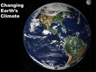
This article explores the factors that influence climate, including latitude, distance from the sea, and prevailing winds. It discusses how these factors can affect temperature and precipitation patterns in different regions.

E N D
Introduction • Factors that influence climate. • 1. Latitude • 2. Distance from sea / ocean • 3. Prevailing winds and air masses
Latitude • Latitude is the distance north or south of the equator. • In general, the further north or south of the equator an area is, the colder it will be.
Activity • Complete the exercise on page 90 of your books to explain how distance from the sea can affect climate.
Distance from the sea / ocean. • Water in the sea absorbs heat very slowly during the summer. • It also loses its heat very slowly during the winter. • Therefore, areas of land close to the sea will be cooled by the water in the summer, and warmed up by the water in the winter. • Therefore, areas close to the sea tend to have a small temperature range.
Distance from the sea / ocean. • Land absorbs heat very quickly during the summer, and loses it very quickly during the winter. • Therefore, inland areas far from the sea tend to have very hot summers and very cold winters. • Therefore, inland areas far from the sea tend to have a larger temperature range than coastal areas. (Areas beside the sea).
Prevailing Winds and Air Masses • Winds and air masses can make an area colder, warmer, wetter or drier. • Their influence will depend on the direction they come from and whether they pass over land or water.
Factors that influence local climate • Local climate is the climate experienced by a small region, for example, the Wicklow Mountains. • Even though Wicklow is in Ireland, the area of the Wicklow mountains would generally be colder and wetter than low lying Co. Kildare. • Local climates are influenced by the shape of the land (relief), in particular, Aspect and Altitude.
Aspect • Aspect refers to the direction in which a slope is facing. For example, a slope can be facing north or south. • In the northern hemisphere, where we live, south facing slopes are warmer. Why? • There are 3 reasons why. • The sun shines directly onto south facing slopes. • Warm southerly winds blow against south facing slopes. • They are protected from the cold northerly winds.
Altitude • Altitude refers to height above sea level. • In general, the higher you go, the colder it is. • The temperature drops 7°C for each 1000m you go up. Why? • There are two reasons for this. • This is because the air is thinner and it can hold less heat. • Upland areas are more exposed to the wind which also makes it colder. This is known as the Wind Chill Factor.
Case Study: Mount Kilimanjaro: Even though this mountain is in Africa, and very close to the equator, it is so high that the top part of the mountain is covered in snow all year round. The word Kilimanjaro means White Mountain, just like Mont Blanc in the Alps.
Where is Mount Kilimanjaro? = Mt. Kilimanjaro = The Equator
Mount Kilimanjaro • Mt. Kilimanjaro is made from 3 inactive volcanoes. • It is in north-eastern Tanzania, 340 km south of the Equator close to the border with Kenya. • It is the highest mountain in Africa at 5,895 metres. • Mount Kilimanjaro is one of the tallest freestanding mountains in the world, rising 4600 m from the base.
World Climates • There are many different climate types in the world. • World climates can be put into 3 groups. • 1. Hot Climates • 2. Temperate Climates • 3. Cold Climates
The Major Climates of the World Hot TemperateCold Equatorial Cool Temperate Boreal Savanna Warm Temperate Tundra Hot Desert
Activity • Draw the diagram of the world’s climates on page 94 of your book. Remember to mark in the hot, temperate and cold climates.
Hot Climates of the World • Most hot climates are found within latitudes 30°N and 30°S. In other words, they are found close to the equator.
Equatorial Climate Hot all year (28°C) One Season Rain every afternoon. Rainfall 2000mm / yr Rainforest / jungle. Savanna Climate Hot all year (25-35°C) Two seasons Wet summers, dry winters Scattered trees / grassland Hot Climates
Hot Climates • Desert Climate • Temperature: Day – 30-50°C Night 5°C • 15° - 30° north and south of the equator • Precipitation: • There is very little rain (100mm per year). • There are long droughts (no rain) followed by sudden downpours.
Activity • In pairs find out the climate conditions of the hot desert climate. • Use page 96 to help.
Questions • What is the temperature in December? • What is the temperature in August? • How many millimetres of rain fell in January? • How many millimetres of rain fell in July? • What is the average monthly rainfall from October to March, and from April to September? • Calculate the temperature range.
Hot Deserts Too dry to grow crops without irrigation In order to rear animals, such as camels, goats and sheep, the people have to be nomadic, moving from place to place in search of water and grazing Disadvantages Water is in short supply. Wells and streams often run dry. To obtain a large amount of water people have to build very expensive dams and reservoirs across major rivers.
Plants and Animals in the Desert. • It is difficult for plants and animals to survive in the desert because there is so little water. • Plants that survive have adapted to the desert climate. One example is the Cactus. • It has thick bark which prevents loss of moisture and it can store water inside it. The spread out over long distance to reach available water. The needles protect it from wild animals.
Cactus • Use page 97 to find out why the cactus survives the desert conditions.
Animals in the Desert • An example of an animal that has adapted to life in the desert is the camel. • They have long eye lashes to protect their eyes and thick skin on their legs so they can kneel in the hot sand. They have wide hooves for walking in the sand and can store fat in their humps for when food is scarce. • http://www.youtube.com/watch?v=7N58Z8uIVS0
End of Chapter Assessment • Answer question 2 on page 97 of your book.
The Desert and Desertification • The spread of the desert is called Desertification • The Sahel Region in Africa is suffering badly from desertification.
The Sahel regions are areas which experience desertification.
DESERTIFICATION Why does the Sahel suffer from desertification? Increase in cattle Increase in population Deforestation for fire wood Grassland grazed more intensively Roots no longer hold soil together Roots may be eaten as well as grass Less vegetation means less protection from weather Leaves no longer protect soil from weather Loose top soil blown away by wind (Soil Erosion) = Loose top soil blown away by wind (Soil Erosion) = DESERTIFICATION
Effects of Desertification • Affects millions of hectares of land and threatens the livelihoods of nearly 100 million people. • Contributed to the outbreak of famine. • Forced millions to migrate to other areas. This can lead to more desertification.. Why?
Solutions • Irrigation schemes are being introduced to increase the amount of grazing land available. • Restrict the number of cattle, sheep and goats that graze the land. • Drought resistant grasses and trees are being planted to help bind the roots of plants together.
EFFECTS OF DESERTIFICATION YOU HAVE 5 MINUTES FOR EACH TASK. TASK 1 – DRAW A SPIDER DIAGRAM LISTING AT LEAST 8 EFFECTS OF DESERTIFICATION. EFFECTS OF DESERTIFICATION TASK 2 – I WILL SHOW YOU ON THE NEXT SLIDE A PHOTOGRAPH. YOU ARE A JOURNALIST AND YOU MUST GIVE AN APPROPRIATE CAPTION OR TITLE TO THE PHOTOGRAPH. THE BEST CAPTION/TITLE WILL BE STORED WITH THIS PHOTO FOREVER
Today’s Class - Irrigation Keywords Irrigation Drought Central Valley Project California Sacramento River San Joachin Valley
Irrigation Irrigation is the artificial watering of the land. There are 3 main ways of irrigating the land Sprinklers and canals Flooding whole areas Boring wells to use ground water.
Example of an Irrigation Scheme: Central Valley Project, California USA Mediterranean Climate – hot dry summers with almost no rain in June, July and August. Temps 30°C Winters are mild and wet (8°C) California suffers from drought – long period of time with no rain. Agricultural land is in the south end of California in the San Joachin Valley. There is a little supply of water. In the north there is the Sacramento River, where there is a large supply of water.
The Central Valley Project 1935 Plan was to move water from the wetter northern end of the Central Valley Project to the dry southern end. Dams and reservoirs were built across the Sacramento River. Canals were built to transfer this water southwards to the San Joachin Valley. Water is stored during the winter months and used in the summer.
Central Valley Project http://www.youtube.com/watch?v=dWzEQxD_zGs http://www.youtube.com/watch?v=dWzEQx