Download
1 / 19
190 likes | 291 Views
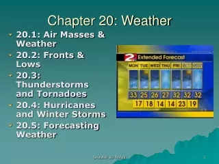
Chapter 20 Weather Patterns and Sever Storms. Earth Science. Air Masses 20.1. Immense body of air that has similar temp and humidity Can be 1500 km or more Air mass carries temp and humidity from region in which it formed but characteristics change to take on some climate of area.

E N D
Chapter 20 Weather Patterns and Sever Storms Earth Science
Air Masses 20.1 • Immense body of air that has similar temp and humidity • Can be 1500 km or more • Air mass carries temp and humidity from region in which it formed but characteristics change to take on some climate of area
Classifying Air Masses 20.1 • Source region – area over which air mass gets properties • 7 in US • POLAR (P) = from high latitudes • cold • TROPICAL (T) = from low latitudes • warm • Maritime (m) = form over water • Likely to be humid • Continental (c) = form over land • Likely to be dry
Weather in North America 20.1 • Continental Polar (cP) • Winter: cold and dry; Summer: cool and dry • Can cause lake-effect snows • Air gets heat and moisture from water = unstable air mass that is humid = lots of snow
Weather in North America 20.1 • Maritime Tropical (mT) • Warm, loaded with moisture = usual unstable • Source of most of precipitation in eastern 2/3 US • Continental Tropical (cT) • Least influence on US • Hot, dry • Rarely affect weather outside their source region
Fronts 20.2 • Front – boundary that separates two air masses • Associated with precipitation • Types of Fronts (4 Types) • 1) Warm Front moves into area formerly covered by cooler air • Weather map: red line with semicircles pointing towards cooler air • Cirrus clouds indicate incoming of warm front • Usually produces light to moderate precipitation • 2)Cold Front forms when cold, dense air moves into region occupied by warmer air • Weather map: blue lined edged with blue triangles that point toward the warmer air mass • Move more rapidly and have steeper slope • Heavy downpours and gusty winds • Weather clears after cold front passes
Fronts 20.2 • Types of Fronts Continued: • 3) Stationary Fronts Almost parallel to line of front • Weather map – blue triangles on one side and red semicircle on the other • 4) Occluded Fronts when active cold front overtake warm front • Wedges warm air upward
Middle-Latitude Cyclones 20.2 • Large centers of low pressure and generally travel west to east • Cause stormy weather • Rotate counter clockwise in toward the center • http://www.youtube.com/watch?v=xYyidKV36xI • 4 minutes
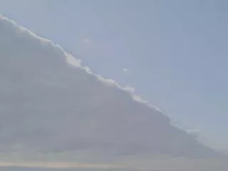
Severe Storms 20.3 • Thunderstorms – generates lightning and thunder • Cumulonimbus cloud • Form when warm, humid air rises in an unstable environment • 3 stages • Cumulus Stage – warm moist air is supplied to cloud • Mature stage – Heavy precipitation • Dissipating Stage – cloud begins to evaporate • Life span: single cumulonimbus cell is about an hour or two
Tornadoes 20.3 • Rotation column of air called vortex • Vortex extend downward from cumulonimbus cloud • 770 reported each year • Normally from April to June • A mesocyclone must form for tornado to develop
Tornadoes Continued… 20.3 • Pressure inside tornado is about 10% lower • Low pressure = air near ground rushes into in all direction • Winds can approach 480km/hr • Intensity measure by the Fujita Tornado Intensity Scale
Tornado Clips • http://www.youtube.com/watch?v=GM-abtIT6Is • 1 minute • http://www.youtube.com/watch?v=75PniEZxGwE&feature=fvw • 3 minutes • http://www.youtube.com/watch?v=KzUTxZkU5pc&feature=related • 4 minutes
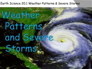
Hurricanes • Whirling tropical cyclones • Winds of at least 119 km/hr • Aka: typhoons, cyclones, tropical cyclones • Most powerful storms on earth • can generate 15 meter waves • Most form between 5 – 20 degrees N or S latitude • North Pacific has around 20 per year • Most often in late summer when water temps can give necessary heat and moisture to air
Hurricanes Continued… 20.3 • Eye Wall – doughnut-shaped wall the surrounds the center of the storm • Heaviest rainfall and wind speeds here • Eye – very center • No precipitation and wind subsides • Warmest part of storm
Hurricanes Continued… 20.3 • Hurricane Intensity-described by Saffir-Simpson Scale • Storm Surge – dome of water about 65 – 80 km wide that sweeps across the coast
Hurricane Clips • http://www.youtube.com/watch?v=OEPZOC6YHUc • 3:30 minutes • http://www.youtube.com/watch?v=HJydFJORWf4&feature=related • 5:30