Download
1 / 53
530 likes | 683 Views
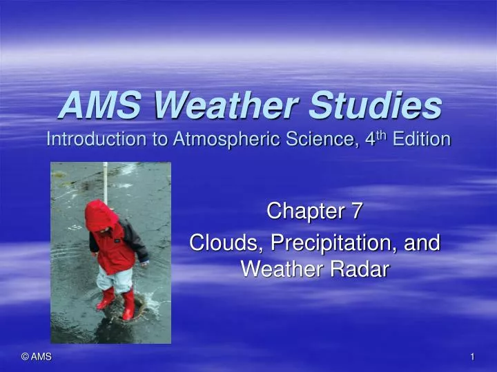
AMS Weather Studies Introduction to Atmospheric Science, 4 th Edition. Chapter 7 Clouds, Precipitation, and Weather Radar. Case-in-Point. Contrails may be affecting weather and climate They are formed when hot, humid air from the jet’s exhaust mixes with cold, drier air at high altitudes

E N D
AMS Weather StudiesIntroduction to Atmospheric Science, 4th Edition Chapter 7 Clouds, Precipitation, and Weather Radar
Case-in-Point • Contrails may be affecting weather and climate • They are formed when hot, humid air from the jet’s exhaust mixes with cold, drier air at high altitudes • Exhaust turbulence causes mixing • May dissipate within minutes or hours, or they may spread laterally, formally cirrus clouds that last for a day • Effect on local radiation budget • During day, reflect solar radiation and cool Earth’s surface • At night, absorb/emit infrared radiation from below and enhance greenhouse effect by warming Earth’s surface • May stimulate local precipitation by providing ice crystal nuclei for lower clouds • Effect on climate may increase in the future with the increase in global air traffic
Driving Question • How do clouds and precipitation form? • Clouds are products of condensation, or in the case of ice clouds, deposition, within the atmosphere • Clouds are essential to the global water cycle • Without clouds, there would be no precipitation • Yet most clouds do not yield precipitation • This chapter covers: • Development and classification of clouds and fog • Formation and types of precipitation • Weather radar • A valuable tool for monitoring air motion within weather systems • Methods for measuring precipitation
Cloud Formation • Water vapor is invisible • Clouds are visible products of condensation or deposition of water vapor within the atmosphere • Clouds are increasingly likely to form as air nears saturation • Clouds do not form in laboratory clean air unless it is supersaturated due to the curvature effect
Cloud Formation • The curvature effect • The curvature of a water surface affects the ability of a water molecule to evaporate from the surface • The smaller the droplet, the greater the water vapor concentration needed for droplet growth • Smaller droplets have greater curvature than large droplets • They also have the fewest surrounding molecules, so they are more weakly bonded • Water vapor more readily escapes a curved surface than a flat surface • There is more surface area on a curved surface • Saturation vapor pressure is greater surrounding a small droplet vs. a large one • For droplets with a radius of 0.001 micrometer, saturation vapor pressure is up to 3.4 times greater than for larger surface → this equates to 340% relative humidity • For droplets with a radius > 1.0 micrometer, RH only slightly higher than 100% is required • What then makes cloud formation possible?
Cloud Formation • Role of Nuclei • Outside the laboratory, clouds form readily as the relative humidity nears 100% • Suspended in the air are solid or liquid particles, known as nuclei, which provide a relatively large surface area for condensation or deposition to occur • Nuclei have radii > 1 micrometer • When condensation starts on the surface of the nuclei, they become comparably sized cloud droplets (or ice crystals) and additional growth is more likely • Nuclei are essential for cloud formation • They are abundant within the atmosphere • Sources include volcanic eruptions, wind erosion of soil, forest fires, and ocean spray
Cloud Formation January 2008 July 2008 Sea salt serves as hygroscopic nuclei for cloud development
Cloud Formation • Role of Nuclei, continued • Types of nuclei: • Cloud condensation nuclei (CCN) promote condensation at temperatures both above and below the freezing point of water • Cloud droplets can remain liquid even at temperatures well below 0 °C (32 °F) - supercooled droplets • Ice-forming nuclei (IN) promote ice crystal formation at temperatures well below freezing • Freezing nuclei – surfaces on which water first condenses, then freezes • Active at temperatures below about -9 °C (16 °F) • Deposition nuclei – surfaces on which ice deposits directly from vapor • Not fully active until temperature is below -20 °C (-4 °F)
Cloud Formation • Role of Nuclei, continued • Types of nuclei, continued: • CCN are much more common than IN • Hygroscopic nuclei – special category of CCN • They have a chemical attraction for water molecules • Clouds form more readily in their presence, for example, magnesium chloride in ocean spray can promote condensation at relative humidity as low as 70% • Many sources exist in urban-industrial areas • Cities also spur clouds and precipitation development by contributing water vapor (raising the relative humidity) and adding heat (adding to the buoyancy of air) • Rainfall has been shown to be greater downwind from an urban-industrial area
Cloud Formation • Supercooled water • Supercooling = fresh water cooled below its freezing point remains liquid • Within very small droplets, kinetic energy is sufficient to prevent growth of ice embryos to the critical size needed for continued growth and freezing • Hence, water droplets can remain liquid even at temperatures well below freezing • As droplet temperature falls, the probability of an ice embryo growing to critical size increases because average kinetic molecular activity decreases
Cloud Formation • Supercooled water, continued • Homogeneous nucleation • The formation of ice embryos of critical size due to the chance aggregation of water molecules • If no foreign particles acting as IN are present, a cloud droplet can cool to as low as -39 °C (-38.2 ° F) without freezing (Schaefer point) • Additional cooling leads to homogeneous nucleation • Heterogeneous nucleation • If a supercooled droplet contains (or comes in contact with) foreign particles that are IN, the cloud droplet will freeze at a temperature below freezing, but well above the Schaefer point • Water molecules collect on the IN and form an embryo that is close enough to critical size that additional growth causes the droplet to freeze
Cloud Classification • Clouds are classified based on: • General appearance • Cirriform – wispy, fibrous • Stratiform – layered • Cumuliform – heaped, or puffy • Altitude of cloud base • High, middle, or low • Temperature • Warm cloud – 0 °C (32 ° F) • Cold cloud – at or below 0 °C (32 ° F) • Composition • Corresponds to temperature • See Table 7.1 (next slide)
High Clouds • Bases above 5000 m (16,000 ft) where average temperatures are typically below -25 °C (-13 °F) • Clouds are composed almost exclusively of ice crystals and have fibrous appearance • Names include the prefix cirro cirrus cirrostratus cirrocumulus
Middle Clouds • Bases between 2000 and 5000 m (6600 and 16,000 ft) where average temperatures are typically between 0 °C and -25 °C (32 °F and -13 °F) • Clouds are composed of supercooled water droplets or a mixture of droplets and ice crystals • Names include the prefix alto altostratus altocumulus
Low Clouds • Bases from Earth’s surface (fog) to 2000 m (6600 ft) where average temperatures are typically above -5 °C (23 °F) • Clouds are composed of mostly water droplets • Include stratocumulus, stratus, and nimbostratus • Usually only drizzle falls from stratus, but significant amounts of rain or snow may fall from thicker nimbostratus stratocumulus stratus
Clouds Having Significant Vertical Development cumulus cumulus clouds on a visible satellite image Satellite showing clouds streets cumulus congestus cumulonimbus
Sky Watching • Cumuliform and stratiform clouds are often observed in the sky together • Clouds at different levels may move in different directions at different speeds • Caused by wind shear – change in wind direction or speed with distance • Strong vertical shear in horizontal wind speed or direction may cause cloud streets to form • Cloud holes may be formed by aircraft • Turbulence may cause expansional cooling of supercooled droplets • Droplets freeze to ice crystals that fall out of the cloud
Unusual Clouds • Stationary disk-shaped clouds (altocumlus lenticularis) are generated when a prominent mountain range disturbs large scale winds • Mountain-wave clouds – lenticular clouds situated over the mountain • Lee-wave clouds - lenticular clouds formed in the wave crests downwind of the mountain
Unusual Clouds • In a stable atmosphere, waves and wave-type clouds can develop along the interface between two layers of air moving horizontally at different speeds • In the figure, a layer of relatively warm air moving horizontal more rapidly overlies a colder, denser air layer • Vertical shear in the horizontal wind creates Kelvin-Helmholtz waves along the boundary • Billow clouds are formed in the wave crests
Unusual Clouds • Noctilucent clouds form in the upper mesosphere above an altitude of about 80 km (50 mi) • Seldom observed, and then only at high latitudes • Key to formation is exceptionally low temperatures; ice clouds can form at extremely low vapor pressures • Water vapor can be from volcanic eruptions or chemical reactions involving methane • Nacreous clouds occur in the stratosphere at altitudes of 20 to 30 km (12 to 19 mi) and form on sulfuric acid nuclei
Fog • Fog is simply a cloud in contact with the ground • Restricts visibility to 1000 m (3250 ft) or less • Otherwise, the suspension is called mist (light drizzle) • Types: • Radiation – radiational cooling causes humid air near the ground to saturate
Fog • Types: • Advection fog • The advecting air passes over a relatively cool surface causing condensation to occur as the air cools • This happens in the summer over the surface of the Great Lakes
Fog • Types of fog: • Steam fog • Also called Arctic sea smoke • Develops in late fall or winter when extrememly cold and dry air flows over a large unfrozen body of water • Evaporation and sensible heating cause the lower portion of the air mass to become more humid and warmer than the air above • The air is destabilized, and the consequent mixing of mild, humid air with cold, dry air causes saturation and fog formation • It looks like steam or smoke coming off the water
Fog • Types of fog: • Upslope fog – fog develops on mountainsides or hillsides as the ascending humid air reaches saturation
Precipitation Processes • Precipitation is water in solid or liquid form that falls from clouds to Earth’s surface under the influence of gravity • Terminal velocity • Terminal velocity is defined as the constant downward-directed speed of a droplet (or other particle within a fluid) due to a balance between gravity acting downward and air (or fluid) resistance acting upward • Helps explain why tiny water droplets and ice crystals composing clouds will not fall as precipitation unless they are sufficiently large • The two basic methods for cloud particle growth are collision-coalescence (warm clouds) and the Bergeron-Findeisen process (cold clouds)
Precipitation Processes The terminal velocity of a particle falling through the air increases with the size of the particle
Precipitation Processes • Warm-Cloud Precipitation (collision-coalescence process) • Warm cloud = cloud at temperatures > 0 °C • Droplets may grow by colliding and coalescing with one another • Takes place in a cloud with a mixture of droplet sizes, ideally with some having diameters of at least 20 micrometers • Laboratory simulations demonstrate that colliding droplets will not coalesce unless they are of significantly different sizes • Eventually, the droplets become large enough that their terminal velocity overcomes updrafts • Then, precipitation will occur • A key factor is collision efficiency • This is the fraction of all droplets in the path of the falling larger droplet that come into contact with the larger droplet • Collision efficiency increases with the size of the larger droplet
Warm-Cloud Precipitation • The relatively large droplet falls through a cloud of much smaller droplets • The larger drop falls faster and collides with the smaller droplets in its path • The larger drop grows via coalescence • This is the collision-coalescence process
Precipitation Processes • Cold-Cloud Precipitation (Bergeron-Findeisen process) • Cold cloud = clouds or portions of clouds at temperatures < 0 °C • Most middle and high latitude clouds form precipitation in an environment of supercooled water and ice crystals • At sub-freezing temperatures, water molecules more readily vaporize from a liquid water surface than an ice surface because water molecules have stronger bonds in the solid phase • At the same sub-freezing temperature, the saturation vapor pressure is greater over water than over ice (see next slide showing Table 6.3) • A vapor pressure that is saturated for water droplets is actually supersaturated for ice crystals, hence the water vapor deposits on the ice and the crystals grow at the expense of surrounding water droplets
Cold-Cloud Precipitation • Bergeron-Findeisen process, cont. • Terminal velocity increases with increased ice crystal size • Larger crystals overtake, collide, and agglomerate with smaller crystals and water droplets • May fall out of cloud base when large enough, and may reach Earth’s surface as snow or rain depending on ambient air temperatures below the cloud
Precipitation Processes • Once a falling raindrop or snowflake leaves the base of a cloud, it enters unsaturated air and begins to vaporize • Amount that vaporizes increases with cloud base height and decreased relative humidity of ambient air • Virga is streaks of water and ice crystals falling from a cloud that mostly vaporize before reaching Earth’s surface
Forms of Precipitation • Precipitation – water in solid or liquid form that falls from clouds to the Earth’s surface • Occurs in many forms • Liquid (rain, drizzle) • Freezing (freezing rain and freezing drizzle) • Frozen (snow, snow pellets, snow grains, ice pellets, hail) • Liquid precipitation • Rain (diameters of 0.5 – 6 mm or 0.02 to 0.2 in.) • Flattened spheres (not teardrop shaped) • Unstable at larger diameters and break apart • Fall mostly form nimbostratus and cumulonimbus clouds • Drizzle (diameters of 0.2 – 0.5 mm or 0.01 to 0.1 in.) • Originates mostly in stratus cloud and has limited growth by collision-coalescence
Forms of Precipitation • Frozen precipitation • Snow (aggregate diameters can reach 5 – 10 cm or 2 – 4 in.) • An agglomeration of ice crystals in the form of flakes • Vary in size depending on water vapor concentration and the temperature in the portion of the cloud where they grow
Forms of Precipitation • Frozen precipitation, continued • Snow pellets (diameters of 2 – 5 mm or 0.08 – 0.2 in.) • Soft conical or spherical white ice particles • Form when supercooled cloud droplets collide with an ice crystal and freeze • Snow grains (diameters < 1 mm or 0.04 in.) • Flat or elongated opaque white ice particles • Form in similar way to drizzle, but freeze prior to reaching the ground • Ice pellets (sleet) (diameters < 5 mm or 0.02 in.) • Spherical or irregularly shaped transparent or translucent ice particles • Form when snowflakes partially or completely melt below cloud base and then refreeze into ice particles before striking the ground
Forms of Precipitation • Frozen precipitation, continued • Freezing rain (freezing drizzle) • Supercooled liquid precipitation that freezes (totally or partially) on contact with subfreezing objects • Forms a coating of ice (glaze) on exposed surfaces Sounding favorable to freezing rain formation
Forms of Precipitation • Frozen precipitation, continued • Hail • Characterized by concentric, onion-like layers of ice • Develops within severe thunderstorms characterized by vigorous updrafts, abundant supercooled water droplet supply, and great vertical cloud development • Updrafts lift ice pellets into higher portion of cloud, they grow by collecting supercooled droplets and eventually may exit the cloud base
Acid Deposition • Rain and snow are naturally slightly acidic • They dissolve some atmospheric CO2, producing weak carbonic acid H2CO3 • When air is polluted with oxides of sulfur and oxides of nitrogen, acid rain may form • These gases interact with moisture in the atmosphere to form tiny droplets of sulfuric acid H2SO4 and nitric acid HNO3 • These acids dissolve in precipitation and may increase its acidity by as much as 200 times • Without precipitation, sulfuric acid droplets convert to acidic aerosols that reduce visibility and may cause human health problems – acidic aerosols may settle to ground as dry deposition • Acid deposition is the combination of acid precipitation and dry deposition
Acid Deposition • An acid is a hydrogen-containing compound that releases hydrogen ions (H+) when it dissolves in water • An alkaline substance releases hydroxyl ions (OH-) when dissolved in water • Acidity and alkalinity are expressed in terms of pH, a measure of the hydrogen ion concentration • Rain with a pH < 5.6 is considered acid rain
Weather Radar:Locating Precipitation • Radar is an acronym (radio detection and ranging) • Emits microwave signals and receives reflected signals from targets as it continually scans a large volume of the lower atmosphere • Can detect potentially dangerous weather, such as a tornado’s circulation within a parent thunderstorm • Monitors rainfall rates and cumulative rainfall totals • Widespread use began after WWII • Mid-1950s, Congress allocated funds to purchase long-range radar units for meteorological purposes following several tornado and hurricane disasters • 1959, coastal hurricane radar stations established (WSR-57) • Late 1960s – common to television weather reporting • 1974 – major upgrade (WSR-74) • 1990s – implementation of Doppler radar network (WSR 88-D) • Operates in a reflectivity or velocity mode • Reflectivity – detects location, movement, and intensity of areas of precipitation • Velocity – detect motion directly toward or away from the radar unit
Weather Radar:Locating Precipitation • Reflectivity mode • WSR 88-D emits short pulses of microwave energy with wavelengths of 10 to 11.1 cm • At these wavelengths, radar pulses are scattered readily by rain, snow, or hail, but not significantly by cloud droplets • Falling precipitation reflects some of radar signal back to a receiving unit, where it is processed and displayed on a computer screen as a radar echo • Some radar echoes may be caused by fixed objects on ground (ground clutter) – typically this is electronically subtracted from display
Weather Radar:Locating Precipitation A radar reflectivity product in which echo intensity is graduated by color The radome for a WSR-88D unit houses a rotating radar dish antenna
Weather Radar:Locating Precipitation • Doppler Effect • The shift in frequency of sound or electromagnetic waves that accompanies the motion of the wave source(s) or wave receiver • (A) = The sound wave source is stationary and wave frequency is uniform everywhere • (B) = The wave source is in motion so that wave frequency is greater ahead of the source than behind the source
Velocity (Doppler) mode Determines horizontal air motions within a weather system There is a shift in frequency of sound and electromagnetic waves coming from a moving source Doppler radar can detect this frequency shift, and displays it as motion Doppler radars monitor movement of precipitation particles directly toward or away from the radar unit Doppler radar allow advance notification of severe approaching weather Weather Radar:Locating Precipitation
Weather Radar:Locating Precipitation • Doppler image – greens and blues indicate motion directly towards the radar, while reds and yellows indicate motion directly away from the radar
Phased array radar uses multiple beams that are sent out simultaneously Scans the atmosphere much faster Can focus on a severe weather feature More detailed examination of storm evolution Phased Array Weather Radar
Measuring Precipitation • Rainfall and snowfall are routinely measured in terms of accumulation depth over a specified time interval, usually hourly and every 6 hrs and 24 hrs • Measurements are made with gauges or remotely by weather radar or satellite sensors • Standard non-recording rain gauge • Cylinder with a cone-shaped funnel opening • Can resolve rainfall into increments as small as 0.01 in. (0.25 mm) • A graduated stick measures depth of water in cylinder • Rainfall is measured manually at a fixed time and then the gauge is emptied • Weighing-bucket rain gauge • calibrates the weight of rainwater in terms of water depth • Marks a chart on a clock-driven drum that sends an electronic signal to a computer • May melt frozen precipitation with antifreeze or a heater