Download
1 / 24
240 likes | 458 Views
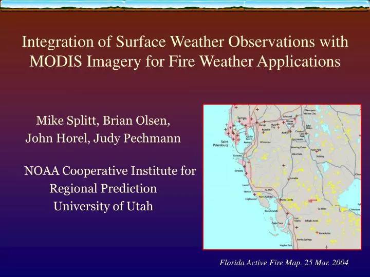
Mike Splitt, Brian Olsen, John Horel, Judy Pechmann NOAA Cooperative Institute for Regional Prediction University of Utah. Integration of Surface Weather Observations with MODIS Imagery for Fire Weather Applications. Florida Active Fire Map. 25 Mar. 2004. Outline. Overview of ROMAN

E N D
Mike Splitt, Brian Olsen, John Horel, Judy Pechmann NOAA Cooperative Institute for Regional Prediction University of Utah Integration of Surface Weather Observations withMODIS Imagery for Fire Weather Applications Florida Active Fire Map. 25 Mar. 2004
Outline • Overview of ROMAN • Goals and Applications • Sampling of ROMAN data and displays • MODIS Applications within ROMAN • Documentation & Summary
ROMAN Goals • Real-Time Observation Monitor and Analysis Network • Provide real-time weather data around the nation to meteorologists and land managers • Display data in fast-loading formats tailored to the wildland fire community and accessible to: • Top-level managers using high speed networks • Fire-behavior analysts and IMETs in the field over slow dial-up connections San Diego Tribune. 28 Oct. 2003
ROMAN Development Geographic Area Coordination Centers • Software developed at University of Utah to assist entire fire weather community to obtain access to current surface weather information • Data stored in MySQL database • Support for development of ROMAN from BLM and NWS • Tools designed for fire weather applications can be used for many other purposes • Tested during 2002 and 2003 summer fire seasons • Operational for 2004 summer fire season
MesoWest: lifeblood of ROMAN • MesoWest: Cooperative sharing of real-time surface weather data around the nation • Application of “nontraditional” data in operational meteorology (ski areas, DOTs) • Real-time and retrospective access to weather information through state-of-the-art MySQL database • ADAS analyses over the West of current temperature, wind, and moisture based on surface observations • http://www.met.utah.edu/mesowest • Horel et al. (2002) Bull. Amer. Meteor. Soc.
2003 Fire Locations (Red); ROMAN stations (Grey) Fire locations provided by Remote Sensing Applications Center from MODIS imagery
Applications of ROMAN • Fire behavior analysts, fire management officers, GACC meteorologists: • Monitor weather conditions for strategic and tactical decision making • Determine impacts of weather on fire behavior and fire fighting resources • NWS meteorologists at WFOs • Monitor conditions within County Warning Areas, issue spot fire and general forecasts, verifying forecasts • NWS Incident Meteorologists • Monitor weather conditions in vicinity of major wildland fires
States GACCs CWAs States MODIS regions FWZs Top-Level Organization
ROMAN • Structured by • GACC Predictive Service Areas • NWS CWA Forecast Zones • NWS Fire Weather Zones • Counties within States • Intuitive, easily navigable interface • Clickable maps • Station Weather • Weather Summary • Trend Monitor • Weather Monitor • 5 Day Temp/RH Summary • Precip Summary/Monitor • Weather Near Fires • Search by zip code, geographic location Triangles: RAWS Major data providers: NWS/FAA; SNOTEL; RAWS
Sample of Data Access: Search by: maps (state, CWAs, GACCs, etc.)
Map Based Applications in ROMAN • Powered by MapServer [ an OpenSource development environment for building spatially enabled Internet applications.] • Or, Powered by IDL (Interactive Display Language, RSI) • Imported data: • ROMAN database • Shapefiles ( e.g. fire weather zones) • RASTER files (e.g. GeoTIFF topography)
Surface Weather Data Plot Shaded Relief from the National Atlas of the United States (GeoTIFF Format)
ROMAN MODIS Applications • Active Fire Maps (Operational) • Maps (jpeg files) provided by Remote Sensing Applications Center • IDL based application produces station locations maps (static) • MODIS Land Use (Demo) • MapServer Based (dynamic) • 30+ tiles over North America • MODIS Leaf Area Index (Demo) • MapServer Based (dynamic)
October 31 MODIS Active Fire Maps October 29
Mapserver Based Applications • Allows for Dynamic Integration of MODIS data sets and Weather • GIS layering • Querying capabilities NOAA Coast Watch MODIS SST Demo
MODIS Land Products Data • Data Downloaded from EOS Data Gateway in HDF format. • Files converted to GeoTIFF format using HEG (HDF-EOS to GeoTIFF converter) • Pixel values converted to RGB values within MapServer Scripts.
The Land Cover Parameter recognizes 17 categories of land cover following the International Geosphere-Biosphere Program (IGBP) scheme. MODIS/Terra Land Cover Type 96-Day Global 1km Provides context to observations. MODIS Based Land Cover Zoom in, add more networks and change Change boundaries GACC boundaries, land cover and weather
MODIS Based Land Cover • The Land Cover Parameter recognizes 17 categories of land cover following the International Geosphere-Biosphere Program (IGBP) scheme. • MODIS/Terra Land Cover Type 96-Day Global 1km • Provides context to observations. NWS Fire Wx Zones, land cover and weather
MODIS Based Land Cover • Addition of “latest” fire detects from NOAA's MODIS Near Real Time Processing System • Shapefile format modislatest24hr.shp • Updated every 15 minutes, and contain detcts from the past 24 hours. • Data obtained from NOAA/NESDIS/SSD Fire Products Page. Land Cover Type with Added GIS Layer (fire detects)
MODIS Leaf Area Index • 1km LAI • Pixel value proportional to LAI. Converted to green shading within MapServer.
Other MODIS Data Sets of Interest • Thermal Anomalies/Fires • Vegetation Indices • Net Primary Vegetation Production
Documentation • ROMAN: • Horel et al. (2004) Submitted to International Journal of Wildland Fire. Jan. 2004 • Text: http://www.met.utah.edu/jhorel/homepages/jhorel/ROMAN_text.pdf • Figures: http://www.met.utah.edu/jhorel/homepages/jhorel/ROMAN_fig.pdf • Horel et al. (2004) IIPS Conference • On-line help: http://www.met.utah.edu/droman/help • MesoWest: Horel et al. (2002) Bull. Amer. Meteor. Soc. February 2002
Summary • ROMAN under development for use by weather professionals and the public • Existing web resources can be used for many GIS applications with access to both real-time and archival information. MODIS use evolving. • http://www.met.utah.edu/droman will continue as a testbed and ROMAN backup • Operational ROMAN will be located at http://roman.boi.noaa.gov • Feedback: mesowest@met.utah.edu