Download
1 / 13
140 likes | 361 Views
Introduction to GIS. What is GIS? GIS stands for Geographic Information Systems. This system is not just a set of software and hardware, but includes you, the user. Why GIS?.

E N D
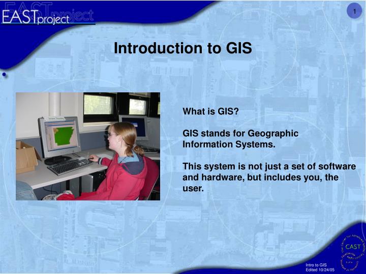
Introduction to GIS What is GIS? GIS stands for Geographic Information Systems. This system is not just a set of software and hardware, but includes you, the user.
Why GIS? GIS allows you to collect, manipulate, analyze, and display spatial data and information. Spatial data is any data that deals with locations of things. Just about anything you can imagine has a spatial component to it. The next few slides will show you some examples of what people have done with a GIS.
It all starts with DATA! Normally when you think of data you think of something like this chart. GIS let’s you turn this table showing the population of counties:
Thematic Mapping Natural Disasters Danger Zones Using data regarding past natural disasters, you may create a map showing high risk areas. source: http://www.gjep.org/qol/disaster_map.html
1999 population Into a Map: Now you can see WHERE the population is.
Butterfield Elementary Transportation Analysis With the proper data you can use GIS to determine how far you can walk in a certain amount of time. The green area shows how far a student can walk from Butterfield Elementary school within 15 minutes. source: Jessica A. McCullough, Nashville, Arkansas EAST student and CADIS participant.
3-D Visualization You may wish to turn a two-dimensional map into a three- dimensional map. source: http://www.fs.fed.us/gpnf/forest-research/ei/maps/if-3d.html
3-D Visualization Fayetteville, Arkansas 2003 You can even make a 3D map of your city. source: Greg Seltz, Gravette, Arkansas EAST student and CADIS participant.
Aerial and Satellite Imagery The University of Arkansas, Fayetteville
Can GIS help me get a good job? Adding GIS skills is one of the best moves you can make to increase your ability to get a good job. The next slide lists just a few of the industries that employ GIS specialists.
Mining Exploration; Environmental Protection; Management; Operations etc. Jobs Real Estate Agriculture Internet Home Locator Service; Title and Property Searches; Property Appraisal; Location Analysis; Demographic Reports; Risk Management; Lease Negotiation etc. Crop Management; Soil Management; Precision Agriculture; Fertilizer Application; Pest and Disease Control; Irrigation; Erosion Control; Production Trends; Distribution Logistics; Crop Insurance Rating etc. Retail/Commercial Business Banking Competitive Analysis; Demographic Reports; Customer Distribution Analysis; Customer Profiling; Market Analysis; Target Marketing; Site Selection; Location Analysis; Sales Territory Optimization Performance Monitoring; ATM Location Planning; Competitive Analysis; Customer Service; Loan Administration; Risk Management; Target Marketing; Compliance etc. Religion Healthcare Mysticism; Congregant Analysis; Marketing etc. Epidemiology; Outbreak Investigation and Tracking; Site and Facility Inspections; Program Evaluation; Site; Community Needs Assessment and Service Demand Analysis Telecommunications/Utilities Administration; Call-Before-You-Dig, Service Dispatch; Troubleshooting Analysis; Wireless Communication Coverage; Needs Survey and Analysis; Hook-up Scheduling; System Implementation Planning and Design Insurance Internet Insurance Agent Locator Service; Disaster Management; Target Marketing; Compliance; Claims Processing; Risk Management; Underwriting Transportation Route Planning; Traffic Flow Analysis; Drive Time Estimates; Operations Research; Transportation Planning; In-car Navigation; Civil Engineering; Transportation Engineering; Transit Planning and Scheduling Government Crime Prevention; Land Use Planning; 911 Response; Public Works Management; Economic Development; Tax Assessment; Facility Management; Defense; Districting; Elections etc.
Learning to make a map is a great place to begin Your first GIS project will be to make a map of your school and determine the land use areas for the various facilities on campus.
Now you are ready to begin The remaining chapters will guide you through the process of making a map of your school. Good luck and have fun!