Download
1 / 13
130 likes | 145 Views
GLOBAL ATMOSPHERE WATCH PROGRAMME: Quality monitoring. Oksana Tarasova, WMO Research Department. WMO: Research Department. GAW focal areas. Stratospheric Ozone and vertical ozone distribution Greenhouse Gases ( CO 2 and its isotopes , CH 4 and its isotopes, N 2 O, SF 6 , CFCs )

E N D
GLOBAL ATMOSPHERE WATCH PROGRAMME:Quality monitoring Oksana Tarasova, WMO Research Department WMO: Research Department
GAW focal areas • Stratospheric Ozone and vertical ozone distribution • Greenhouse Gases (CO2 and its isotopes , CH4 and its isotopes, N2O, SF6, CFCs) • Reactive Gases (O3, CO, VOC, NOx, SO2) • Total atmospheric deposition • Aerosols (chemical and physical properties, AOD) • UV Radiation Different groups of variables were included in the programme during different periods, hence their understanding is in the different stage of maturity
GAW Implementation Plan (2015-2023) • The plan concerns only implementation of the GAW Programme, WMO Strategic Plan is taken as an overall strategy • Short (focuses on the major principles, SAG specific tasks are in the annex) • Follows the concept “research enabling services” – the activities are around application areas rather than focused on GAW parameter specific areas • More focus on modelling tools and value added products • Provides clear framework for the programme implementation concerning network design, modelling tools, quality assurance principles, data management, collaboration with the other programmes IP builds upon the premise that atmospheric composition matters - to climate, weather forecasting, human health, terrestrial and aquatic ecosystems, agricultural productivity, aeronautical operations, renewable energy production, and more.
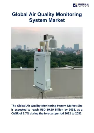
Observations in GAW GAW strives to implement “integrated” observing system including ground-based observations and satellite remote sensing integrated through models Surface-based in situ and remote sensing observations are the backbone of the GAW network. There are Global and Regional GAW stations and stations working within contributing networks. New category of local stations was introduced in 2015. Currently GAW coordinates activities and data from 30 Global stations and about 400 Regional stations (http://gaw.empa.ch/gawsis/)
GAW Station Information System (GAWSIS) Ground based observational capacity database in OSCAR
General requirements to GAW stations 1. The station location is chosen such that, for the variables measured, it is regionally representative and is normally free of the influence of significant local pollution sources. 2. There are adequate power, air conditioning, communication and building facilities to sustain long term observations with greater than 90% data capture (i.e. <10% missing data). 3. The technical support provided is trained in the operation of the equipment. 4. There is a commitment by the responsible agency to long term observations of at least one of the GAW variables in the GAW focal areas (ozone, aerosols, greenhouse gases, reactive gases, UV radiation, precipitation chemistry). 5. The GAW observation made is of known quality and linked to the GAW Primary Standard. 6. The data and associated metadata are submitted to one of the GAW World Data Centres no later than one year after the observation is made. Changes of metadata including instrumentation, traceability, observation procedures, are reported to the responsible WDC in a timely manner. 7. If required, data are submitted to a designated data distribution system in near-real-time. 8. Standard meteorological in situ observations, necessary for the accurate determination and interpretation of the GAW variables, are made with known accuracy and precision. 9. The station characteristics and observational programme are updated in the GAW Station Information System (GAWSIS) on a regular basis. 10. A station logbook (i.e. record of observations made and activities that may affect observations) is maintained and is used in the data validation process.
How does GAW work with contributing networks GAW contributing networks where agreement is signed: AD-Net, ALINE, EARLINET, IMPROVE TCCON, NADP, DEBITS, MPLNet, IDAF, CASTNET • Agreement with contributing network allows networks: • Use network standard for calibration (which must me traceable to WMO primary standard) • Use network procedures for network harmonization • Keep data in the network data center, ensuring that link to the data is provided in the WMO/GAW Data Centers • Information about contributing stations must be made available in GAWSIS Regional networks introduce regional biases in particular variable (should be accounted for)!
QMF principles • Full support of the GCOS Climate Monitoring Principles • Network-wide use of only one reference standard or scale (primary standard). In consequence, there is only one institution that is responsible for this standard. • Full traceability to the primary standard of all measurements made by Global, Regional and Contributing GAW stations. • The definition of data quality objectives (DQOs). • Establishment of guidelines on how to meet these quality targets, i.e., harmonized measurement techniques based on Measurement Guidelines (MGs) and Standard Operating Procedures (SOPs). • Establishment of MGs or SOPs for these measurements. • Use of detailed log books for each parameter containing comprehensive meta information related to the measurements, maintenance, and 'internal' calibrations. • Regular independent assessments (system and performance audits). • Timely submission of data and associated metadata to the responsible World Data Centre as a means of permitting independent review of data by a wider community.
Central Facilities Five types of central facilities: • Central Calibration Laboratories (CCLs) • Quality Assurance/Science Activity Centres (QA/SACs) • World Calibration Centres (WCCs) • Regional Calibration Centres (RCCs) • World Data Centres (WDCs)
GAW’s Foundation - “Collecting adequate information on the chemical composition of the atmosphere and on the consequences of the anthropogenic impact on a global scale is valuable and possible only IF all the relevant measurements are expressed in the same units or on the same scale and IF data from the countries and at different sites are comparable”
Evaluation of the quality of observations • Activities of the Central Facilities (stations audits, regional and global comparison exercisers) • Recommendations on Measurement Techniques (Measurement Guidelines and Standard Operating Procedures) • Stations twinning • Expert meetings • Training of station personnel Network performance in general is discussed at GAW Symposiums, at the meetings of Scientific Advisory Groups and Scientific Steering Committee
Procedures to be implemented in GAWSIS • Application checks monthly if data have been submitted during the past 27 months. Regional stations require submission of 1 variable, for global stations 3 variables from 3 different categories are required. • If these conditions are not met, application triggers an e-mail message to station contact and GAW Country Contact informing them about this 3 times during 3 months, then sets station status to “silent”. Station will be checked routinely and will be re-activated upon data submission. • Country can report a station as “closed”, system will check and assign only status “reporting” or “silent” based on data submission. Status “intermittent” will disappear, also status “unknown”. All stations currently listed as “intermittent” will be set to “reporting”. Stations currently listed as “unknown” with a measurement programme will be set to “reporting”, otherwise to “silent”.
Thank you for your attention!