Download
1 / 15
150 likes | 495 Views
Contents. Background informationThe Williston BasinBainville North Oil FieldRed River FormationWinnipegosis FormationStructure Maps From SeismicQuestions. Background information. M.S. thesis: Seismic Attribute Porosity Prediction in Bainville North Oil Field, MT1996 Seismic data set provided

E N D
1. Geology of the Bainville North Oil Field Greg Sheridan
10 April 2007
2. Contents Background information
The Williston Basin
Bainville North Oil Field
Red River Formation
Winnipegosis Formation
Structure Maps From Seismic
Questions
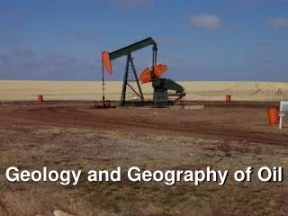
3. Background information M.S. thesis: Seismic Attribute Porosity Prediction in Bainville North Oil Field, MT
1996 Seismic data set provided by Nance Petroleum
Geology of two known producing formations
Red River
Winnipegosis This is just the Geology portion of my final presentationThis is just the Geology portion of my final presentation
4. The Williston Basin Intracratonic basin containing over 12,000� of sedimentary rock
Every geologic period from the Cambrian through the Tertiary
Located in North Dakota, South Dakota, Montana, and Southern Canada
Sediment deposition in either continental or shallow epicontinental seas
Sea depth never much greater than 300� Cambrian � 540 million years ago
Tretiary � ended 2 million years agoCambrian � 540 million years ago
Tretiary � ended 2 million years ago
5. The Williston Basin Elliptical shaped basin outlined by several prominent geologic features:
-south - Black Hills Uplift
-west - Bowdoin and Porcupine Domes
-Northwest and north � Sweetgrass and Moosejaw Syncline
-Northeast and east � Precambrian Canadian shield
-southeast � Sioux uplift
--Location of Bainville North � one of many small �pods� of oil fields within the Williston BasinElliptical shaped basin outlined by several prominent geologic features:
-south - Black Hills Uplift
-west - Bowdoin and Porcupine Domes
-Northwest and north � Sweetgrass and Moosejaw Syncline
-Northeast and east � Precambrian Canadian shield
-southeast � Sioux uplift
--Location of Bainville North � one of many small �pods� of oil fields within the Williston Basin
6. Bainville North Oil Field Primarily located in T 28 N, R 58 E
Roosevelt County, MT
8 horizons with shows
-Map of montana with all oil and gas fields and pipelines
-Horizons with shows including the Red River and Winnipegosis Formations-Map of montana with all oil and gas fields and pipelines
-Horizons with shows including the Red River and Winnipegosis Formations
7. Bainville North Oil Field
8. Red River Formation Most productive horizon in Bainville North
Ordovician age
About 400� thick and comprised of three cycles of sedimentation
Stony mountain shale above
Winnipeg below
Average drilling depth � 12,280� (10,080� subsea)
Average Porosity � 10.6%
Structural stratigraphic trap
Ordovician � 488 to 444 Million years agoOrdovician � 488 to 444 Million years ago
9. Red River Formation -A, B, and C members are the three cycles of dep
-each cycle has Burrowed, Laminated, Anhydrite except for the �A� in Montana
-C is only producing horizon in Bainville North-A, B, and C members are the three cycles of dep
-each cycle has Burrowed, Laminated, Anhydrite except for the �A� in Montana
-C is only producing horizon in Bainville North
10. Winnipegosis Formation Middle Devonian age
Overlain by the Prairie Evaporite Formation
Ashern Formation Below
Average drilling depth � 11,325� (9,100� subsea)
Average Porosity � 11.5%
Structural stratigraphic trap
Regionally extensive platform carbonate deposition in the Williston Basin
Edges of Winnipegosis Basin created small areas of carbonate deposition -Small areas of carbonate deposition follow structure of Ordovician Red River
-Small areas usually less than 1 mile (Bainville North is one of the larger ones)
-Small areas of carbonate deposition follow structure of Ordovician Red River
-Small areas usually less than 1 mile (Bainville North is one of the larger ones)
11. Winnipegosis Formation Carbonate dep during perioed of high sea level in Middle Devonian
Sea recedes � diagenesis on exposed carbonate deposit while evaporite deposites from seawater form Carbonate dep during perioed of high sea level in Middle Devonian
Sea recedes � diagenesis on exposed carbonate deposit while evaporite deposites from seawater form
12. Winnipegosis Formation 0 to 25 ft of porous zone when present; prososity is not always present in Bainville North0 to 25 ft of porous zone when present; prososity is not always present in Bainville North
13. Structure maps from seismic Greenhorn to Horizon Velocity Grid (Kriging) = [Depth interval]/[one-way traveltime]
At each well
G to H Isopach = [Kriged velocity grid]*[One- way traveltime isochron from seismic]
Horizon subsea structure map = [Kriged Greenhorn Subsea grid] � [G to H Isopach]
14. Red River subsea structure Point out north, scale from -10,375 to -10,000 ft subsea
-Structural High (most production)Point out north, scale from -10,375 to -10,000 ft subsea
-Structural High (most production)
15. Winnipegosis subsea structure Scale from -9350 to -9050
-Structural High (most production)
Scale from -9350 to -9050
-Structural High (most production)
16. References Gerhard, L. C., S. B. Anderson, J. A. LeFever, and C. G. Carlson, 1982, Geological
development and origin of the Williston Basin, in C. E. Dunn, D. M. Kent, and J. A., Lorsong, eds., Fourth International Williston Basin Symposium: Saskatchewan Geological Society, 1.
Mrkvicka, S. R., 1982, The mechanical and thermal subsidence history of the Williston Basin: M.S. thesis, University of Oklahoma.
Sloss, L.L., 1987, The Williston Basin in the family of cratonic basins, in James A.
Peterson, Donald M. Kent, Sidney B. Anderson, Richard H. Pilatzke, and Mark W. Longman, eds., Williston Basin: Anatomy of a cratonic oil province: The Rocky Mountain Association of Geologists, 1-8.
Lepp, C. L., 1981, Depositional environments of upper Cretaceous�lower Tertiary rocks, western Williston Basin, Montana: M.S. thesis, Texas Tech University.
Kerr, S. D., Jr., 1988, Overview: Williston Basin Carbonate Reservoirs, in 1988 Carbonate
Symposium: Rocky Mountain Association of Geologists, 251-274.
Perrin, N. A., 1982, Environments of Deposition and Diagenesis of the Winnipegosis Formation (Middle Devonian), Williston Basin, North Dakota, in C. E. Dunn, D. M. Kent, and J. A., Lorsong, eds., Fourth International Williston Basin Symposium: Saskatchewan Geological Society, 51-73.
Kleeman, G., 1985, Bainville, North Field, in John J. Tonnesen, ed., Montana Oil and Gas
Fields Symposium 1985: Montana Geological Society, 185-187.
Montana Oil and Gas Conservation Commission, 1985, in Tonnsen, J. J., ed., Montana Oil and Gas Fields Symposium, 1985, vol. 1: Montana Geological Society, xvii.