Download

1 / 31
330 likes | 897 Views
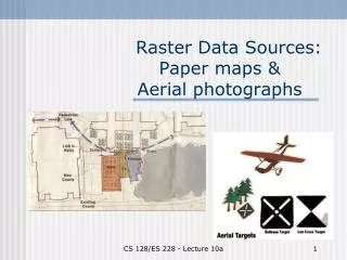
Acquisition of Aerial Photographs. Lecture 8 prepared by R. Lathrop 9/99 Updated 9/07 with reference to material in Avery & Berlin 5th edition. Learning Objectives. Remote sensing concepts Range of existing imagery sources

E N D
Acquisition of Aerial Photographs Lecture 8 prepared by R. Lathrop 9/99 Updated 9/07 with reference to material in Avery & Berlin 5th edition
Learning Objectives • Remote sensing concepts • Range of existing imagery sources • Important parameters to consider in planning/contracting imagery acquisition • Math concepts • Calculating number of photos required as part of flight planning • Skills • Lay out a flight plan and calculate number of photos required to cost out a flight mission
Aerial Photographic Sources • National High Altitude Photography (NHAP): (1980-1987) 1:58,000 CIR or 1:80,000 Pan • National Aerial Photography Program (NAPP): (since 1987) 1:40,000 CIR • NASA high altitude photography: (since 1964) 1:60,000-1:120,000 PAN, COLOR, CIR • These images are archived by the Eros Data Center as part of the USGS Global Land Information System. To search archive • http://edcsns17.cr.usgs.gov/EarthExplorer/
Aerial Photographic Sources • USDA: (since 1955): mainly PAN of 1:20,000-1:40,000. These photos are archived by the Aerial Photography Field Office http://www.fsa.usda.gov/dam/APFO/airfto.htm • National Archives and Records Administration archives older (pre- 1950’s) aerial photography http://www.nara.gov/research/ordering/mapordr.html
1930’s B&W aerial photography mosaics of New Jersey(source: NJDEP)
1-meter resolution natural color aerial photography of New Jersey, leaf-on: July-August 2006 (source: USDA-FSA APFO)
Aerial Photographic Sources • National Ocean Survey (NOS) coastal photography: (since 1945), color, scales of 1;10,000 - 1:50,000 • The photos are used for a variety of geo-positioning applications, which include delineating the shoreline for Nautical Chart creation, measuring water depths, mapping seabed characteristics, and locating obstructions to marine and air navigation. • http://mapfinder.nos.noaa.gov
Army Corps NJ shore aerial photos of 1920’s-30’s-40’s-60’ http://chl.wes.army.mil/shore/newjersey/
NASA Astronaut Photography • http://eol.jsc.nasa.gov/sseop/clickmap/
Satellite imagery sources • Will be covered later in the semester
Contract Imagery • Existing aerial photographs/imagery may be unsuitable for certain projects • Special-purpose photography/imagery - may be contracted through commercial aerial survey firms
Contracting Imagery Considerations • Camera focal length • Camera format size • Image scale ground coverage and resolution desired • Film/filter • Overlap/sidelap • Photo Alignment/tilt • Seasonal considerations • Time-of-Day considerations/ cloud cover
Seasonal considerations • Cloud free conditions, ideally < 10% • Leaf-off: spring/fall when deciduous tree leaves are off and ground free of snow used for topographic/soils mapping, terrain/landform interpretation • Leaf-on: summer when deciduous trees are leafed out or late fall when various tree species may be identified by foliage color used for vegetation analyses
Scale Considerations • What is the minimum mapping unit or size of smallest object that you want resolved and mapped? • What is the ground coverage desired for an individual photo or image frame? • How large of a study area to be covered? • 3 considerations involve trade-offs
Time-of-day considerations • Quantity of light determined by solar elevation angle no shadows: +- 2 hrs around solar noon shadows desired: early or late day • Spectral quality: possibility of sun/hot spots causing image saturation
Flight Alignment • Flight lines are planned to be parallel • Usually in a N-S or E-W direction. For maximum aircraft efficiency, they should be parallel to the long axis of the study area (minimize aircraft turns). • Crab or drift should be minimized • Tilt , 2-3o for any single photo, average < 1o for entire project
Example:Flight planning for aerial photography of submerged aquatic vegetation • Color film gives better water depth penetration
Example:Flight planning for aerial photography of submerged aquatic vegetation • Other considerations • Scales of 1:12,000 to 1:24,000 needed • Time of year: late spring-early summer • Time of day: sun angles 15-30o, generally early morning to reduce wind/surface waves • Tides: +- 2 hours of lowest tide
Example:Flight planning for aerial photography of submerged aquatic vegetation • GeoVantage Digital Camera • 4 bands: Blue, Green, Red, NIR • Pixel Array Size: 0.00465mm • Focal Length: 12mm • Field of View: 28.1o crossrange, 21.1o along range • Easily mounted on wheel strut • Coordinated acquisition with Inertial Measurement Unit to determine precise geodetic positioning to provide for georegistration and orthorectification
Example:Flight planning for aerial photography of submerged aquatic vegetation • What Flying Height (m) needed to resolve individual SAV beds of 1m wide x 10 m long (0.001 ha in size)? • General Rule of Thumb: GSD at a minimum of ½ the size of smallest feature. In this case need, GSD of 0.5m. • GSD = array element size * H’ . focal length • Example: array element size = 0.00465mm f = 12 mm GSD = 0.5m H’ = ? • H’ = 0.5m * 12 mm / 0.00465mm = 1290 m
Example:Flight planning for aerial photography of submerged aquatic vegetation FOV = 28.1o • What will be the image width(m)? H’ = 1290m
Example:Flight planning for aerial photography of submerged aquatic vegetation FOV = 28.1o • What will be the image width(m)? • Remember your basic trigonometry? Tan = opposite / adjacent • Tan FOV/2 = (1/2 image width)/H’ • Image width = 2 * tan14.05 * 1290m = 2 * 0.250 * 1290m = 645 m H’ = 1290m adj opp
Example: Flight Planning Mission parameters • Study area: 20 km E-W & 35 km N-S • Elevation of study area: 500 m above sea level • Desired Photo scale: 1:25,000 • Film format: 23 x 23 cm or 0.23 x 0.23 m • Focal length: 152 mm or 0.152 m • Overlap: 60% • Sidelap: 30% From Avery & Berlin, 5th ed. pp 101-102
Map with Study Area Footprint 20km wide 35 km long
Example: Flight planningFlight altitude • RF = f / H or H = RFd * f • H = (25,000) (0.152 m) = 3,800 m above terrain • Flight altitude = 3,800 m + 500 = 4,300 m above sea level
Example: Flight planningGround distance • Ground distance coverage of a single photo RF = PD / GD or GD = RFd * PD • GD = 25,000 * 0.23 m = 5,750 m
Example: Flight planning Number of flight lines • NL = [W / (GD)(Sg)] + 2 where W = width of study area GD = ground distance of single photo Sg = sidelap gain (100 - % sidelap) expressed as a decimal fraction 2 = extra flight lines (1 per side) • NL = [20 km / (5.75 km)(0.7)] + 2 = 4.97 + 2 = 6.97 = 7 (always round up)
Map with Study Area Footprint and Flight Lines 20km wide 35 km long
Example: Flight planning Number of photos per flight line • NP = [L / (GD)(Og)] + 4 where L = length of flight line GD = ground distance of single photo Og = overlap gain (100 - % overlap) expressed as a decimal fraction 4 = extra photos (2 per end of flight line) • NP = [35 km / (5.75 km)(0.4)] + 4 = 15.2 + 4 = 19.2 = 20(always round up)
Example: Flight planning Total number of photos • Number of flight lines x number of photos per flight line or TN = NP x NL • TN = NP x NL = 7 x 20 = 140 photos • If each photo cost approximately $25/frame, what is the total cost of the mission? • 140 photos * $25/photo = $3,500