Download
1 / 1
10 likes | 234 Views
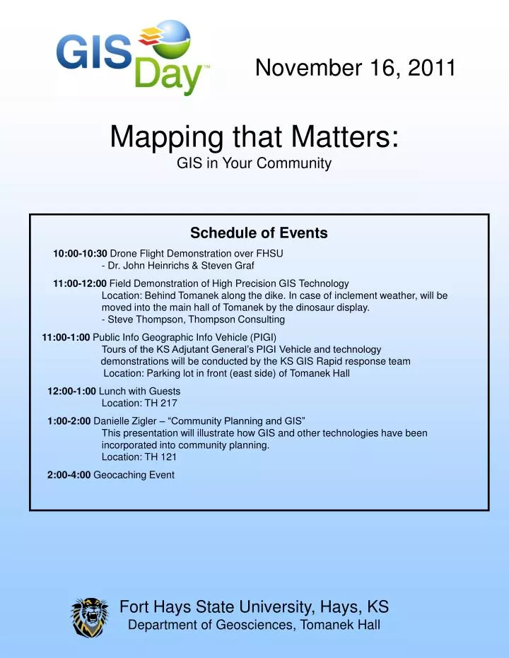
Fort Hays State University, Hays, KS Department of Geosciences, Tomanek Hall. November 16, 2011. Mapping that Matters: GIS in Your Community. Schedule of Events 10:00-10:30 Drone Flight Demonstration over FHSU - Dr. John Heinrichs & Steven Graf

E N D
Fort Hays State University, Hays, KS Department of Geosciences, Tomanek Hall November 16, 2011 Mapping that Matters:GIS in Your Community Schedule of Events 10:00-10:30 Drone Flight Demonstration over FHSU - Dr. John Heinrichs & Steven Graf 11:00-12:00 Field Demonstration of High Precision GIS Technology Location: Behind Tomanek along the dike. In case of inclement weather, will be moved into the main hall of Tomanek by the dinosaur display. - Steve Thompson, Thompson Consulting 11:00-1:00 Public Info Geographic Info Vehicle (PIGI) Tours of the KS Adjutant General’s PIGI Vehicle and technology demonstrations will be conducted by the KS GIS Rapid response team Location: Parking lot in front (east side) of Tomanek Hall 12:00-1:00 Lunch with Guests Location: TH 217 1:00-2:00 Danielle Zigler – “Community Planning and GIS” This presentation will illustrate how GIS and other technologies have been incorporated into community planning. Location: TH 121 2:00-4:00 Geocaching Event